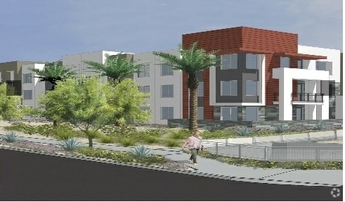
Property Record
307 S Hawes Rd, Mesa, AZ 85208

Property Detail
307 S Hawes Rd
218-44-001D
PT W2 SW4 DAF BEG SW COR SW4 TH E 392.18F N 1137.17F W 392.86F S 1141.17F TO POB EX W 40F RD & EX S 65F RD
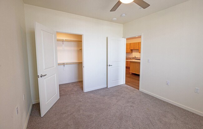
Apartment
Maricopa
M-H
Arizona
C and X Area of minimal flood hazard, usually depicted on FIRMs as above the 500-year flood level.
12
0
8.69 AC
2025
East Mesa
422627
Phoenix
279,462 SF
Phoenix-Mesa-Chandler, AZ
NEARBY LISTINGS FOR SALE OR LEASE
-
-
View all Mesa listings for sale on LoopNet.com
DEMOGRAPHICS near 307 S Hawes Rd
1 mile
3 mile
5 mile
2025 Total Population
14,380
113,317
260,635
2030 Population
15,356
118,797
274,734
Pop Growth 2025-2030
+ 6.79%
+ 4.84%
+ 5.41%
Average Age
51
45
45
2025 Total Households
6,726
47,373
106,017
HH Growth 2025-2030
+ 7.52%
+ 5.04%
+ 5.82%
Median Household Inc
$57,047
$71,987
$78,873
Avg Household Size
2.10
2.30
2.40
2025 Avg HH Vehicles
2.00
2.00
2.00
Median Home Value
$209,250
$349,382
$396,133
Median Year Built
1984
1993
1994
Nearby Places
Map Layers
Map Styles
 Street
 Aerial
Layers
 Traffic
 Biking
Places
Listings with unknown addresses are not visible on the map
- Restaurants
- Banks
- Shops
- Fitness
- Groceries
PUBLIC TRANSPORTATION
AIRPORT
Phoenix-Mesa Gateway
Drive
Walk
Distance
Phoenix-Mesa Gateway
17 min
10.7 mi
Phoenix Sky Harbor International
Drive
Walk
Distance
Phoenix Sky Harbor International
35 min
26.8 mi
Freight Ports
Port of San Diego
Drive
Walk
Distance
Port of San Diego
421 min
383.2 mi
Nearby Properties
Address
Land Use
TOTAL SIZE
Lot Size
Zoning
Address
Land Use
TOTAL SIZE
Lot Size
Zoning
1,522,034 SF
32.67 AC
C-N
Address
Land Use
TOTAL SIZE
Lot Size
Zoning
493,357 SF
46.94 AC
C-N
Address
Land Use
TOTAL SIZE
Lot Size
Zoning
330,352 SF
28.30 AC
PF
Address
Land Use
TOTAL SIZE
Lot Size
Zoning
57.25 AC
PF
Address
Land Use
TOTAL SIZE
Lot Size
Zoning
324,534 SF
50.86 AC
PF
Address
Land Use
TOTAL SIZE
Lot Size
Zoning
271,098 SF
142.75 AC
PF
Address
Land Use
TOTAL SIZE
Lot Size
Zoning
390,917 SF
15.82 AC
RM4
Address
Land Use
TOTAL SIZE
Lot Size
Zoning
422,427 SF
18.21 AC
C-C
Address
Land Use
TOTAL SIZE
Lot Size
Zoning
4.77 AC
LC
Address
Land Use
TOTAL SIZE
Lot Size
Zoning
711,933 SF
45.84 AC
Address
Land Use
TOTAL SIZE
Lot Size
Zoning
10.63 AC
Address
Land Use
TOTAL SIZE
Lot Size
Zoning
244,351 SF
18.46 AC
RS43
Address
Land Use
TOTAL SIZE
Lot Size
Zoning
162,260 SF
7.62 AC
Address
Land Use
TOTAL SIZE
Lot Size
Zoning
140,141 SF
37.70 AC
PF
Address
Land Use
TOTAL SIZE
Lot Size
Zoning
172,756 SF
8.52 AC
LC
Address
Land Use
TOTAL SIZE
Lot Size
Zoning
1.68 AC
Address
Land Use
TOTAL SIZE
Lot Size
Zoning
1.68 AC
Address
Land Use
TOTAL SIZE
Lot Size
Zoning
82,772 SF
131.12 AC
PF
Address
Land Use
TOTAL SIZE
Lot Size
Zoning
267,380 SF
17.08 AC
M-H
Address
Land Use
TOTAL SIZE
Lot Size
Zoning
225,660 SF
10.36 AC
M-H
Address
Land Use
TOTAL SIZE
Lot Size
Zoning
190,630 SF
6.61 AC
M-H
Address
Land Use
TOTAL SIZE
Lot Size
Zoning
201,114 SF
11.66 AC
M-H
Address
Land Use
TOTAL SIZE
Lot Size
Zoning
256,284 SF
11.42 AC
M-H
Address
Land Use
TOTAL SIZE
Lot Size
Zoning
142,817 SF
11.44 AC
RS43
Address
Land Use
TOTAL SIZE
Lot Size
Zoning
94,209 SF
14.93 AC
C-G
Address
Land Use
TOTAL SIZE
Lot Size
Zoning
163,562 SF
16.34 AC
Address
Land Use
TOTAL SIZE
Lot Size
Zoning
124,850 SF
12.09 AC
RM4
Address
Land Use
TOTAL SIZE
Lot Size
Zoning
69,102 SF
12.80 AC
OC
Address
Land Use
TOTAL SIZE
Lot Size
Zoning
308,103 SF
14.78 AC
M-H
Address
Land Use
TOTAL SIZE
Lot Size
Zoning
79,632 SF
10.54 AC
I-1
The World's #1 Commercial Real Estate Marketplace
Connect with us
© 2026 CoStar Group
The information above has been obtained from sources believed reliable. While we do not doubt its accuracy we have not verified it and make no guarantee, warranty or representation about it. It is your responsibility to independently confirm its accuracy and completeness. Any projections, opinions, assumptions, or estimates used are for example only and do not represent the current or future performance of the property. The value of this transaction to you depends on tax and other factors which should be evaluated by your tax, financial, and legal advisors. You and your advisors should conduct a careful, independent investigation of the property to determine to your satisfaction the suitability of the property for your needs.