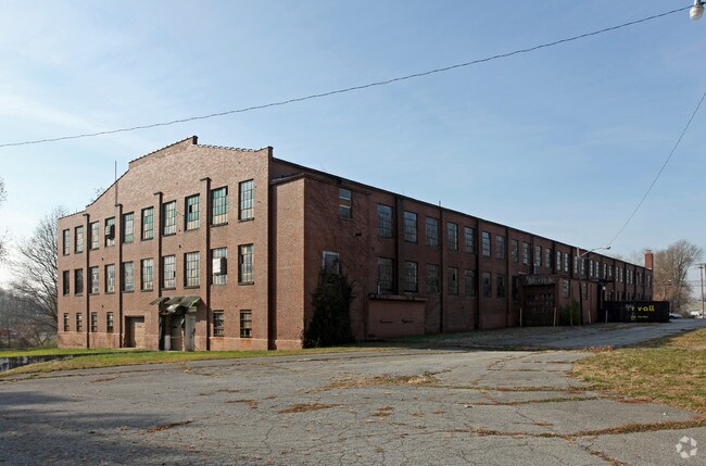
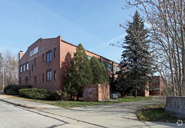
Property Record
307 S Whitley St, Columbia City, IN 46725
NEARBY LISTINGS FOR SALE OR LEASE
Property Detail
307 S Whitley St
Fort Wayne, IN
1St Add
92-06-11-501-317.001-004
LOTS 1 2 3 & 4 BLK 17 1ST ADD
Apartment
Whitley
AE
Indiana
18183C0163C
1
2024
1.01 AC
2024
Columbia City
050500
Fort Wayne
78,108 SF
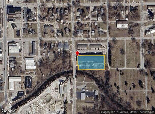
DEMOGRAPHICS near 307 S Whitley St
1 Mile
3 Mile
5 Mile
2024 Total Population
6,299
12,737
15,852
2029 Population
6,679
13,424
16,691
Pop Growth 2024-2029
+ 6.03%
+ 5.39%
+ 5.29%
Average Age
38
39
40
2024 Total Households
2,603
5,295
6,479
HH Growth 2024-2029
+ 6.03%
+ 5.36%
+ 5.26%
Median Household Inc
$57,767
$62,043
$63,612
Avg Household Size
2.30
2.30
2.40
2024 Avg HH Vehicles
2.00
2.00
2.00
Median Home Value
$151,233
$166,764
$174,097
Median Year Built
1966
1983
1983
Nearby Places
Map Layers
Map Styles
 Street
 Aerial
- Restaurants
- Banks
- Shops
- Fitness
- Groceries
PUBLIC TRANSPORTATION
AIRPORT
Fort Wayne International
DRIVE
WALK
Distance
Fort Wayne International
43 min
27.2 mi
Freight Ports
Port of Toledo
DRIVE
WALK
Distance
Port of Toledo
164 min
126.1 mi
Nearby Properties
Address
Land Use
TOTAL SIZE
Lot Size
Zoning
Address
Land Use
TOTAL SIZE
Lot Size
Zoning
108,834 SF
39.70 AC
Address
Land Use
TOTAL SIZE
Lot Size
Zoning
43,097 SF
20 AC
Address
Land Use
TOTAL SIZE
Lot Size
Zoning
60,204 SF
0.63 AC
Address
Land Use
TOTAL SIZE
Lot Size
Zoning
41,936 SF
1 AC
Address
Land Use
TOTAL SIZE
Lot Size
Zoning
47,154 SF
16.19 AC
Address
Land Use
TOTAL SIZE
Lot Size
Zoning
115,418 SF
9.18 AC
Address
Land Use
TOTAL SIZE
Lot Size
Zoning
69,446 SF
7.84 AC
Address
Land Use
TOTAL SIZE
Lot Size
Zoning
50,796 SF
5.56 AC
Address
Land Use
TOTAL SIZE
Lot Size
Zoning
17,520 SF
3.54 AC
Address
Land Use
TOTAL SIZE
Lot Size
Zoning
71,000 SF
14.80 AC
Address
Land Use
TOTAL SIZE
Lot Size
Zoning
25,693 SF
5.75 AC
Address
Land Use
TOTAL SIZE
Lot Size
Zoning
30,480 SF
8.16 AC
Address
Land Use
TOTAL SIZE
Lot Size
Zoning
40,419 SF
1.21 AC
Address
Land Use
TOTAL SIZE
Lot Size
Zoning
37,439 SF
38.80 AC
Address
Land Use
TOTAL SIZE
Lot Size
Zoning
23,796 SF
1 AC
Address
Land Use
TOTAL SIZE
Lot Size
Zoning
146 SF
38.17 AC
Address
Land Use
TOTAL SIZE
Lot Size
Zoning
49,840 SF
7.51 AC
Address
Land Use
TOTAL SIZE
Lot Size
Zoning
38,016 SF
3.07 AC
Address
Land Use
TOTAL SIZE
Lot Size
Zoning
38,016 SF
3.29 AC
Address
Land Use
TOTAL SIZE
Lot Size
Zoning
13,692 SF
3.07 AC
Address
Land Use
TOTAL SIZE
Lot Size
Zoning
20,036 SF
8.79 AC
Address
Land Use
TOTAL SIZE
Lot Size
Zoning
63,600 SF
10 AC
Address
Land Use
TOTAL SIZE
Lot Size
Zoning
82,080 SF
24 AC
Address
Land Use
TOTAL SIZE
Lot Size
Zoning
8,980 SF
1.02 AC
Address
Land Use
TOTAL SIZE
Lot Size
Zoning
114,090 SF
13.04 AC
Address
Land Use
TOTAL SIZE
Lot Size
Zoning
28,338 SF
2 AC
Address
Land Use
TOTAL SIZE
Lot Size
Zoning
4,326 SF
0.99 AC
Address
Land Use
TOTAL SIZE
Lot Size
Zoning
20,300 SF
1.37 AC
Address
Land Use
TOTAL SIZE
Lot Size
Zoning
12,176 SF
2.09 AC
Address
Land Use
TOTAL SIZE
Lot Size
Zoning
3,024 SF
1 AC
The World's #1 Commercial Real Estate Marketplace
Connect with us
© 2025 CoStar Group
The information above has been obtained from sources believed reliable. While we do not doubt its accuracy we have not verified it and make no guarantee, warranty or representation about it. It is your responsibility to independently confirm its accuracy and completeness. Any projections, opinions, assumptions, or estimates used are for example only and do not represent the current or future performance of the property. The value of this transaction to you depends on tax and other factors which should be evaluated by your tax, financial, and legal advisors. You and your advisors should conduct a careful, independent investigation of the property to determine to your satisfaction the suitability of the property for your needs.