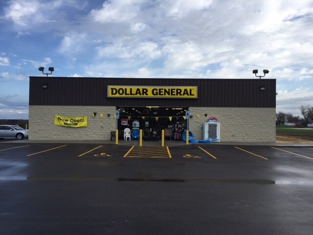
Property Record
307 W State St, Hamel, IL 62046

Property Detail
307 W State St
St. Louis, MO-IL
W2 SW4 T05N R07W
11-2-10-11-00-000-013
MADISON
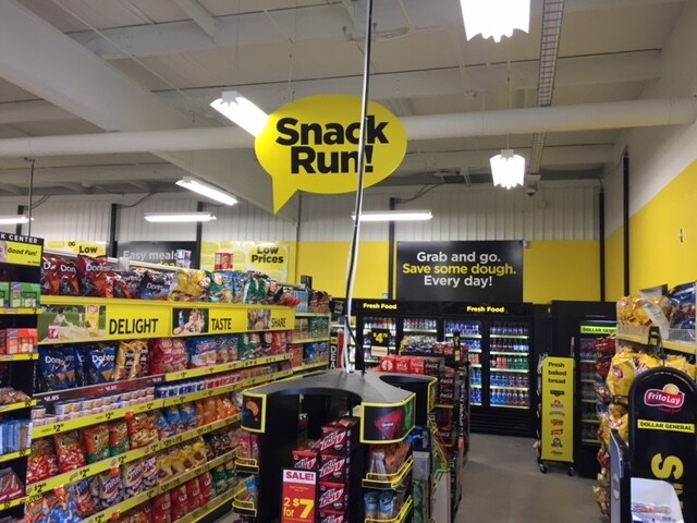
Commercialnec
Illinois
2024
1
2024
1.22 AC
403801
NE Metro Illinois
9,146 SF
St. Louis
NEARBY LISTINGS FOR SALE OR LEASE
-
-
View all Hamel listings for sale on LoopNet.com
DEMOGRAPHICS near 307 W State St
1 mile
3 mile
5 mile
2025 Total Population
809
2,360
5,428
2030 Population
783
2,312
5,329
Pop Growth 2025-2030
(3.21%)
(2.03%)
(1.82%)
Average Age
41
41
42
2025 Total Households
329
919
2,087
HH Growth 2025-2030
(3.34%)
(2.07%)
(1.82%)
Median Household Inc
$100,893
$102,696
$107,230
Avg Household Size
2.50
2.50
2.60
2025 Avg HH Vehicles
2.00
2.00
2.00
Median Home Value
$242,248
$268,721
$291,414
Median Year Built
1973
1974
1977
Nearby Places
Map Layers
Map Styles
 Street
 Aerial
Transit
 Traffic
 Biking
Places
Listings with unknown addresses are not visible on the map
- Restaurants
- Banks
- Shops
- Fitness
- Groceries
PUBLIC TRANSPORTATION
AIRPORT
Scott AFB/Midamerica St Louis
Drive
Walk
Distance
Scott AFB/Midamerica St Louis
51 min
31.0 mi
St Louis Lambert International
Drive
Walk
Distance
St Louis Lambert International
47 min
37.1 mi
SALE & LEASE HISTORY
LISTING DATE
SALE/LEASE

Sep 24, 2016
For Sale
Dec 30, 2016
For Sale
Nearby Properties
Address
Land Use
TOTAL SIZE
Lot Size
Zoning
Address
Land Use
TOTAL SIZE
Lot Size
Zoning
7,920 SF
27 AC
Address
Land Use
TOTAL SIZE
Lot Size
Zoning
49,680 SF
7 AC
Address
Land Use
TOTAL SIZE
Lot Size
Zoning
55,665 SF
7.95 AC
Address
Land Use
TOTAL SIZE
Lot Size
Zoning
17,987 SF
3.70 AC
Address
Land Use
TOTAL SIZE
Lot Size
Zoning
3,200 SF
1.87 AC
Address
Land Use
TOTAL SIZE
Lot Size
Zoning
25,260 SF
8 AC
Address
Land Use
TOTAL SIZE
Lot Size
Zoning
9,342 SF
5.31 AC
Address
Land Use
TOTAL SIZE
Lot Size
Zoning
11,790 SF
2.36 AC
Address
Land Use
TOTAL SIZE
Lot Size
Zoning
70.09 AC
Address
Land Use
TOTAL SIZE
Lot Size
Zoning
6,144 SF
9.83 AC
Address
Land Use
TOTAL SIZE
Lot Size
Zoning
3,840 SF
1.22 AC
Address
Land Use
TOTAL SIZE
Lot Size
Zoning
3,934 SF
2.05 AC
Address
Land Use
TOTAL SIZE
Lot Size
Zoning
10,200 SF
7.31 AC
Address
Land Use
TOTAL SIZE
Lot Size
Zoning
2,221 SF
10.66 AC
Address
Land Use
TOTAL SIZE
Lot Size
Zoning
8,316 SF
2.73 AC
Address
Land Use
TOTAL SIZE
Lot Size
Zoning
3,500 SF
0.43 AC
Address
Land Use
TOTAL SIZE
Lot Size
Zoning
1,899 SF
0.23 AC
Address
Land Use
TOTAL SIZE
Lot Size
Zoning
5,000 SF
1.58 AC
Address
Land Use
TOTAL SIZE
Lot Size
Zoning
4,698 SF
1.03 AC
Address
Land Use
TOTAL SIZE
Lot Size
Zoning
1,120 SF
2.02 AC
Address
Land Use
TOTAL SIZE
Lot Size
Zoning
2.72 AC
Address
Land Use
TOTAL SIZE
Lot Size
Zoning
1,344 SF
5.33 AC
Address
Land Use
TOTAL SIZE
Lot Size
Zoning
8,000 SF
2.85 AC
Address
Land Use
TOTAL SIZE
Lot Size
Zoning
1,400 SF
0.50 AC
Address
Land Use
TOTAL SIZE
Lot Size
Zoning
1,440 SF
0.33 AC
Address
Land Use
TOTAL SIZE
Lot Size
Zoning
148.02 AC
Address
Land Use
TOTAL SIZE
Lot Size
Zoning
3,600 SF
7.66 AC
Address
Land Use
TOTAL SIZE
Lot Size
Zoning
900 SF
0.39 AC
Address
Land Use
TOTAL SIZE
Lot Size
Zoning
6,600 SF
1.32 AC
The World's #1 Commercial Real Estate Marketplace
Connect with us
© 2026 CoStar Group
The information above has been obtained from sources believed reliable. While we do not doubt its accuracy we have not verified it and make no guarantee, warranty or representation about it. It is your responsibility to independently confirm its accuracy and completeness. Any projections, opinions, assumptions, or estimates used are for example only and do not represent the current or future performance of the property. The value of this transaction to you depends on tax and other factors which should be evaluated by your tax, financial, and legal advisors. You and your advisors should conduct a careful, independent investigation of the property to determine to your satisfaction the suitability of the property for your needs.