Property Record
3070 Sw Ivey Rd, Gainesville, GA 30504

NEARBY LISTINGS FOR SALE OR LEASE
Property Detail
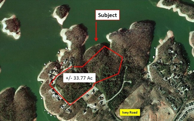
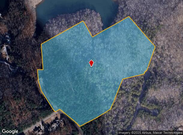
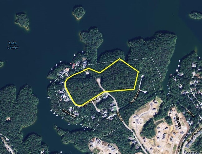
3070 Sw Ivey Rd
Gainesville, GA
Lost River Cove
08-00020-00-028
3070 IVEY ROAD S W
Residentialacreage
Hall
A
Georgia
13139C0170G
19.55 AC
2025
Gainesville/Hall County
2025
Atlanta
001005
DEMOGRAPHICS near 3070 Sw Ivey Rd
1 Mile
3 Mile
5 Mile
2024 Total Population
2,222
26,737
79,587
2029 Population
2,470
29,685
88,790
Pop Growth 2024-2029
+ 11.16%
+ 11.03%
+ 11.56%
Average Age
48
38
38
2024 Total Households
940
9,615
28,363
HH Growth 2024-2029
+ 11.06%
+ 10.99%
+ 11.60%
Median Household Inc
$65,588
$58,333
$61,205
Avg Household Size
2.30
2.70
2.70
2024 Avg HH Vehicles
2.00
2.00
2.00
Median Home Value
$426,157
$300,838
$289,879
Median Year Built
1996
1992
1990
Nearby Places
Map Layers
Map Styles
 Street
 Aerial
- Restaurants
- Banks
- Shops
- Fitness
- Groceries
PUBLIC TRANSPORTATION
COMMUTER RAIL
Gainesville Amtrak Station (Crescent - Amtrak)
DRIVE
WALK
Distance
Gainesville Amtrak Station (Crescent - Amtrak)
12 min
5.6 mi
Freight Ports
Georgia Ports - Savannah
DRIVE
WALK
Distance
Georgia Ports - Savannah
327 min
256.2 mi
SALE & LEASE HISTORY
LISTING DATE
SALE/LEASE

Dec 14, 2016
For Sale
Apr 20, 2017
For Sale
Nearby Properties
Address
Land Use
TOTAL SIZE
Lot Size
Zoning
Address
Land Use
TOTAL SIZE
Lot Size
Zoning
66,720 SF
27.49 AC
PUD
Address
Land Use
TOTAL SIZE
Lot Size
Zoning
157,050 SF
144.96 AC
N-B
Address
Land Use
TOTAL SIZE
Lot Size
Zoning
3,620 SF
20.20 AC
PUD
Address
Land Use
TOTAL SIZE
Lot Size
Zoning
41,471 SF
27.60 AC
G-B/R-1
Address
Land Use
TOTAL SIZE
Lot Size
Zoning
19,875 SF
19.76 AC
R-B
Address
Land Use
TOTAL SIZE
Lot Size
Zoning
132,557 SF
32.85 AC
O-I
Address
Land Use
TOTAL SIZE
Lot Size
Zoning
11,430 SF
38 AC
R-I
Address
Land Use
TOTAL SIZE
Lot Size
Zoning
308,672 SF
41.22 AC
L-I
Address
Land Use
TOTAL SIZE
Lot Size
Zoning
123,944 SF
13.21 AC
G-B
Address
Land Use
TOTAL SIZE
Lot Size
Zoning
301,380 SF
16.76 AC
I-1
Address
Land Use
TOTAL SIZE
Lot Size
Zoning
1,558 SF
2.53 AC
L-I
Address
Land Use
TOTAL SIZE
Lot Size
Zoning
37,632 SF
8.52 AC
R-II
Address
Land Use
TOTAL SIZE
Lot Size
Zoning
83,076 SF
48.86 AC
R-B
Address
Land Use
TOTAL SIZE
Lot Size
Zoning
29,445 SF
4.06 AC
PUD
Address
Land Use
TOTAL SIZE
Lot Size
Zoning
73,733 SF
2.19 AC
G-B
Address
Land Use
TOTAL SIZE
Lot Size
Zoning
99,093 SF
10.94 AC
R-B
Address
Land Use
TOTAL SIZE
Lot Size
Zoning
33,351 SF
16.80 AC
R-1
Address
Land Use
TOTAL SIZE
Lot Size
Zoning
86,258 SF
12.54 AC
R-I
Address
Land Use
TOTAL SIZE
Lot Size
Zoning
3,696 SF
11.89 AC
R-II
Address
Land Use
TOTAL SIZE
Lot Size
Zoning
62,894 SF
6.02 AC
G-B
Address
Land Use
TOTAL SIZE
Lot Size
Zoning
143,381 SF
10.99 AC
G-B
Address
Land Use
TOTAL SIZE
Lot Size
Zoning
202,540 SF
R-B
Address
Land Use
TOTAL SIZE
Lot Size
Zoning
67,718 SF
27.31 AC
PUD
Address
Land Use
TOTAL SIZE
Lot Size
Zoning
1,610 SF
6.69 AC
R-II
Address
Land Use
TOTAL SIZE
Lot Size
Zoning
68,214 SF
10.85 AC
O-I
Address
Land Use
TOTAL SIZE
Lot Size
Zoning
44,388 SF
1.66 AC
O-I
Address
Land Use
TOTAL SIZE
Lot Size
Zoning
178,860 SF
14.72 AC
I-1
Address
Land Use
TOTAL SIZE
Lot Size
Zoning
83,090 SF
11.37 AC
I-1
Address
Land Use
TOTAL SIZE
Lot Size
Zoning
17,500 SF
7.66 AC
G-B
Address
Land Use
TOTAL SIZE
Lot Size
Zoning
105,349 SF
9.22 AC
G-B
The World's #1 Commercial Real Estate Marketplace
Connect with us
© 2025 CoStar Group
The information above has been obtained from sources believed reliable. While we do not doubt its accuracy we have not verified it and make no guarantee, warranty or representation about it. It is your responsibility to independently confirm its accuracy and completeness. Any projections, opinions, assumptions, or estimates used are for example only and do not represent the current or future performance of the property. The value of this transaction to you depends on tax and other factors which should be evaluated by your tax, financial, and legal advisors. You and your advisors should conduct a careful, independent investigation of the property to determine to your satisfaction the suitability of the property for your needs.