Property Record
3075 Arnold Rd Ne, Albany, OR 97321
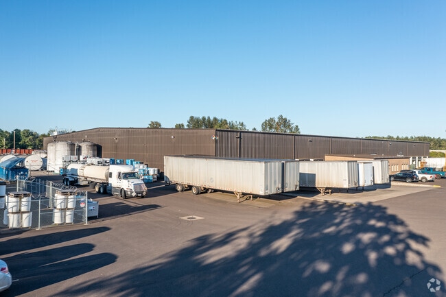

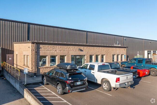

Property Detail
3075 Arnold Rd Ne
0046520
10S03W2800
Stateproperty
Linn
GI
Oregon
B and X Area of moderate flood hazard, usually the area between the limits of the 100-year and 500-year floods.
10.90 AC
2025
Linn County
2025
Portland
020101
Albany, OR
NEARBY LISTINGS FOR SALE OR LEASE
DEMOGRAPHICS near 3075 Arnold Rd Ne
1 mile
3 mile
5 mile
2025 Total Population
793
20,128
62,699
2030 Population
832
20,617
63,715
Pop Growth 2025-2030
+ 4.92%
+ 2.43%
+ 1.62%
Average Age
41
41
41
2025 Total Households
283
7,628
24,072
HH Growth 2025-2030
+ 4.95%
+ 2.39%
+ 1.65%
Median Household Inc
$131,731
$82,061
$80,855
Avg Household Size
2.80
2.60
2.50
2025 Avg HH Vehicles
3.00
2.00
2.00
Median Home Value
$588,541
$465,129
$418,617
Median Year Built
2007
1990
1978
Nearby Places
Map Layers
Map Styles
 Street
 Aerial
Transit
 Traffic
 Biking
Places
Listings with unknown addresses are not visible on the map
- Restaurants
- Banks
- Shops
- Fitness
- Groceries
PUBLIC TRANSPORTATION
COMMUTER RAIL
Albany Amtrak Station (Amtrak Cascades - Amtrak, Coast Starlight - Amtrak)
Drive
Walk
Distance
Albany Amtrak Station (Amtrak Cascades - Amtrak, Coast Starlight - Amtrak)
9 min
4.8 mi
Freight Ports
Port of Portland
Drive
Walk
Distance
Port of Portland
86 min
68.2 mi
SALE & LEASE HISTORY
LISTING DATE
SALE/LEASE

Dec 10, 2020
For Sale
Nearby Properties
Address
Land Use
TOTAL SIZE
Lot Size
Zoning
Address
Land Use
TOTAL SIZE
Lot Size
Zoning
19.77 AC
RS-5
Address
Land Use
TOTAL SIZE
Lot Size
Zoning
34.91 AC
LI
Address
Land Use
TOTAL SIZE
Lot Size
Zoning
46.43 AC
GI
Address
Land Use
TOTAL SIZE
Lot Size
Zoning
2,025 SF
16.52 AC
MUC
Address
Land Use
TOTAL SIZE
Lot Size
Zoning
13.01 AC
RC
Address
Land Use
TOTAL SIZE
Lot Size
Zoning
15.63 AC
RM
Address
Land Use
TOTAL SIZE
Lot Size
Zoning
46.46 AC
GI
Address
Land Use
TOTAL SIZE
Lot Size
Zoning
63.70 AC
GI
Address
Land Use
TOTAL SIZE
Lot Size
Zoning
84,000 SF
8.99 AC
RC
Address
Land Use
TOTAL SIZE
Lot Size
Zoning
14.42 AC
RS-5
Address
Land Use
TOTAL SIZE
Lot Size
Zoning
11.01 AC
CC
Address
Land Use
TOTAL SIZE
Lot Size
Zoning
666 SF
6.32 AC
RM
Address
Land Use
TOTAL SIZE
Lot Size
Zoning
3,591 SF
2.15 AC
RM
Address
Land Use
TOTAL SIZE
Lot Size
Zoning
15.15 AC
RM
Address
Land Use
TOTAL SIZE
Lot Size
Zoning
194,166 SF
10.14 AC
RS-10
Address
Land Use
TOTAL SIZE
Lot Size
Zoning
94,070 SF
6.52 AC
RC
Address
Land Use
TOTAL SIZE
Lot Size
Zoning
60,176 SF
17.67 AC
RC
Address
Land Use
TOTAL SIZE
Lot Size
Zoning
182.33 AC
RS-6.5
Address
Land Use
TOTAL SIZE
Lot Size
Zoning
5.26 AC
LI
Address
Land Use
TOTAL SIZE
Lot Size
Zoning
40 AC
GI
Address
Land Use
TOTAL SIZE
Lot Size
Zoning
164,057 SF
19.21 AC
RC
Address
Land Use
TOTAL SIZE
Lot Size
Zoning
70,432 SF
6.39 AC
RC
Address
Land Use
TOTAL SIZE
Lot Size
Zoning
36,235 SF
2.21 AC
CC
Address
Land Use
TOTAL SIZE
Lot Size
Zoning
3.98 AC
RS-6.5
Address
Land Use
TOTAL SIZE
Lot Size
Zoning
94,665 SF
5.07 AC
RM
Address
Land Use
TOTAL SIZE
Lot Size
Zoning
7.59 AC
LI
Address
Land Use
TOTAL SIZE
Lot Size
Zoning
11,160 SF
6.62 AC
RC
Address
Land Use
TOTAL SIZE
Lot Size
Zoning
20,427 SF
2.44 AC
MUC
Address
Land Use
TOTAL SIZE
Lot Size
Zoning
29,583 SF
6.71 AC
RS-10
Address
Land Use
TOTAL SIZE
Lot Size
Zoning
21,598 SF
2.60 AC
RR-5
The World's #1 Commercial Real Estate Marketplace
Connect with us
© 2026 CoStar Group
The information above has been obtained from sources believed reliable. While we do not doubt its accuracy we have not verified it and make no guarantee, warranty or representation about it. It is your responsibility to independently confirm its accuracy and completeness. Any projections, opinions, assumptions, or estimates used are for example only and do not represent the current or future performance of the property. The value of this transaction to you depends on tax and other factors which should be evaluated by your tax, financial, and legal advisors. You and your advisors should conduct a careful, independent investigation of the property to determine to your satisfaction the suitability of the property for your needs.