Property Record
2090 Deadwood Ave, Rapid City, SD 57702


NEARBY LISTINGS FOR SALE OR LEASE
Property Detail
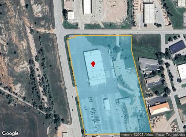
2090 Deadwood Ave
Rapid City, SD
Black Hills Meridian
0047737
S27, T2N, R07E, BLACK HILLS MERIDIAN, LOT A OF LOT 2 OF NW1/4SW1/4 & SW1/4NW1/4 LESS LOT H2 & LESS ROW
Industrialgeneral
Pennington
D
South Dakota
46103C0757H
2a
0
12.55 AC
2025
Rapid City
011400
Other Market Areas
48,201 SF
DEMOGRAPHICS near 2090 Deadwood Ave
1 Mile
3 Mile
5 Mile
2024 Total Population
269
29,941
69,407
2029 Population
299
33,210
77,034
Pop Growth 2024-2029
+ 11.15%
+ 10.92%
+ 10.99%
Average Age
48
41
41
2024 Total Households
135
12,914
29,326
HH Growth 2024-2029
+ 11.85%
+ 11.25%
+ 11.39%
Median Household Inc
$33,749
$53,772
$58,437
Avg Household Size
1.90
2.20
2.20
2024 Avg HH Vehicles
1.00
2.00
2.00
Median Home Value
$139,285
$236,256
$245,884
Median Year Built
1998
1972
1976
Nearby Places
Map Layers
Map Styles
 Street
 Aerial
- Restaurants
- Banks
- Shops
- Fitness
- Groceries
PUBLIC TRANSPORTATION
AIRPORT
Rapid City Regional
DRIVE
WALK
Distance
Rapid City Regional
25 min
13.7 mi
SALE & LEASE HISTORY
LISTING DATE
SALE/LEASE

Sep 27, 2023
For Lease
Sep 25, 2016
For Lease
Sep 24, 2016
For Sale
Sep 10, 2020
For Lease
Dec 11, 2023
For Lease
Nearby Properties
Address
Land Use
TOTAL SIZE
Lot Size
Zoning
Address
Land Use
TOTAL SIZE
Lot Size
Zoning
5,244 SF
17.53 AC
Address
Land Use
TOTAL SIZE
Lot Size
Zoning
40,853 SF
8.09 AC
Address
Land Use
TOTAL SIZE
Lot Size
Zoning
48,204 SF
15.19 AC
Address
Land Use
TOTAL SIZE
Lot Size
Zoning
6,820 SF
10.60 AC
Address
Land Use
TOTAL SIZE
Lot Size
Zoning
26,807 SF
0.58 AC
Address
Land Use
TOTAL SIZE
Lot Size
Zoning
7,680 SF
9.34 AC
Address
Land Use
TOTAL SIZE
Lot Size
Zoning
14,360 SF
2.07 AC
Address
Land Use
TOTAL SIZE
Lot Size
Zoning
10,608 SF
10.90 AC
Address
Land Use
TOTAL SIZE
Lot Size
Zoning
50,656 SF
9.17 AC
Address
Land Use
TOTAL SIZE
Lot Size
Zoning
46,025 SF
36.26 AC
Address
Land Use
TOTAL SIZE
Lot Size
Zoning
4,576 SF
4.85 AC
Address
Land Use
TOTAL SIZE
Lot Size
Zoning
26,845 SF
3.49 AC
Address
Land Use
TOTAL SIZE
Lot Size
Zoning
105,621 SF
10 AC
Address
Land Use
TOTAL SIZE
Lot Size
Zoning
5,448 SF
7.92 AC
Address
Land Use
TOTAL SIZE
Lot Size
Zoning
3,008 SF
4.66 AC
Address
Land Use
TOTAL SIZE
Lot Size
Zoning
30,740 SF
3.22 AC
Address
Land Use
TOTAL SIZE
Lot Size
Zoning
95,992 SF
56.73 AC
Address
Land Use
TOTAL SIZE
Lot Size
Zoning
23,089 SF
0.30 AC
Address
Land Use
TOTAL SIZE
Lot Size
Zoning
48,786 SF
5 AC
Address
Land Use
TOTAL SIZE
Lot Size
Zoning
19,170 SF
1.28 AC
Address
Land Use
TOTAL SIZE
Lot Size
Zoning
9,395 SF
3.26 AC
Address
Land Use
TOTAL SIZE
Lot Size
Zoning
24,609 SF
0.46 AC
Address
Land Use
TOTAL SIZE
Lot Size
Zoning
144,045 SF
11.96 AC
Address
Land Use
TOTAL SIZE
Lot Size
Zoning
10,455 SF
0.24 AC
Address
Land Use
TOTAL SIZE
Lot Size
Zoning
62,341 SF
4.84 AC
Address
Land Use
TOTAL SIZE
Lot Size
Zoning
5,412 SF
2.03 AC
Address
Land Use
TOTAL SIZE
Lot Size
Zoning
15,217 SF
1.55 AC
Address
Land Use
TOTAL SIZE
Lot Size
Zoning
9,934 SF
1.34 AC
Address
Land Use
TOTAL SIZE
Lot Size
Zoning
1,376 SF
260.54 AC
Address
Land Use
TOTAL SIZE
Lot Size
Zoning
27,807 SF
3.63 AC
The World's #1 Commercial Real Estate Marketplace
Connect with us
© 2025 CoStar Group
The information above has been obtained from sources believed reliable. While we do not doubt its accuracy we have not verified it and make no guarantee, warranty or representation about it. It is your responsibility to independently confirm its accuracy and completeness. Any projections, opinions, assumptions, or estimates used are for example only and do not represent the current or future performance of the property. The value of this transaction to you depends on tax and other factors which should be evaluated by your tax, financial, and legal advisors. You and your advisors should conduct a careful, independent investigation of the property to determine to your satisfaction the suitability of the property for your needs.