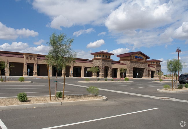
Property Record
3076 E Chandler Heights Rd, Gilbert, AZ 85298

Property Detail
3076 E Chandler Heights Rd
304-77-982
CHANDLER HEIGHTS VILLAGE MCR 955-17
Storebuilding
MARICOPA
C-N
Arizona
C and X Area of minimal flood hazard, usually depicted on FIRMs as above the 500-year flood level.
2
2025
6.51 AC
2025
Gilbert
816002
Phoenix
44,008 SF
Phoenix-Mesa-Chandler, AZ
NEARBY LISTINGS FOR SALE OR LEASE
DEMOGRAPHICS near 3076 E Chandler Heights Rd
1 mile
3 mile
5 mile
2025 Total Population
11,471
69,115
180,278
2030 Population
11,781
72,250
188,455
Pop Growth 2025-2030
+ 2.70%
+ 4.54%
+ 4.54%
Average Age
37
38
37
2025 Total Households
3,414
20,799
55,372
HH Growth 2025-2030
+ 2.67%
+ 4.42%
+ 4.53%
Median Household Inc
$149,060
$151,959
$143,681
Avg Household Size
3.30
3.20
3.20
2025 Avg HH Vehicles
2.00
2.00
2.00
Median Home Value
$686,736
$709,766
$702,371
Median Year Built
2007
2008
2007
Nearby Places
Map Layers
Map Styles
 Street
 Aerial
Transit
 Traffic
 Biking
Places
Listings with unknown addresses are not visible on the map
- Restaurants
- Banks
- Shops
- Fitness
- Groceries
PUBLIC TRANSPORTATION
AIRPORT
Phoenix-Mesa Gateway
Drive
Walk
Distance
Phoenix-Mesa Gateway
16 min
8.2 mi
Phoenix Sky Harbor International
Drive
Walk
Distance
Phoenix Sky Harbor International
43 min
30.0 mi
Nearby Properties
Address
Land Use
TOTAL SIZE
Lot Size
Zoning
Address
Land Use
TOTAL SIZE
Lot Size
Zoning
23,766 SF
29.45 AC
R-43
Address
Land Use
TOTAL SIZE
Lot Size
Zoning
54,689 SF
5.41 AC
R-43
Address
Land Use
TOTAL SIZE
Lot Size
Zoning
22.83 AC
PF
Address
Land Use
TOTAL SIZE
Lot Size
Zoning
339,494 SF
48.27 AC
R-4
Address
Land Use
TOTAL SIZE
Lot Size
Zoning
262,955 SF
57.93 AC
PF
Address
Land Use
TOTAL SIZE
Lot Size
Zoning
430,700 SF
63.32 AC
PF
Address
Land Use
TOTAL SIZE
Lot Size
Zoning
139,348 SF
16.39 AC
R-12
Address
Land Use
TOTAL SIZE
Lot Size
Zoning
195,297 SF
8.90 AC
SC
Address
Land Use
TOTAL SIZE
Lot Size
Zoning
103,423 SF
27.10 AC
PF
Address
Land Use
TOTAL SIZE
Lot Size
Zoning
6,594 SF
0.86 AC
C-C
Address
Land Use
TOTAL SIZE
Lot Size
Zoning
85,775 SF
10.40 AC
PF
Address
Land Use
TOTAL SIZE
Lot Size
Zoning
95,040 SF
20.19 AC
PF/I
Address
Land Use
TOTAL SIZE
Lot Size
Zoning
92,160 SF
14.95 AC
PF
Address
Land Use
TOTAL SIZE
Lot Size
Zoning
85,763 SF
24.84 AC
PF
Address
Land Use
TOTAL SIZE
Lot Size
Zoning
98,930 SF
9.17 AC
BP
Address
Land Use
TOTAL SIZE
Lot Size
Zoning
100,758 SF
12.30 AC
R-7
Address
Land Use
TOTAL SIZE
Lot Size
Zoning
109,657 SF
11.71 AC
C-C
Address
Land Use
TOTAL SIZE
Lot Size
Zoning
73,801 SF
8 AC
PF
Address
Land Use
TOTAL SIZE
Lot Size
Zoning
61,641 SF
39.91 AC
PF
Address
Land Use
TOTAL SIZE
Lot Size
Zoning
88,288 SF
13.23 AC
SF7
Address
Land Use
TOTAL SIZE
Lot Size
Zoning
2.16 AC
C-G
Address
Land Use
TOTAL SIZE
Lot Size
Zoning
137,650 SF
13.28 AC
C-C
Address
Land Use
TOTAL SIZE
Lot Size
Zoning
90,169 SF
10.98 AC
C-C
Address
Land Use
TOTAL SIZE
Lot Size
Zoning
82,182 SF
10.66 AC
C-C
Address
Land Use
TOTAL SIZE
Lot Size
Zoning
40,069 SF
35.19 AC
PARK
Address
Land Use
TOTAL SIZE
Lot Size
Zoning
57,816 SF
8.36 AC
PF/I
Address
Land Use
TOTAL SIZE
Lot Size
Zoning
49,300 SF
8.01 AC
SC
Address
Land Use
TOTAL SIZE
Lot Size
Zoning
135,670 SF
3.58 AC
GC
Address
Land Use
TOTAL SIZE
Lot Size
Zoning
6,553 SF
9.06 AC
R-43
Address
Land Use
TOTAL SIZE
Lot Size
Zoning
71,024 SF
8.72 AC
SF43
The World's #1 Commercial Real Estate Marketplace
Connect with us
© 2026 CoStar Group
The information above has been obtained from sources believed reliable. While we do not doubt its accuracy we have not verified it and make no guarantee, warranty or representation about it. It is your responsibility to independently confirm its accuracy and completeness. Any projections, opinions, assumptions, or estimates used are for example only and do not represent the current or future performance of the property. The value of this transaction to you depends on tax and other factors which should be evaluated by your tax, financial, and legal advisors. You and your advisors should conduct a careful, independent investigation of the property to determine to your satisfaction the suitability of the property for your needs.