Property Record
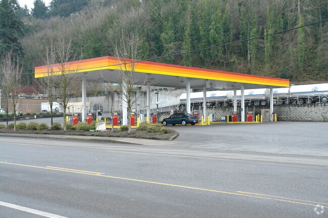
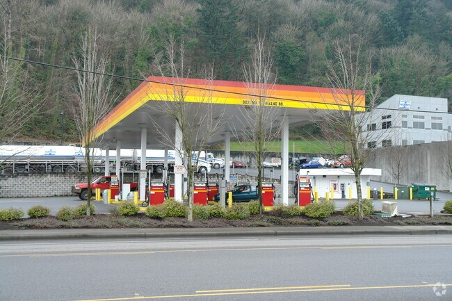
3031 Nw Saint Helens Rd, Portland, OR 97210
Property Detail
3031 Nw Saint Helens Rd
R316462
SECTION 29 1N 1E, TL 1200 2.26 ACRES
Commercialnec
Multnomah
IH
Oregon
B and X Area of moderate flood hazard, usually the area between the limits of the 100-year and 500-year floods.
2.26 AC
2025
Guilds Lake
2025
Portland
004300
Portland-Vancouver-Hillsboro, OR-WA
9,931 SF
NEARBY LISTINGS FOR SALE OR LEASE
DEMOGRAPHICS near 3031 Nw Saint Helens Rd
1 mile
3 mile
5 mile
2025 Total Population
1,876
122,725
344,845
2030 Population
1,904
123,011
344,462
Pop Growth 2025-2030
+ 1.49%
+ 0.23%
(0.11%)
Average Age
42
40
40
2025 Total Households
941
61,810
160,957
HH Growth 2025-2030
+ 1.38%
+ 0.10%
(0.15%)
Median Household Inc
$109,027
$90,111
$97,218
Avg Household Size
2.00
1.80
2.00
2025 Avg HH Vehicles
1.00
1.00
1.00
Median Home Value
$1,024,793
$736,605
$726,575
Median Year Built
1963
1980
1971
Nearby Places
Map Layers
Map Styles
 Street
 Aerial
Layers
 Traffic
 Biking
Places
Listings with unknown addresses are not visible on the map
- Restaurants
- Banks
- Shops
- Fitness
- Groceries
PUBLIC TRANSPORTATION
COMMUTER RAIL
Drive
Walk
Distance
9 min
3.1 mi
AIRPORT
Portland International
Drive
Walk
Distance
Portland International
25 min
12.6 mi
Nearby Properties
Address
Land Use
TOTAL SIZE
Lot Size
Zoning
Address
Land Use
TOTAL SIZE
Lot Size
Zoning
395,815 SF
2.66 AC
IRD
Address
Land Use
TOTAL SIZE
Lot Size
Zoning
882,480 SF
80.73 AC
CI1
Address
Land Use
TOTAL SIZE
Lot Size
Zoning
57,314 SF
60.69 AC
OS
Address
Land Use
TOTAL SIZE
Lot Size
Zoning
20.71 AC
OS
Address
Land Use
TOTAL SIZE
Lot Size
Zoning
326,547 SF
2.42 AC
RH
Address
Land Use
TOTAL SIZE
Lot Size
Zoning
304,836 SF
10.85 AC
CX
Address
Land Use
TOTAL SIZE
Lot Size
Zoning
598,328 SF
12.32 AC
CX
Address
Land Use
TOTAL SIZE
Lot Size
Zoning
257,700 SF
2.89 AC
EX
Address
Land Use
TOTAL SIZE
Lot Size
Zoning
128,500 SF
6.95 AC
OS
Address
Land Use
TOTAL SIZE
Lot Size
Zoning
689,840 SF
0.92 AC
CX
Address
Land Use
TOTAL SIZE
Lot Size
Zoning
125,217 SF
0.23 AC
CX
Address
Land Use
TOTAL SIZE
Lot Size
Zoning
97,465 SF
107.18 AC
OS
Address
Land Use
TOTAL SIZE
Lot Size
Zoning
Address
Land Use
TOTAL SIZE
Lot Size
Zoning
426,742 SF
0.53 AC
RXD
Address
Land Use
TOTAL SIZE
Lot Size
Zoning
243,371 SF
0.67 AC
CI2
Address
Land Use
TOTAL SIZE
Lot Size
Zoning
584,483 SF
0.90 AC
CX
Address
Land Use
TOTAL SIZE
Lot Size
Zoning
645,294 SF
5.64 AC
CO2D
Address
Land Use
TOTAL SIZE
Lot Size
Zoning
247,520 SF
7.74 AC
CX
Address
Land Use
TOTAL SIZE
Lot Size
Zoning
596,161 SF
0.92 AC
CX
Address
Land Use
TOTAL SIZE
Lot Size
Zoning
456,760 SF
0.53 AC
EX
Address
Land Use
TOTAL SIZE
Lot Size
Zoning
193,898 SF
2.50 AC
IRD
Address
Land Use
TOTAL SIZE
Lot Size
Zoning
134,398 SF
3.17 AC
CG
Address
Land Use
TOTAL SIZE
Lot Size
Zoning
191,506 SF
10.43 AC
IH
Address
Land Use
TOTAL SIZE
Lot Size
Zoning
291,451 SF
1.64 AC
RH
Address
Land Use
TOTAL SIZE
Lot Size
Zoning
354,677 SF
0.79 AC
CX
Address
Land Use
TOTAL SIZE
Lot Size
Zoning
359,574 SF
6.75 AC
R-9
Address
Land Use
TOTAL SIZE
Lot Size
Zoning
265,110 SF
1.32 AC
EX
Address
Land Use
TOTAL SIZE
Lot Size
Zoning
537,280 SF
NULL
Address
Land Use
TOTAL SIZE
Lot Size
Zoning
265,300 SF
0.92 AC
EX
Address
Land Use
TOTAL SIZE
Lot Size
Zoning
85,000 SF
1.65 AC
CI2
The World's #1 Commercial Real Estate Marketplace
Connect with us
© 2026 CoStar Group
The information above has been obtained from sources believed reliable. While we do not doubt its accuracy we have not verified it and make no guarantee, warranty or representation about it. It is your responsibility to independently confirm its accuracy and completeness. Any projections, opinions, assumptions, or estimates used are for example only and do not represent the current or future performance of the property. The value of this transaction to you depends on tax and other factors which should be evaluated by your tax, financial, and legal advisors. You and your advisors should conduct a careful, independent investigation of the property to determine to your satisfaction the suitability of the property for your needs.