Property Record
3077 S Highway 91, Bountiful, UT 84010
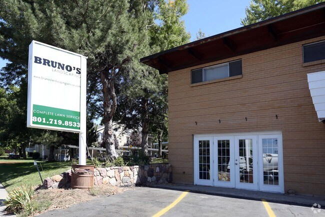

Property Detail
3077 S Highway 91
Ogden, UT
BEG AT NW COR LOT 18, BLK 2, AMD PLAT OF IRFRED PARK SUB; TH S 89^13'15" W 93.50 FT TO THE E LINE OF HWY 91; TH S 29^22'20" W 110 FT ALG SD HWY; TH N 89^13'15" E 148.20 FT TO THE W LINE OF LOT 18, SD
01-056-0001
DAVIS
Commercialnec
Utah
RM-13
18
B and X Area of moderate flood hazard, usually the area between the limits of the 100-year and 500-year floods.
0.18 AC
2025
Davis/Weber Counties
2025
Salt Lake City
126901
NEARBY LISTINGS FOR SALE OR LEASE
DEMOGRAPHICS near 3077 S Highway 91
1 mile
3 mile
5 mile
2025 Total Population
12,620
70,992
110,091
2030 Population
12,886
72,790
112,516
Pop Growth 2025-2030
+ 2.11%
+ 2.53%
+ 2.20%
Average Age
37
36
37
2025 Total Households
4,297
23,501
36,443
HH Growth 2025-2030
+ 2.21%
+ 2.68%
+ 2.37%
Median Household Inc
$97,724
$109,391
$107,945
Avg Household Size
2.90
3.00
3.00
2025 Avg HH Vehicles
2.00
2.00
2.00
Median Home Value
$458,305
$569,168
$566,929
Median Year Built
1976
1984
1981
Nearby Places
Map Layers
Map Styles
 Street
 Aerial
Layers
 Traffic
 Biking
Places
Listings with unknown addresses are not visible on the map
- Restaurants
- Banks
- Shops
- Fitness
- Groceries
PUBLIC TRANSPORTATION
COMMUTER RAIL
Woods Cross (FrontRunner North - Utah Transit Authority (UTA))
Drive
Walk
Distance
Woods Cross (FrontRunner North - Utah Transit Authority (UTA))
5 min
2.3 mi
Warm Springs Relief Point (FrontRunner - Utah Transit Authority (UTA))
Drive
Walk
Distance
Warm Springs Relief Point (FrontRunner - Utah Transit Authority (UTA))
10 min
5.6 mi
AIRPORT
Salt Lake City International
Drive
Walk
Distance
Salt Lake City International
17 min
12.0 mi
Freight Ports
Port of Stockton
Drive
Walk
Distance
Port of Stockton
717 min
702.3 mi
SALE & LEASE HISTORY
LISTING DATE
SALE/LEASE

Dec 17, 2018
For Lease
Nearby Properties
Address
Land Use
TOTAL SIZE
Lot Size
Zoning
Address
Land Use
TOTAL SIZE
Lot Size
Zoning
6,673 SF
345.82 AC
Address
Land Use
TOTAL SIZE
Lot Size
Zoning
123,416 SF
14.85 AC
R4
Address
Land Use
TOTAL SIZE
Lot Size
Zoning
181,804 SF
24.72 AC
Address
Land Use
TOTAL SIZE
Lot Size
Zoning
240,104 SF
37.03 AC
C2
Address
Land Use
TOTAL SIZE
Lot Size
Zoning
657,526 SF
35.95 AC
MD
Address
Land Use
TOTAL SIZE
Lot Size
Zoning
4,241 SF
8.67 AC
P
Address
Land Use
TOTAL SIZE
Lot Size
Zoning
208,638 SF
56.05 AC
Address
Land Use
TOTAL SIZE
Lot Size
Zoning
3,026 SF
14.42 AC
P
Address
Land Use
TOTAL SIZE
Lot Size
Zoning
13,126 SF
7.83 AC
P
Address
Land Use
TOTAL SIZE
Lot Size
Zoning
168,369 SF
10.14 AC
H
Address
Land Use
TOTAL SIZE
Lot Size
Zoning
113,419 SF
16.45 AC
R4
Address
Land Use
TOTAL SIZE
Lot Size
Zoning
92,796 SF
2.22 AC
DN
Address
Land Use
TOTAL SIZE
Lot Size
Zoning
113,265 SF
0.55 AC
CG
Address
Land Use
TOTAL SIZE
Lot Size
Zoning
230,020 SF
27.33 AC
MD
Address
Land Use
TOTAL SIZE
Lot Size
Zoning
156,694 SF
7.67 AC
Address
Land Use
TOTAL SIZE
Lot Size
Zoning
167,410 SF
12.89 AC
CG
Address
Land Use
TOTAL SIZE
Lot Size
Zoning
259,942 SF
18.52 AC
MD
Address
Land Use
TOTAL SIZE
Lot Size
Zoning
155,896 SF
8.96 AC
Address
Land Use
TOTAL SIZE
Lot Size
Zoning
58,273 SF
3.80 AC
I1
Address
Land Use
TOTAL SIZE
Lot Size
Zoning
19,299 SF
3.06 AC
Address
Land Use
TOTAL SIZE
Lot Size
Zoning
113,197 SF
3.62 AC
Address
Land Use
TOTAL SIZE
Lot Size
Zoning
3,986 SF
13 AC
CG
Address
Land Use
TOTAL SIZE
Lot Size
Zoning
119,710 SF
13.15 AC
R4
Address
Land Use
TOTAL SIZE
Lot Size
Zoning
6,050 SF
59.94 AC
Address
Land Use
TOTAL SIZE
Lot Size
Zoning
101,110 SF
8.12 AC
Address
Land Use
TOTAL SIZE
Lot Size
Zoning
57,830 SF
3.54 AC
Address
Land Use
TOTAL SIZE
Lot Size
Zoning
9,747 SF
7.73 AC
R4
Address
Land Use
TOTAL SIZE
Lot Size
Zoning
37,334 SF
9.72 AC
RM19
Address
Land Use
TOTAL SIZE
Lot Size
Zoning
166.84 AC
R-F
Address
Land Use
TOTAL SIZE
Lot Size
Zoning
72,760 SF
12 AC
PD
The World's #1 Commercial Real Estate Marketplace
Connect with us
© 2026 CoStar Group
The information above has been obtained from sources believed reliable. While we do not doubt its accuracy we have not verified it and make no guarantee, warranty or representation about it. It is your responsibility to independently confirm its accuracy and completeness. Any projections, opinions, assumptions, or estimates used are for example only and do not represent the current or future performance of the property. The value of this transaction to you depends on tax and other factors which should be evaluated by your tax, financial, and legal advisors. You and your advisors should conduct a careful, independent investigation of the property to determine to your satisfaction the suitability of the property for your needs.