Property Record
308 Nashua Rd, Londonderry, NH 03053
NEARBY LISTINGS FOR SALE OR LEASE
-
-
View all Londonderry listings for sale on LoopNet.com
Property Detail
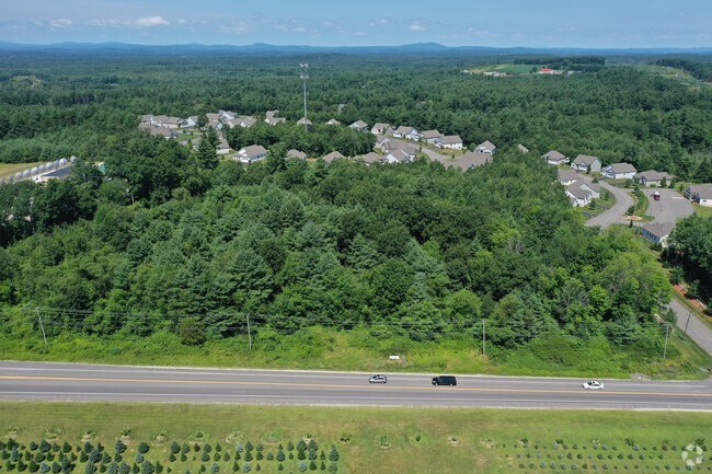
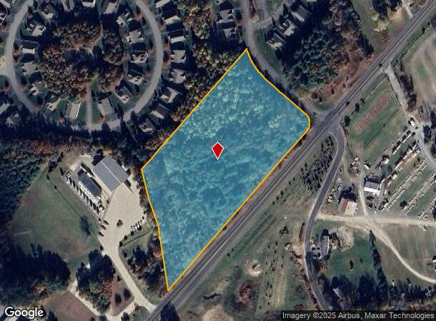
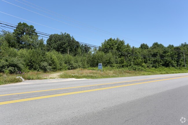
308 Nashua Rd
LOND-000002-000000-000027-000028
Rockingham
Commercialacreage
New Hampshire
X
27-28
33011C0509D
6.85 AC
2024
Rockingham
2024
Boston
003802
Boston-Cambridge-Newton, MA-NH
DEMOGRAPHICS near 308 Nashua Rd
1 Mile
3 Mile
5 Mile
2024 Total Population
1,813
19,396
66,844
2029 Population
1,878
20,033
68,959
Pop Growth 2024-2029
+ 3.59%
+ 3.28%
+ 3.16%
Average Age
42
42
42
2024 Total Households
641
6,995
25,227
HH Growth 2024-2029
+ 3.59%
+ 3.25%
+ 3.14%
Median Household Inc
$129,521
$131,489
$118,330
Avg Household Size
2.80
2.80
2.60
2024 Avg HH Vehicles
2.00
2.00
2.00
Median Home Value
$427,092
$407,272
$395,651
Median Year Built
1985
1983
1983
Nearby Places
Map Layers
Map Styles
 Street
 Aerial
- Restaurants
- Banks
- Shops
- Fitness
- Groceries
PUBLIC TRANSPORTATION
AIRPORT
Manchester Boston Regional
DRIVE
WALK
Distance
Manchester Boston Regional
24 min
9.5 mi
Freight Ports
Port of Boston
DRIVE
WALK
Distance
Port of Boston
71 min
48.7 mi
SALE & LEASE HISTORY
LISTING DATE
SALE/LEASE

Jul 22, 2019
For Sale
Nearby Properties
Address
Land Use
TOTAL SIZE
Lot Size
Zoning
Address
Land Use
TOTAL SIZE
Lot Size
Zoning
188,520 SF
111.12 AC
GD
Address
Land Use
TOTAL SIZE
Lot Size
Zoning
80,710 SF
20 AC
AR-I
Address
Land Use
TOTAL SIZE
Lot Size
Zoning
41,989 SF
C-III
Address
Land Use
TOTAL SIZE
Lot Size
Zoning
38 AC
RES
Address
Land Use
TOTAL SIZE
Lot Size
Zoning
11.28 AC
C-I
Address
Land Use
TOTAL SIZE
Lot Size
Zoning
34,442 SF
99.29 AC
AR-I
Address
Land Use
TOTAL SIZE
Lot Size
Zoning
15,000 SF
C-III
Address
Land Use
TOTAL SIZE
Lot Size
Zoning
17.55 AC
RES
Address
Land Use
TOTAL SIZE
Lot Size
Zoning
45,330 SF
1 AC
R3
Address
Land Use
TOTAL SIZE
Lot Size
Zoning
69,900 SF
18.10 AC
BD
Address
Land Use
TOTAL SIZE
Lot Size
Zoning
44,280 SF
1 AC
R3
Address
Land Use
TOTAL SIZE
Lot Size
Zoning
25,083 SF
1.42 AC
C-III
Address
Land Use
TOTAL SIZE
Lot Size
Zoning
2,400 SF
15.50 AC
G1
Address
Land Use
TOTAL SIZE
Lot Size
Zoning
31,091 SF
3.42 AC
BD
Address
Land Use
TOTAL SIZE
Lot Size
Zoning
684 SF
178.86 AC
G1
Address
Land Use
TOTAL SIZE
Lot Size
Zoning
8,596 SF
9.97 AC
GD
Address
Land Use
TOTAL SIZE
Lot Size
Zoning
13,560 SF
27.43 AC
R2
Address
Land Use
TOTAL SIZE
Lot Size
Zoning
11.94 AC
I1/2
Address
Land Use
TOTAL SIZE
Lot Size
Zoning
32,946 SF
1.20 AC
C-I
Address
Land Use
TOTAL SIZE
Lot Size
Zoning
9,800 SF
10.09 AC
B
Address
Land Use
TOTAL SIZE
Lot Size
Zoning
256.45 AC
TRANSI
Address
Land Use
TOTAL SIZE
Lot Size
Zoning
12,300 SF
9.93 AC
AR-1/C
Address
Land Use
TOTAL SIZE
Lot Size
Zoning
4.15 AC
C-I
Address
Land Use
TOTAL SIZE
Lot Size
Zoning
67.75 AC
I1/2
Address
Land Use
TOTAL SIZE
Lot Size
Zoning
24,225 SF
7 AC
AR-I
Address
Land Use
TOTAL SIZE
Lot Size
Zoning
9,960 SF
3.11 AC
C-I
Address
Land Use
TOTAL SIZE
Lot Size
Zoning
600 SF
21.74 AC
ID
Address
Land Use
TOTAL SIZE
Lot Size
Zoning
9,600 SF
15.14 AC
C-II
Address
Land Use
TOTAL SIZE
Lot Size
Zoning
15,253 SF
5.09 AC
G1
Address
Land Use
TOTAL SIZE
Lot Size
Zoning
6.80 AC
H COMH
The World's #1 Commercial Real Estate Marketplace
Connect with us
© 2025 CoStar Group
The information above has been obtained from sources believed reliable. While we do not doubt its accuracy we have not verified it and make no guarantee, warranty or representation about it. It is your responsibility to independently confirm its accuracy and completeness. Any projections, opinions, assumptions, or estimates used are for example only and do not represent the current or future performance of the property. The value of this transaction to you depends on tax and other factors which should be evaluated by your tax, financial, and legal advisors. You and your advisors should conduct a careful, independent investigation of the property to determine to your satisfaction the suitability of the property for your needs.