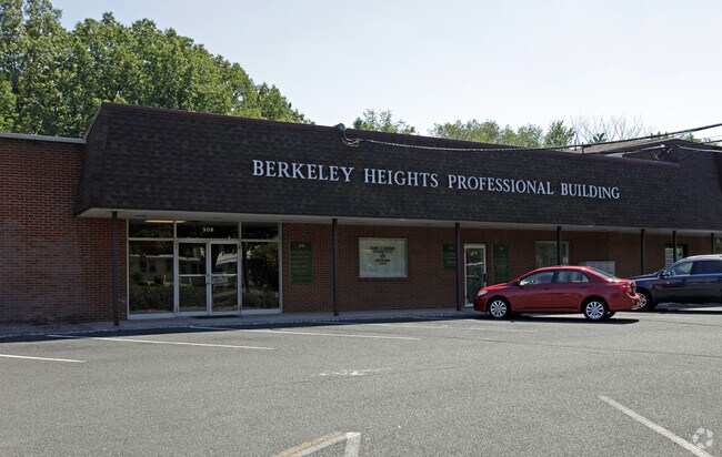
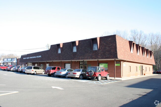
Property Record
308 Springfield Ave, Berkeley Heights, NJ 07922

Property Detail
308 Springfield Ave
Newark, NJ
INCL BLK 801 LOTS 28 & 28-01
01-00801-0000-00028
Union
Officebuilding
New Jersey
HB2
28
AE The base floodplain where base flood elevations are provided. AE Zones are now used on new format FIRMs instead of A1-A30 Zones.
1.23 AC
2024
Short Hills/Millburn
2025
Northern New Jersey
038202
NEARBY LISTINGS FOR SALE OR LEASE
DEMOGRAPHICS near 308 Springfield Ave
1 mile
3 mile
5 mile
2025 Total Population
8,347
43,867
184,329
2030 Population
8,862
46,133
193,097
Pop Growth 2025-2030
+ 6.17%
+ 5.17%
+ 4.76%
Average Age
42
42
41
2025 Total Households
2,895
15,532
62,910
HH Growth 2025-2030
+ 6.25%
+ 5.17%
+ 4.86%
Median Household Inc
$154,224
$179,723
$157,441
Avg Household Size
2.80
2.80
2.80
2025 Avg HH Vehicles
2.00
2.00
2.00
Median Home Value
$779,093
$786,132
$770,285
Median Year Built
1968
1966
1958
Nearby Places
Map Layers
Map Styles
 Street
 Aerial
Transit
 Traffic
 Biking
Places
Listings with unknown addresses are not visible on the map
- Restaurants
- Banks
- Shops
- Fitness
- Groceries
PUBLIC TRANSPORTATION
COMMUTER RAIL
Berkeley Heights (Morris & Essex Gladstone Branch - NJ Transit Commuter Rail (NJ Transit))
Drive
Walk
Distance
Berkeley Heights (Morris & Essex Gladstone Branch - NJ Transit Commuter Rail (NJ Transit))
3 min
13 min
0.7 mi
Murray Hill (Morris & Essex Gladstone Branch - NJ Transit Commuter Rail (NJ Transit))
Drive
Walk
Distance
Murray Hill (Morris & Essex Gladstone Branch - NJ Transit Commuter Rail (NJ Transit))
6 min
2.3 mi
AIRPORT
Newark Liberty International
Drive
Walk
Distance
Newark Liberty International
27 min
18.9 mi
LaGuardia
Drive
Walk
Distance
LaGuardia
62 min
38.1 mi
Trenton Mercer
Drive
Walk
Distance
Trenton Mercer
77 min
46.2 mi
Freight Ports
Maher Terminal
Drive
Walk
Distance
Maher Terminal
31 min
20.0 mi
Nearby Properties
Address
Land Use
TOTAL SIZE
Lot Size
Zoning
Address
Land Use
TOTAL SIZE
Lot Size
Zoning
151,088 SF
26.48 AC
CCRC
Address
Land Use
TOTAL SIZE
Lot Size
Zoning
153.40 AC
OR
Address
Land Use
TOTAL SIZE
Lot Size
Zoning
439.33 AC
Address
Land Use
TOTAL SIZE
Lot Size
Zoning
0.42 AC
R-1
Address
Land Use
TOTAL SIZE
Lot Size
Zoning
47.69 AC
MU
Address
Land Use
TOTAL SIZE
Lot Size
Zoning
47.80 AC
H-D
Address
Land Use
TOTAL SIZE
Lot Size
Zoning
34.60 AC
MU
Address
Land Use
TOTAL SIZE
Lot Size
Zoning
140,732 SF
42.73 AC
OR
Address
Land Use
TOTAL SIZE
Lot Size
Zoning
23.93 AC
B2
Address
Land Use
TOTAL SIZE
Lot Size
Zoning
24.92 AC
MU
Address
Land Use
TOTAL SIZE
Lot Size
Zoning
61,912 SF
16 AC
OR
Address
Land Use
TOTAL SIZE
Lot Size
Zoning
23.66 AC
R2
Address
Land Use
TOTAL SIZE
Lot Size
Zoning
356.94 AC
OL
Address
Land Use
TOTAL SIZE
Lot Size
Zoning
36.55 AC
OL
Address
Land Use
TOTAL SIZE
Lot Size
Zoning
184,000 SF
24.43 AC
OR
Address
Land Use
TOTAL SIZE
Lot Size
Zoning
6.76 AC
MU
Address
Land Use
TOTAL SIZE
Lot Size
Zoning
3,612 SF
7.92 AC
C
Address
Land Use
TOTAL SIZE
Lot Size
Zoning
16.30 AC
OR
Address
Land Use
TOTAL SIZE
Lot Size
Zoning
34.89 AC
R-1
Address
Land Use
TOTAL SIZE
Lot Size
Zoning
192 SF
8.68 AC
Address
Land Use
TOTAL SIZE
Lot Size
Zoning
218,207 SF
15.28 AC
Address
Land Use
TOTAL SIZE
Lot Size
Zoning
35.20 AC
OL
Address
Land Use
TOTAL SIZE
Lot Size
Zoning
9.53 AC
DD
Address
Land Use
TOTAL SIZE
Lot Size
Zoning
24.62 AC
CCRC
Address
Land Use
TOTAL SIZE
Lot Size
Zoning
Address
Land Use
TOTAL SIZE
Lot Size
Zoning
16.32 AC
R2
Address
Land Use
TOTAL SIZE
Lot Size
Zoning
Address
Land Use
TOTAL SIZE
Lot Size
Zoning
11.16 AC
R-3
Address
Land Use
TOTAL SIZE
Lot Size
Zoning
8.56 AC
R2
Address
Land Use
TOTAL SIZE
Lot Size
Zoning
27.24 AC
A-H
The World's #1 Commercial Real Estate Marketplace
Connect with us
© 2026 CoStar Group
The information above has been obtained from sources believed reliable. While we do not doubt its accuracy we have not verified it and make no guarantee, warranty or representation about it. It is your responsibility to independently confirm its accuracy and completeness. Any projections, opinions, assumptions, or estimates used are for example only and do not represent the current or future performance of the property. The value of this transaction to you depends on tax and other factors which should be evaluated by your tax, financial, and legal advisors. You and your advisors should conduct a careful, independent investigation of the property to determine to your satisfaction the suitability of the property for your needs.