Property Record
3080 East Blvd, Bethlehem, PA 18017

NEARBY LISTINGS FOR SALE OR LEASE
-
-
View all Bethlehem listings for sale on LoopNet.com
Property Detail
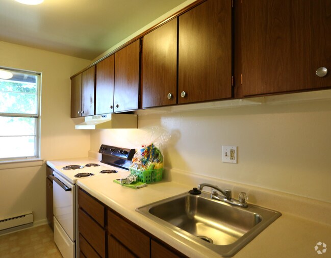
3080 East Blvd
Gardenaptcourtapt5plusunits
Northampton
X
Pennsylvania
42095C0261E
0.57 AC
2025
E Bethlehem/W Northampton County
2025
Philadelphia
010200
Allentown-Bethlehem-Easton, PA-NJ
5,600 SF
M7SW4-10-6-0204
DEMOGRAPHICS near 3080 East Blvd
1 Mile
3 Mile
5 Mile
2024 Total Population
10,724
73,422
152,867
2029 Population
10,718
73,638
153,622
Pop Growth 2024-2029
(0.06%)
+ 0.29%
+ 0.49%
Average Age
43
43
41
2024 Total Households
4,312
29,322
59,074
HH Growth 2024-2029
+ 0.02%
+ 0.27%
+ 0.55%
Median Household Inc
$87,249
$82,691
$73,558
Avg Household Size
2.40
2.40
2.40
2024 Avg HH Vehicles
2.00
2.00
2.00
Median Home Value
$255,003
$264,022
$255,842
Median Year Built
1971
1971
1966
Nearby Places
Map Layers
Map Styles
 Street
 Aerial
- Restaurants
- Banks
- Shops
- Fitness
- Groceries
PUBLIC TRANSPORTATION
AIRPORT
Lehigh Valley International
DRIVE
WALK
Distance
Lehigh Valley International
14 min
6.2 mi
Freight Ports
Port of Philadelphia
DRIVE
WALK
Distance
Port of Philadelphia
92 min
55.3 mi
Nearby Properties
Address
Land Use
TOTAL SIZE
Lot Size
Zoning
Address
Land Use
TOTAL SIZE
Lot Size
Zoning
605,906 SF
94.28 AC
A
Address
Land Use
TOTAL SIZE
Lot Size
Zoning
302,378 SF
83.53 AC
A
Address
Land Use
TOTAL SIZE
Lot Size
Zoning
26,653 SF
13.51 AC
HI
Address
Land Use
TOTAL SIZE
Lot Size
Zoning
276,484 SF
31.19 AC
A
Address
Land Use
TOTAL SIZE
Lot Size
Zoning
52,164 SF
124.81 AC
IN
Address
Land Use
TOTAL SIZE
Lot Size
Zoning
800,250 SF
40.07 AC
HI
Address
Land Use
TOTAL SIZE
Lot Size
Zoning
3,400 SF
65.07 AC
RM
Address
Land Use
TOTAL SIZE
Lot Size
Zoning
298,660 SF
37.43 AC
PIBD
Address
Land Use
TOTAL SIZE
Lot Size
Zoning
524,948 SF
35.66 AC
LI
Address
Land Use
TOTAL SIZE
Lot Size
Zoning
421,883 SF
34.66 AC
HI
Address
Land Use
TOTAL SIZE
Lot Size
Zoning
347,514 SF
10.27 AC
RM
Address
Land Use
TOTAL SIZE
Lot Size
Zoning
168,984 SF
20.31 AC
I
Address
Land Use
TOTAL SIZE
Lot Size
Zoning
249,872 SF
41.83 AC
PC
Address
Land Use
TOTAL SIZE
Lot Size
Zoning
56,276 SF
14.91 AC
RR
Address
Land Use
TOTAL SIZE
Lot Size
Zoning
319,788 SF
60 AC
IN
Address
Land Use
TOTAL SIZE
Lot Size
Zoning
512,902 SF
35.18 AC
LI
Address
Land Use
TOTAL SIZE
Lot Size
Zoning
601,903 SF
41.68 AC
LI
Address
Land Use
TOTAL SIZE
Lot Size
Zoning
63,711 SF
31.56 AC
RR
Address
Land Use
TOTAL SIZE
Lot Size
Zoning
42,465 SF
7.28 AC
LI
Address
Land Use
TOTAL SIZE
Lot Size
Zoning
539,133 SF
47 AC
LI
Address
Land Use
TOTAL SIZE
Lot Size
Zoning
1,456 SF
29.36 AC
A
Address
Land Use
TOTAL SIZE
Lot Size
Zoning
508,835 SF
34.92 AC
A
Address
Land Use
TOTAL SIZE
Lot Size
Zoning
208,053 SF
45.58 AC
I
Address
Land Use
TOTAL SIZE
Lot Size
Zoning
244,478 SF
26.32 AC
LI
Address
Land Use
TOTAL SIZE
Lot Size
Zoning
307,425 SF
37.13 AC
A
Address
Land Use
TOTAL SIZE
Lot Size
Zoning
109,753 SF
15.33 AC
PIBD
Address
Land Use
TOTAL SIZE
Lot Size
Zoning
294,412 SF
28.72 AC
A
Address
Land Use
TOTAL SIZE
Lot Size
Zoning
44,400 SF
2.77 AC
CL
Address
Land Use
TOTAL SIZE
Lot Size
Zoning
284,079 SF
20.65 AC
A
Address
Land Use
TOTAL SIZE
Lot Size
Zoning
106,155 SF
11.80 AC
RIS
The World's #1 Commercial Real Estate Marketplace
Connect with us
© 2025 CoStar Group
The information above has been obtained from sources believed reliable. While we do not doubt its accuracy we have not verified it and make no guarantee, warranty or representation about it. It is your responsibility to independently confirm its accuracy and completeness. Any projections, opinions, assumptions, or estimates used are for example only and do not represent the current or future performance of the property. The value of this transaction to you depends on tax and other factors which should be evaluated by your tax, financial, and legal advisors. You and your advisors should conduct a careful, independent investigation of the property to determine to your satisfaction the suitability of the property for your needs.