Property Record
3081 Route 22, Patterson, NY 12563

Save to a Folder
{{folder.Name}}
{{folder.ListingIds.length}} Properties
{{folder.ListingIds.length}} Property
Create a New Folder
Property Detail
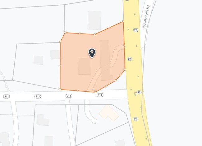
3081 Route 22
372400-004-000-0001-037-000-0000
Putnam
Servicestation
New York
C1
37.00
B and X Area of moderate flood hazard, usually the area between the limits of the 100-year and 500-year floods.
1.04 AC
2024
Brewster
2025
Westchester/So Connecticut
010202
New York-Jersey City-White Plains, NY-NJ
2,436 SF
NEARBY LISTINGS FOR SALE OR LEASE
DEMOGRAPHICS near 3081 Route 22
1 mile
3 mile
5 mile
2025 Total Population
792
6,238
24,726
2030 Population
781
6,222
24,948
Pop Growth 2025-2030
(1.39%)
(0.26%)
+ 0.90%
Average Age
43
44
44
2025 Total Households
275
1,975
8,830
HH Growth 2025-2030
(1.45%)
(0.20%)
+ 0.95%
Median Household Inc
$113,392
$109,130
$118,397
Avg Household Size
2.70
2.60
2.60
2025 Avg HH Vehicles
2.00
2.00
2.00
Median Home Value
$458,571
$450,917
$424,813
Median Year Built
1968
1981
1968
Nearby Places
Map Layers
Map Styles
 Street
 Aerial
Layers
 Traffic
 Biking
Places
Listings with unknown addresses are not visible on the map
- Restaurants
- Banks
- Shops
- Fitness
- Groceries
PUBLIC TRANSPORTATION
TRANSIT/SUBWAY
Patterson Station (Harlem Line - Metro-North Commuter Railroad Company (Metro-North))
Drive
Walk
Distance
Patterson Station (Harlem Line - Metro-North Commuter Railroad Company (Metro-North))
2 min
16 min
0.8 mi
COMMUTER RAIL
Patterson Station (Harlem Line - Metro-North Commuter Railroad Company (Metro-North))
Drive
Walk
Distance
Patterson Station (Harlem Line - Metro-North Commuter Railroad Company (Metro-North))
2 min
16 min
0.8 mi
Pawling Station (Harlem Line - Metro-North Commuter Railroad Company (Metro-North))
Drive
Walk
Distance
Pawling Station (Harlem Line - Metro-North Commuter Railroad Company (Metro-North))
8 min
4.0 mi
AIRPORT
Westchester County
Drive
Walk
Distance
Westchester County
46 min
34.6 mi
New York Stewart International
Drive
Walk
Distance
New York Stewart International
50 min
35.1 mi
Freight Ports
Port of New Haven
Drive
Walk
Distance
Port of New Haven
76 min
49.1 mi
Nearby Properties
Address
Land Use
TOTAL SIZE
Lot Size
Zoning
Address
Land Use
TOTAL SIZE
Lot Size
Zoning
1,498,293 SF
361.91 AC
R4
Address
Land Use
TOTAL SIZE
Lot Size
Zoning
12,064 SF
12.10 AC
C1
Address
Land Use
TOTAL SIZE
Lot Size
Zoning
88,011 SF
23.04 AC
C1
Address
Land Use
TOTAL SIZE
Lot Size
Zoning
129,961 SF
31.51 AC
C1
Address
Land Use
TOTAL SIZE
Lot Size
Zoning
77,537 SF
19.41 AC
R1
Address
Land Use
TOTAL SIZE
Lot Size
Zoning
Address
Land Use
TOTAL SIZE
Lot Size
Zoning
12,871 SF
277.38 AC
R4
Address
Land Use
TOTAL SIZE
Lot Size
Zoning
19,768 SF
2.70 AC
GB
Address
Land Use
TOTAL SIZE
Lot Size
Zoning
Address
Land Use
TOTAL SIZE
Lot Size
Zoning
Address
Land Use
TOTAL SIZE
Lot Size
Zoning
Address
Land Use
TOTAL SIZE
Lot Size
Zoning
Address
Land Use
TOTAL SIZE
Lot Size
Zoning
6,840 SF
127.82 AC
RPL10
Address
Land Use
TOTAL SIZE
Lot Size
Zoning
50,339 SF
14.96 AC
C1
Address
Land Use
TOTAL SIZE
Lot Size
Zoning
22,670 SF
10.58 AC
C1
Address
Land Use
TOTAL SIZE
Lot Size
Zoning
29,220 SF
23.83 AC
C1
Address
Land Use
TOTAL SIZE
Lot Size
Zoning
5.54 AC
Address
Land Use
TOTAL SIZE
Lot Size
Zoning
24,550 SF
2.02 AC
GB
Address
Land Use
TOTAL SIZE
Lot Size
Zoning
32.64 AC
R1
Address
Land Use
TOTAL SIZE
Lot Size
Zoning
17,792 SF
8.52 AC
R1
Address
Land Use
TOTAL SIZE
Lot Size
Zoning
Address
Land Use
TOTAL SIZE
Lot Size
Zoning
2.50 AC
C1
Address
Land Use
TOTAL SIZE
Lot Size
Zoning
10,370 SF
30.93 AC
R4
Address
Land Use
TOTAL SIZE
Lot Size
Zoning
0.23 AC
R4
Address
Land Use
TOTAL SIZE
Lot Size
Zoning
604.69 AC
R4
Address
Land Use
TOTAL SIZE
Lot Size
Zoning
1.26 AC
GB
Address
Land Use
TOTAL SIZE
Lot Size
Zoning
26,275 SF
8.40 AC
PDD
Address
Land Use
TOTAL SIZE
Lot Size
Zoning
Address
Land Use
TOTAL SIZE
Lot Size
Zoning
13,961 SF
2 AC
GB
Address
Land Use
TOTAL SIZE
Lot Size
Zoning
261.39 AC
R4
The World's #1 Commercial Real Estate Marketplace
Connect with us
© 2026 CoStar Group
The information above has been obtained from sources believed reliable. While we do not doubt its accuracy we have not verified it and make no guarantee, warranty or representation about it. It is your responsibility to independently confirm its accuracy and completeness. Any projections, opinions, assumptions, or estimates used are for example only and do not represent the current or future performance of the property. The value of this transaction to you depends on tax and other factors which should be evaluated by your tax, financial, and legal advisors. You and your advisors should conduct a careful, independent investigation of the property to determine to your satisfaction the suitability of the property for your needs.