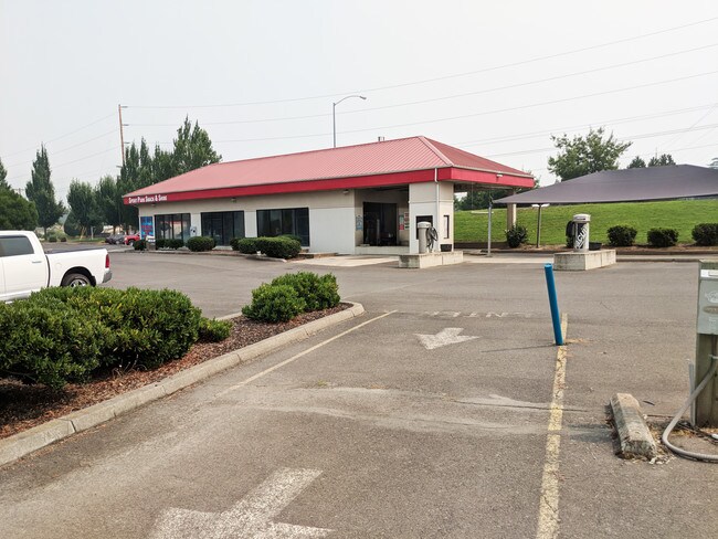
Property Record
3082 Samike Dr, Medford, OR 97501


NEARBY LISTINGS FOR SALE OR LEASE
Property Detail
3082 Samike Dr
10913864
Jackson
Commercialbuilding
Oregon
X
2
41029C1987F
1.33 AC
2025
Medford/Grants Pass
2026
Other Market Areas
001601
Medford, OR
5,540 SF
DEMOGRAPHICS near 3082 Samike Dr
1 mile
3 mile
5 mile
2024 Total Population
4,519
43,670
98,517
2029 Population
4,479
43,340
97,907
Pop Growth 2024-2029
(0.89%)
(0.76%)
(0.62%)
Average Age
44
43
42
2024 Total Households
2,142
18,171
39,824
HH Growth 2024-2029
(0.98%)
(0.87%)
(0.70%)
Median Household Inc
$47,500
$60,497
$60,331
Avg Household Size
2.10
2.30
2.40
2024 Avg HH Vehicles
1.00
2.00
2.00
Median Home Value
$91,555
$356,473
$351,694
Median Year Built
1993
1977
1981
Nearby Places
Map Layers
Map Styles
 Street
 Aerial
Transit
 Traffic
 Biking
Places
Listings with unknown addresses are not visible on the map
- Restaurants
- Banks
- Shops
- Fitness
- Groceries
PUBLIC TRANSPORTATION
AIRPORT
Rogue Valley International - Medford
Drive
Walk
Distance
Rogue Valley International - Medford
13 min
6.5 mi
SALE & LEASE HISTORY
LISTING DATE
SALE/LEASE

Aug 24, 2018
For Sale
Nearby Properties
Address
Land Use
TOTAL SIZE
Lot Size
Zoning
Address
Land Use
TOTAL SIZE
Lot Size
Zoning
674,760 SF
104.26 AC
SFR-4
Address
Land Use
TOTAL SIZE
Lot Size
Zoning
37.16 AC
RR-5
Address
Land Use
TOTAL SIZE
Lot Size
Zoning
762,720 SF
16.25 AC
C-S/P
Address
Land Use
TOTAL SIZE
Lot Size
Zoning
124.05 AC
C-R
Address
Land Use
TOTAL SIZE
Lot Size
Zoning
36,606 SF
2.20 AC
C-S/P
Address
Land Use
TOTAL SIZE
Lot Size
Zoning
196,384 SF
4.80 AC
C-S/P
Address
Land Use
TOTAL SIZE
Lot Size
Zoning
Address
Land Use
TOTAL SIZE
Lot Size
Zoning
77,354 SF
8.28 AC
SFR-4
Address
Land Use
TOTAL SIZE
Lot Size
Zoning
153,140 SF
14.93 AC
SFR-10
Address
Land Use
TOTAL SIZE
Lot Size
Zoning
147,839 SF
15.43 AC
C-R
Address
Land Use
TOTAL SIZE
Lot Size
Zoning
30.50 AC
SFR-4
Address
Land Use
TOTAL SIZE
Lot Size
Zoning
85,610 SF
1.78 AC
C-C
Address
Land Use
TOTAL SIZE
Lot Size
Zoning
81.70 AC
LI
Address
Land Use
TOTAL SIZE
Lot Size
Zoning
12,544 SF
16.70 AC
C-R
Address
Land Use
TOTAL SIZE
Lot Size
Zoning
31,338 SF
4.41 AC
C-R
Address
Land Use
TOTAL SIZE
Lot Size
Zoning
212,477 SF
13.74 AC
I-L
Address
Land Use
TOTAL SIZE
Lot Size
Zoning
5.22 AC
MFR-30
Address
Land Use
TOTAL SIZE
Lot Size
Zoning
6,140 SF
0.84 AC
C-C
Address
Land Use
TOTAL SIZE
Lot Size
Zoning
74,724 SF
7.56 AC
C-R
Address
Land Use
TOTAL SIZE
Lot Size
Zoning
77,365 SF
3.25 AC
SFR-10
Address
Land Use
TOTAL SIZE
Lot Size
Zoning
9,216 SF
1.66 AC
C-R
Address
Land Use
TOTAL SIZE
Lot Size
Zoning
3,600 SF
0.50 AC
I-G
Address
Land Use
TOTAL SIZE
Lot Size
Zoning
127.94 AC
SFR-4
Address
Land Use
TOTAL SIZE
Lot Size
Zoning
106,312 SF
3.87 AC
SFR-10
Address
Land Use
TOTAL SIZE
Lot Size
Zoning
46,774 SF
4.29 AC
SFR-6
Address
Land Use
TOTAL SIZE
Lot Size
Zoning
12,944 SF
21.34 AC
SFR-4
Address
Land Use
TOTAL SIZE
Lot Size
Zoning
7,303 SF
0.69 AC
C-C
Address
Land Use
TOTAL SIZE
Lot Size
Zoning
50,943 SF
0.18 AC
SFR-00
Address
Land Use
TOTAL SIZE
Lot Size
Zoning
130,599 SF
9.43 AC
C-H
Address
Land Use
TOTAL SIZE
Lot Size
Zoning
92,000 SF
3.39 AC
MFR-30
The World's #1 Commercial Real Estate Marketplace
Connect with us
© 2026 CoStar Group
The information above has been obtained from sources believed reliable. While we do not doubt its accuracy we have not verified it and make no guarantee, warranty or representation about it. It is your responsibility to independently confirm its accuracy and completeness. Any projections, opinions, assumptions, or estimates used are for example only and do not represent the current or future performance of the property. The value of this transaction to you depends on tax and other factors which should be evaluated by your tax, financial, and legal advisors. You and your advisors should conduct a careful, independent investigation of the property to determine to your satisfaction the suitability of the property for your needs.