Property Record
309 State St E, Oldsmar, FL 34677


Property Detail
309 State St E
Tampa-St. Petersburg-Clearwater, FL
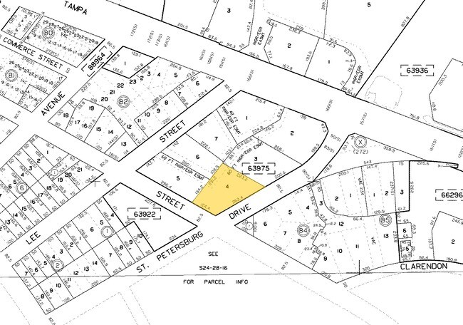
OLDSMAR TOWN CENTER LOT 4
24-28-16-63975-000-0040
Pinellas
Officebuilding
Florida
AE The base floodplain where base flood elevations are provided. AE Zones are now used on new format FIRMs instead of A1-A30 Zones.
4
2024
0.91 AC
2025
North Pinellas
027320
Tampa/St Petersburg
10,924 SF
NEARBY LISTINGS FOR SALE OR LEASE
DEMOGRAPHICS near 309 State St E
1 mile
3 mile
5 mile
2025 Total Population
2,380
45,246
153,503
2030 Population
2,356
46,233
157,618
Pop Growth 2025-2030
(1.01%)
+ 2.18%
+ 2.68%
Average Age
42
43
43
2025 Total Households
919
18,662
64,364
HH Growth 2025-2030
(1.31%)
+ 2.07%
+ 2.44%
Median Household Inc
$98,358
$95,885
$89,098
Avg Household Size
2.60
2.40
2.30
2025 Avg HH Vehicles
2.00
2.00
2.00
Median Home Value
$445,238
$470,695
$442,075
Median Year Built
1982
1990
1988
Nearby Places
Map Layers
Map Styles
 Street
 Aerial
Layers
 Traffic
 Biking
Places
Listings with unknown addresses are not visible on the map
- Restaurants
- Banks
- Shops
- Fitness
- Groceries
PUBLIC TRANSPORTATION
AIRPORT
St Pete-Clearwater International
Drive
Walk
Distance
St Pete-Clearwater International
26 min
12.4 mi
Tampa International
Drive
Walk
Distance
Tampa International
19 min
12.5 mi
Freight Ports
Port of Tampa Bay
Drive
Walk
Distance
Port of Tampa Bay
1 min
15.4 mi
SALE & LEASE HISTORY
LISTING DATE
SALE/LEASE

Sep 24, 2016
For Sale
Nearby Properties
Address
Land Use
TOTAL SIZE
Lot Size
Zoning
Address
Land Use
TOTAL SIZE
Lot Size
Zoning
536,079 SF
23.90 AC
PD
Address
Land Use
TOTAL SIZE
Lot Size
Zoning
399,137 SF
44.98 AC
PD
Address
Land Use
TOTAL SIZE
Lot Size
Zoning
374,906 SF
54.10 AC
PD
Address
Land Use
TOTAL SIZE
Lot Size
Zoning
459,627 SF
23.28 AC
PD
Address
Land Use
TOTAL SIZE
Lot Size
Zoning
449,097 SF
75.52 AC
PD
Address
Land Use
TOTAL SIZE
Lot Size
Zoning
358,185 SF
41.27 AC
PD
Address
Land Use
TOTAL SIZE
Lot Size
Zoning
323,386 SF
30.50 AC
PD
Address
Land Use
TOTAL SIZE
Lot Size
Zoning
473,742 SF
20.84 AC
Address
Land Use
TOTAL SIZE
Lot Size
Zoning
305,687 SF
31.48 AC
PD
Address
Land Use
TOTAL SIZE
Lot Size
Zoning
417,535 SF
42.47 AC
Address
Land Use
TOTAL SIZE
Lot Size
Zoning
427,299 SF
80.21 AC
PD
Address
Land Use
TOTAL SIZE
Lot Size
Zoning
311,117 SF
16.96 AC
Address
Land Use
TOTAL SIZE
Lot Size
Zoning
241,867 SF
19.54 AC
Address
Land Use
TOTAL SIZE
Lot Size
Zoning
173,673 SF
13.77 AC
PD
Address
Land Use
TOTAL SIZE
Lot Size
Zoning
188,940 SF
24.78 AC
PD
Address
Land Use
TOTAL SIZE
Lot Size
Zoning
177,360 SF
9.28 AC
Address
Land Use
TOTAL SIZE
Lot Size
Zoning
123,836 SF
15.17 AC
PD
Address
Land Use
TOTAL SIZE
Lot Size
Zoning
145,000 SF
1.26 AC
Address
Land Use
TOTAL SIZE
Lot Size
Zoning
126,644 SF
19.09 AC
Address
Land Use
TOTAL SIZE
Lot Size
Zoning
575,565 SF
335.60 AC
PD
Address
Land Use
TOTAL SIZE
Lot Size
Zoning
220,103 SF
28.40 AC
Address
Land Use
TOTAL SIZE
Lot Size
Zoning
14,334 SF
117.55 AC
Address
Land Use
TOTAL SIZE
Lot Size
Zoning
130,000 SF
11.27 AC
Address
Land Use
TOTAL SIZE
Lot Size
Zoning
102,074 SF
18.39 AC
Address
Land Use
TOTAL SIZE
Lot Size
Zoning
122,912 SF
19.61 AC
Address
Land Use
TOTAL SIZE
Lot Size
Zoning
249,928 SF
79.57 AC
M1
Address
Land Use
TOTAL SIZE
Lot Size
Zoning
99,132 SF
11.45 AC
PD
Address
Land Use
TOTAL SIZE
Lot Size
Zoning
137,424 SF
9.93 AC
Address
Land Use
TOTAL SIZE
Lot Size
Zoning
100,896 SF
6.60 AC
PD
Address
Land Use
TOTAL SIZE
Lot Size
Zoning
77,858 SF
8.43 AC
PD
The World's #1 Commercial Real Estate Marketplace
Connect with us
© 2026 CoStar Group
The information above has been obtained from sources believed reliable. While we do not doubt its accuracy we have not verified it and make no guarantee, warranty or representation about it. It is your responsibility to independently confirm its accuracy and completeness. Any projections, opinions, assumptions, or estimates used are for example only and do not represent the current or future performance of the property. The value of this transaction to you depends on tax and other factors which should be evaluated by your tax, financial, and legal advisors. You and your advisors should conduct a careful, independent investigation of the property to determine to your satisfaction the suitability of the property for your needs.