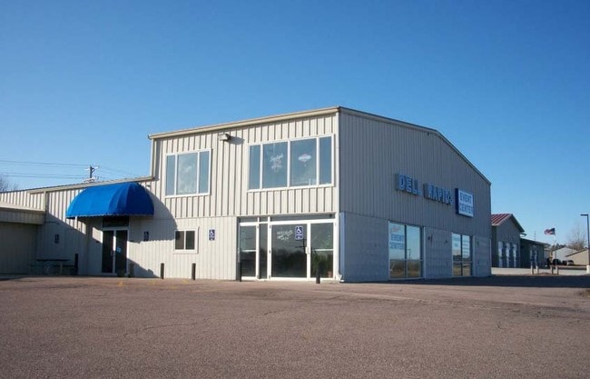
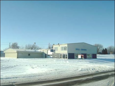
Property Record
309 W 4Th St, Dell Rapids, SD 57022
Property Detail
309 W 4Th St
22528
ALL TRACT 11 N12 SW14 9 104 49 EDENBURNS ADDITION TO THE CITY OF DELL RAPIDS
Conveniencestore
Minnehaha
B and X Area of moderate flood hazard, usually the area between the limits of the 100-year and 500-year floods.
South Dakota
2025
0.57 AC
2025
Other Market Areas
010102
Sioux Falls, SD-MN
3,268 SF
NEARBY LISTINGS FOR SALE OR LEASE
-
-
View all Dell Rapids listings for sale on LoopNet.com
DEMOGRAPHICS near 309 W 4Th St
1 mile
3 mile
5 mile
2025 Total Population
3,976
4,661
6,823
2030 Population
4,168
4,886
7,197
Pop Growth 2025-2030
+ 4.83%
+ 4.83%
+ 5.48%
Average Age
39
39
39
2025 Total Households
1,534
1,797
2,598
HH Growth 2025-2030
+ 5.22%
+ 5.23%
+ 5.85%
Median Household Inc
$97,426
$95,192
$98,513
Avg Household Size
2.60
2.60
2.60
2025 Avg HH Vehicles
2.00
2.00
2.00
Median Home Value
$335,315
$329,818
$334,729
Median Year Built
1992
1991
1993
Nearby Places
Map Layers
Map Styles
 Street
 Aerial
Layers
 Traffic
 Biking
Places
Listings with unknown addresses are not visible on the map
- Restaurants
- Banks
- Shops
- Fitness
- Groceries
PUBLIC TRANSPORTATION
AIRPORT
Joe Foss Field
Drive
Walk
Distance
Joe Foss Field
42 min
24.9 mi
Freight Ports
Port Milwaukee
Drive
Walk
Distance
Port Milwaukee
563 min
520.6 mi
Nearby Properties
Address
Land Use
TOTAL SIZE
Lot Size
Zoning
Address
Land Use
TOTAL SIZE
Lot Size
Zoning
35,352 SF
5.50 AC
Address
Land Use
TOTAL SIZE
Lot Size
Zoning
10,208 SF
12.77 AC
Address
Land Use
TOTAL SIZE
Lot Size
Zoning
19,504 SF
5.29 AC
Address
Land Use
TOTAL SIZE
Lot Size
Zoning
7,779 SF
0.88 AC
Address
Land Use
TOTAL SIZE
Lot Size
Zoning
25,682 SF
3.50 AC
Address
Land Use
TOTAL SIZE
Lot Size
Zoning
3,920 SF
13.39 AC
Address
Land Use
TOTAL SIZE
Lot Size
Zoning
17,040 SF
10.04 AC
Address
Land Use
TOTAL SIZE
Lot Size
Zoning
17,736 SF
2.37 AC
Address
Land Use
TOTAL SIZE
Lot Size
Zoning
24,822 SF
4.81 AC
Address
Land Use
TOTAL SIZE
Lot Size
Zoning
20,440 SF
155.80 AC
RC
Address
Land Use
TOTAL SIZE
Lot Size
Zoning
7,576 SF
1.34 AC
Address
Land Use
TOTAL SIZE
Lot Size
Zoning
26,478 SF
1.98 AC
Address
Land Use
TOTAL SIZE
Lot Size
Zoning
10,965 SF
2.50 AC
Address
Land Use
TOTAL SIZE
Lot Size
Zoning
285.48 AC
Address
Land Use
TOTAL SIZE
Lot Size
Zoning
400 SF
72.15 AC
NO;SPECIAL
Address
Land Use
TOTAL SIZE
Lot Size
Zoning
34.62 AC
Address
Land Use
TOTAL SIZE
Lot Size
Zoning
16,108 SF
0.96 AC
Address
Land Use
TOTAL SIZE
Lot Size
Zoning
23,040 SF
3.91 AC
I1;LIGHT I
Address
Land Use
TOTAL SIZE
Lot Size
Zoning
1,920 SF
167.18 AC
NO;SPECIAL
Address
Land Use
TOTAL SIZE
Lot Size
Zoning
4,176 SF
1.14 AC
Address
Land Use
TOTAL SIZE
Lot Size
Zoning
15,901 SF
1.20 AC
Address
Land Use
TOTAL SIZE
Lot Size
Zoning
3,396 SF
0.52 AC
Address
Land Use
TOTAL SIZE
Lot Size
Zoning
5,760 SF
0.84 AC
Address
Land Use
TOTAL SIZE
Lot Size
Zoning
10,184 SF
0.62 AC
Address
Land Use
TOTAL SIZE
Lot Size
Zoning
2,376 SF
1.20 AC
I1
Address
Land Use
TOTAL SIZE
Lot Size
Zoning
2,880 SF
0.79 AC
Address
Land Use
TOTAL SIZE
Lot Size
Zoning
8,000 SF
0.89 AC
Address
Land Use
TOTAL SIZE
Lot Size
Zoning
1,200 SF
1.31 AC
Address
Land Use
TOTAL SIZE
Lot Size
Zoning
5,823 SF
0.65 AC
The World's #1 Commercial Real Estate Marketplace
Connect with us
© 2026 CoStar Group
The information above has been obtained from sources believed reliable. While we do not doubt its accuracy we have not verified it and make no guarantee, warranty or representation about it. It is your responsibility to independently confirm its accuracy and completeness. Any projections, opinions, assumptions, or estimates used are for example only and do not represent the current or future performance of the property. The value of this transaction to you depends on tax and other factors which should be evaluated by your tax, financial, and legal advisors. You and your advisors should conduct a careful, independent investigation of the property to determine to your satisfaction the suitability of the property for your needs.