Property Record
3090 Colby Rd, Whitehall, MI 49461


NEARBY LISTINGS FOR SALE OR LEASE
-
-
View all Whitehall listings for sale on LoopNet.com
Property Detail
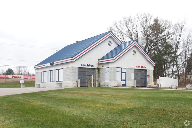
3090 Colby Rd
03-027-200-0010-00
PART OF THE NE OF SEC 27 T12N R17W WHITEHALL TOWNSHIP COMM AT THE E COR OF SD SEC TH N 88D 18M 59S W 1324.27 FT ALNG THE
Commercialnec
Muskegon
X
Michigan
26121C0037E
2.17 AC
2024
Northern Muskegon County
2025
West Michigan
003702
Muskegon, MI
2,600 SF
DEMOGRAPHICS near 3090 Colby Rd
1 Mile
3 Mile
5 Mile
2024 Total Population
1,353
8,947
15,048
2029 Population
1,356
9,061
15,276
Pop Growth 2024-2029
+ 0.22%
+ 1.27%
+ 1.52%
Average Age
43
43
43
2024 Total Households
581
3,693
5,999
HH Growth 2024-2029
0.00%
+ 1.27%
+ 1.55%
Median Household Inc
$46,902
$61,195
$62,562
Avg Household Size
2.30
2.40
2.40
2024 Avg HH Vehicles
2.00
2.00
2.00
Median Home Value
$167,187
$180,394
$182,645
Median Year Built
1972
1972
1976
Nearby Places
Map Layers
Map Styles
 Street
 Aerial
- Restaurants
- Banks
- Shops
- Fitness
- Groceries
Nearby Properties
Address
Land Use
TOTAL SIZE
Lot Size
Zoning
Address
Land Use
TOTAL SIZE
Lot Size
Zoning
620,456 SF
127.38 AC
M-2 GEN
Address
Land Use
TOTAL SIZE
Lot Size
Zoning
104,000 SF
Address
Land Use
TOTAL SIZE
Lot Size
Zoning
126,901 SF
30.35 AC
B COM
Address
Land Use
TOTAL SIZE
Lot Size
Zoning
358,824 SF
38.03 AC
M-1 IND
Address
Land Use
TOTAL SIZE
Lot Size
Zoning
117,661 SF
14.70 AC
M-1 LIM
Address
Land Use
TOTAL SIZE
Lot Size
Zoning
70,092 SF
14.17 AC
C-COM
Address
Land Use
TOTAL SIZE
Lot Size
Zoning
114,008 SF
R - 1
Address
Land Use
TOTAL SIZE
Lot Size
Zoning
183,166 SF
12.83 AC
M-2 GEN
Address
Land Use
TOTAL SIZE
Lot Size
Zoning
44,844 SF
7.83 AC
NC
Address
Land Use
TOTAL SIZE
Lot Size
Zoning
72,461 SF
7.69 AC
M-1 IND
Address
Land Use
TOTAL SIZE
Lot Size
Zoning
52,111 SF
R - 1
Address
Land Use
TOTAL SIZE
Lot Size
Zoning
14,418 SF
2.50 AC
MI LIMI
Address
Land Use
TOTAL SIZE
Lot Size
Zoning
32,945 SF
14.70 AC
Address
Land Use
TOTAL SIZE
Lot Size
Zoning
75,575 SF
5 AC
M-1 LIM
Address
Land Use
TOTAL SIZE
Lot Size
Zoning
41,187 SF
1.50 AC
B COM
Address
Land Use
TOTAL SIZE
Lot Size
Zoning
37,041 SF
12.18 AC
R-1 RES
Address
Land Use
TOTAL SIZE
Lot Size
Zoning
3,332 SF
12.28 AC
RM MULT
Address
Land Use
TOTAL SIZE
Lot Size
Zoning
27,205 SF
3.68 AC
B COM
Address
Land Use
TOTAL SIZE
Lot Size
Zoning
32,717 SF
R - 1
Address
Land Use
TOTAL SIZE
Lot Size
Zoning
23,280 SF
Address
Land Use
TOTAL SIZE
Lot Size
Zoning
35,320 SF
10.88 AC
R-3 RES
Address
Land Use
TOTAL SIZE
Lot Size
Zoning
41,390 SF
9.54 AC
MI LIMI
Address
Land Use
TOTAL SIZE
Lot Size
Zoning
37,368 SF
2.80 AC
B COM
Address
Land Use
TOTAL SIZE
Lot Size
Zoning
78,066 SF
15.24 AC
B COM
Address
Land Use
TOTAL SIZE
Lot Size
Zoning
38,180 SF
3.12 AC
LR-LAKE
Address
Land Use
TOTAL SIZE
Lot Size
Zoning
34,825 SF
6.77 AC
M-1 LIM
Address
Land Use
TOTAL SIZE
Lot Size
Zoning
29,262 SF
2.74 AC
C-1 COM
Address
Land Use
TOTAL SIZE
Lot Size
Zoning
2,359 SF
2.32 AC
LR-LAKE
Address
Land Use
TOTAL SIZE
Lot Size
Zoning
15,846 SF
1.54 AC
B-1 GEN
Address
Land Use
TOTAL SIZE
Lot Size
Zoning
30,300 SF
R - 1
The World's #1 Commercial Real Estate Marketplace
Connect with us
© 2025 CoStar Group
The information above has been obtained from sources believed reliable. While we do not doubt its accuracy we have not verified it and make no guarantee, warranty or representation about it. It is your responsibility to independently confirm its accuracy and completeness. Any projections, opinions, assumptions, or estimates used are for example only and do not represent the current or future performance of the property. The value of this transaction to you depends on tax and other factors which should be evaluated by your tax, financial, and legal advisors. You and your advisors should conduct a careful, independent investigation of the property to determine to your satisfaction the suitability of the property for your needs.