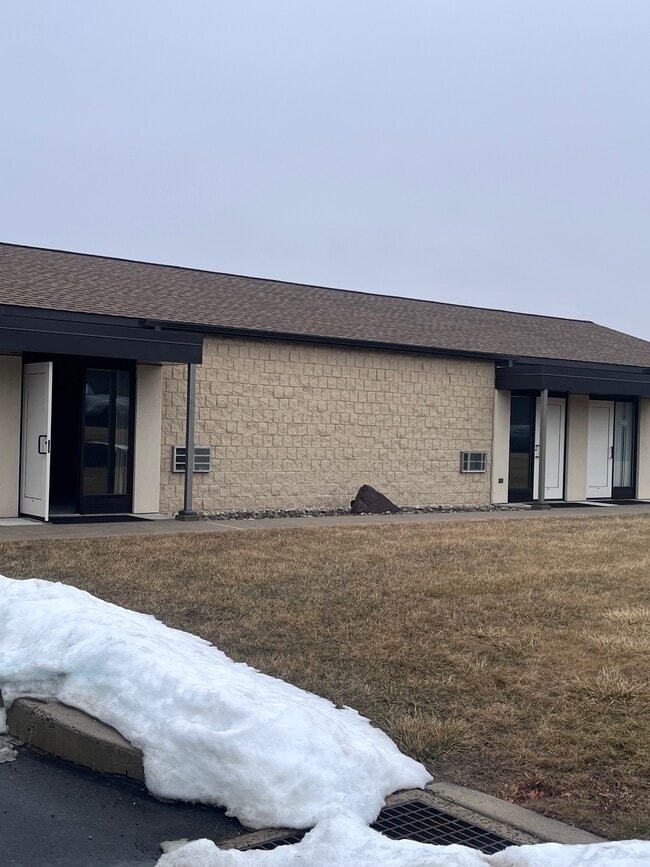
Property Record
3090 State Rd, Telford, PA 18969

Current Lease Availabilities
Property Detail
3090 State Rd
52-017-071
7.907AC NW COR STATE RD & MEETINGHOUSE RD 978 ON STATE RD
Shipyard
Bucks
PI
Pennsylvania
B and X Area of moderate flood hazard, usually the area between the limits of the 100-year and 500-year floods.
7.91 AC
2024
Upper Bucks County
2025
Philadelphia
102700
Philadelphia-Camden-Wilmington, PA-NJ-DE-MD
23,108 SF
NEARBY LISTINGS FOR SALE OR LEASE
DEMOGRAPHICS near 3090 State Rd
1 mile
3 mile
5 mile
2025 Total Population
2,939
44,677
86,369
2030 Population
2,904
45,028
88,478
Pop Growth 2025-2030
(1.19%)
+ 0.79%
+ 2.44%
Average Age
48
42
43
2025 Total Households
1,153
17,400
32,761
HH Growth 2025-2030
(1.39%)
+ 0.76%
+ 2.24%
Median Household Inc
$101,546
$101,566
$103,635
Avg Household Size
2.20
2.50
2.60
2025 Avg HH Vehicles
2.00
2.00
2.00
Median Home Value
$421,730
$377,058
$413,984
Median Year Built
1986
1975
1979
Nearby Places
Map Layers
Map Styles
 Street
 Aerial
Layers
 Traffic
 Biking
Places
Listings with unknown addresses are not visible on the map
- Restaurants
- Banks
- Shops
- Fitness
- Groceries
PUBLIC TRANSPORTATION
COMMUTER RAIL
Link Belt (R5 - Southeastern Pennsylvania Transportation Authority Regional Rail (SEPTA Regional Rail))
Drive
Walk
Distance
Link Belt (R5 - Southeastern Pennsylvania Transportation Authority Regional Rail (SEPTA Regional Rail))
11 min
7.0 mi
Colmar (R5 - Southeastern Pennsylvania Transportation Authority Regional Rail (SEPTA Regional Rail))
Drive
Walk
Distance
Colmar (R5 - Southeastern Pennsylvania Transportation Authority Regional Rail (SEPTA Regional Rail))
11 min
7.1 mi
AIRPORT
Lehigh Valley International
Drive
Walk
Distance
Lehigh Valley International
45 min
27.1 mi
Trenton Mercer
Drive
Walk
Distance
Trenton Mercer
62 min
37.3 mi
Freight Ports
Port of Philadelphia
Drive
Walk
Distance
Port of Philadelphia
50 min
31.2 mi
Nearby Properties
Address
Land Use
TOTAL SIZE
Lot Size
Zoning
Address
Land Use
TOTAL SIZE
Lot Size
Zoning
412,306 SF
40.91 AC
I
Address
Land Use
TOTAL SIZE
Lot Size
Zoning
139,733 SF
46.65 AC
R130
Address
Land Use
TOTAL SIZE
Lot Size
Zoning
152,085 SF
38.16 AC
INST
Address
Land Use
TOTAL SIZE
Lot Size
Zoning
324,796 SF
42.20 AC
LI
Address
Land Use
TOTAL SIZE
Lot Size
Zoning
216,372 SF
18.46 AC
INST
Address
Land Use
TOTAL SIZE
Lot Size
Zoning
184,471 SF
0.80 AC
INST
Address
Land Use
TOTAL SIZE
Lot Size
Zoning
94,598 SF
27.72 AC
INST
Address
Land Use
TOTAL SIZE
Lot Size
Zoning
77,878 SF
17.60 AC
INST
Address
Land Use
TOTAL SIZE
Lot Size
Zoning
230,016 SF
11.27 AC
LI
Address
Land Use
TOTAL SIZE
Lot Size
Zoning
182,010 SF
12.25 AC
LI
Address
Land Use
TOTAL SIZE
Lot Size
Zoning
95,494 SF
13.67 AC
C
Address
Land Use
TOTAL SIZE
Lot Size
Zoning
237,667 SF
37.86 AC
LI
Address
Land Use
TOTAL SIZE
Lot Size
Zoning
121,762 SF
16.66 AC
LI
Address
Land Use
TOTAL SIZE
Lot Size
Zoning
140,008 SF
10.25 AC
C
Address
Land Use
TOTAL SIZE
Lot Size
Zoning
63,183 SF
23.05 AC
INST
Address
Land Use
TOTAL SIZE
Lot Size
Zoning
90,211 SF
1.38 AC
C
Address
Land Use
TOTAL SIZE
Lot Size
Zoning
71,431 SF
2.65 AC
R2
Address
Land Use
TOTAL SIZE
Lot Size
Zoning
53,795 SF
3.64 AC
INST
Address
Land Use
TOTAL SIZE
Lot Size
Zoning
30,267 SF
149.18 AC
REC
Address
Land Use
TOTAL SIZE
Lot Size
Zoning
52,092 SF
5.91 AC
R2
Address
Land Use
TOTAL SIZE
Lot Size
Zoning
98,397 SF
8.23 AC
LI
Address
Land Use
TOTAL SIZE
Lot Size
Zoning
53,040 SF
8.69 AC
R130
Address
Land Use
TOTAL SIZE
Lot Size
Zoning
158,316 SF
12.14 AC
LI
Address
Land Use
TOTAL SIZE
Lot Size
Zoning
39,066 SF
24.21 AC
REC
Address
Land Use
TOTAL SIZE
Lot Size
Zoning
70,800 SF
12.79 AC
L1
Address
Land Use
TOTAL SIZE
Lot Size
Zoning
77,748 SF
1.35 AC
C1
Address
Land Use
TOTAL SIZE
Lot Size
Zoning
37,060 SF
8.38 AC
C
Address
Land Use
TOTAL SIZE
Lot Size
Zoning
38,910 SF
4.40 AC
LI
Address
Land Use
TOTAL SIZE
Lot Size
Zoning
96,780 SF
1.80 AC
INST
Address
Land Use
TOTAL SIZE
Lot Size
Zoning
125,845 SF
11.85 AC
LI
The World's #1 Commercial Real Estate Marketplace
Connect with us
© 2026 CoStar Group
The information above has been obtained from sources believed reliable. While we do not doubt its accuracy we have not verified it and make no guarantee, warranty or representation about it. It is your responsibility to independently confirm its accuracy and completeness. Any projections, opinions, assumptions, or estimates used are for example only and do not represent the current or future performance of the property. The value of this transaction to you depends on tax and other factors which should be evaluated by your tax, financial, and legal advisors. You and your advisors should conduct a careful, independent investigation of the property to determine to your satisfaction the suitability of the property for your needs.