Property Record
30901 W 185Th St, Edgerton, KS 66021
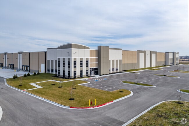

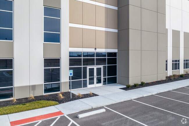

Property Detail
30901 W 185Th St
BP55840000-0003
LOGISTICS PARK KANSAS CITY PHASE VI - LOT 3, LOT 3
Warehouse
JOHNSON
RUR
Kansas
B and X Area of moderate flood hazard, usually the area between the limits of the 100-year and 500-year floods.
3
2024
55.73 AC
2025
Olathe
053712
Kansas City
952,060 SF
Kansas City, MO-KS
NEARBY LISTINGS FOR SALE OR LEASE
DEMOGRAPHICS near 30901 W 185Th St
1 mile
3 mile
5 mile
2025 Total Population
2,199
23,995
30,507
2030 Population
2,300
24,911
31,736
Pop Growth 2025-2030
+ 4.59%
+ 3.82%
+ 4.03%
Average Age
36
35
36
2025 Total Households
768
8,338
10,460
HH Growth 2025-2030
+ 4.82%
+ 3.97%
+ 4.24%
Median Household Inc
$99,329
$88,919
$89,381
Avg Household Size
2.80
2.80
2.80
2025 Avg HH Vehicles
2.00
2.00
2.00
Median Home Value
$330,819
$296,931
$298,223
Median Year Built
2002
2000
2000
Nearby Places
Map Layers
Map Styles
 Street
 Aerial
Transit
 Traffic
 Biking
Places
Listings with unknown addresses are not visible on the map
- Restaurants
- Banks
- Shops
- Fitness
- Groceries
SALE & LEASE HISTORY
LISTING DATE
SALE/LEASE

Oct 28, 2019
For Lease
Nearby Properties
Address
Land Use
TOTAL SIZE
Lot Size
Zoning
Address
Land Use
TOTAL SIZE
Lot Size
Zoning
1,952,263 SF
191.05 AC
RUR
Address
Land Use
TOTAL SIZE
Lot Size
Zoning
616,794 SF
48.06 AC
A-G
Address
Land Use
TOTAL SIZE
Lot Size
Zoning
1,007,020 SF
57.84 AC
RUR
Address
Land Use
TOTAL SIZE
Lot Size
Zoning
1,005,940 SF
66.67 AC
L-P
Address
Land Use
TOTAL SIZE
Lot Size
Zoning
345,346 SF
73.42 AC
R-1
Address
Land Use
TOTAL SIZE
Lot Size
Zoning
921,308 SF
46.62 AC
RUR
Address
Land Use
TOTAL SIZE
Lot Size
Zoning
822,082 SF
42.61 AC
RUR
Address
Land Use
TOTAL SIZE
Lot Size
Zoning
790,120 SF
38.55 AC
RUR
Address
Land Use
TOTAL SIZE
Lot Size
Zoning
750,100 SF
39.48 AC
RUR
Address
Land Use
TOTAL SIZE
Lot Size
Zoning
748,227 SF
38.70 AC
RUR
Address
Land Use
TOTAL SIZE
Lot Size
Zoning
764,500 SF
62.27 AC
RUR
Address
Land Use
TOTAL SIZE
Lot Size
Zoning
760,255 SF
36.45 AC
RUR
Address
Land Use
TOTAL SIZE
Lot Size
Zoning
651,155 SF
30.97 AC
RUR
Address
Land Use
TOTAL SIZE
Lot Size
Zoning
655,128 SF
36.79 AC
A-G
Address
Land Use
TOTAL SIZE
Lot Size
Zoning
206,145 SF
55.77 AC
Address
Land Use
TOTAL SIZE
Lot Size
Zoning
522,478 SF
45.72 AC
PEC3
Address
Land Use
TOTAL SIZE
Lot Size
Zoning
548,880 SF
33.62 AC
RUR
Address
Land Use
TOTAL SIZE
Lot Size
Zoning
511,945 SF
30.34 AC
RUR
Address
Land Use
TOTAL SIZE
Lot Size
Zoning
379,400 SF
22.06 AC
RUR
Address
Land Use
TOTAL SIZE
Lot Size
Zoning
301,675 SF
15.57 AC
I-H, L-P
Address
Land Use
TOTAL SIZE
Lot Size
Zoning
141,329 SF
20.88 AC
R-1
Address
Land Use
TOTAL SIZE
Lot Size
Zoning
73,451 SF
14.39 AC
R-1
Address
Land Use
TOTAL SIZE
Lot Size
Zoning
186,110 SF
11.06 AC
I-H, L-P
Address
Land Use
TOTAL SIZE
Lot Size
Zoning
88,724 SF
127.92 AC
A
Address
Land Use
TOTAL SIZE
Lot Size
Zoning
33,045 SF
15.25 AC
CP-2
Address
Land Use
TOTAL SIZE
Lot Size
Zoning
88,250 SF
9.82 AC
PEC3
Address
Land Use
TOTAL SIZE
Lot Size
Zoning
73,451 SF
12.58 AC
A
Address
Land Use
TOTAL SIZE
Lot Size
Zoning
71,146 SF
16 AC
A
Address
Land Use
TOTAL SIZE
Lot Size
Zoning
573,983 SF
29.43 AC
A-G
The World's #1 Commercial Real Estate Marketplace
Connect with us
© 2026 CoStar Group
The information above has been obtained from sources believed reliable. While we do not doubt its accuracy we have not verified it and make no guarantee, warranty or representation about it. It is your responsibility to independently confirm its accuracy and completeness. Any projections, opinions, assumptions, or estimates used are for example only and do not represent the current or future performance of the property. The value of this transaction to you depends on tax and other factors which should be evaluated by your tax, financial, and legal advisors. You and your advisors should conduct a careful, independent investigation of the property to determine to your satisfaction the suitability of the property for your needs.