Property Record
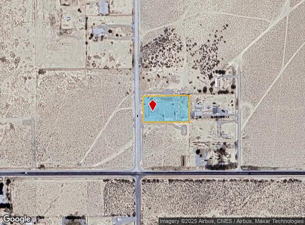
3091 N David St, Pahrump, NV 89060
NEARBY LISTINGS FOR SALE OR LEASE
Property Detail
3091 N David St
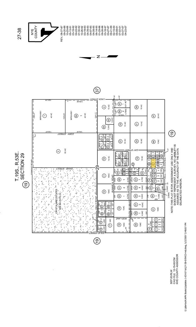
27-381-67
Pm-369161
Commercialnec
T19S R53E S29 F#369161 P.3 1.11AC
X
Nye
32023C8750F
Nevada
2024
1.11 AC
2025
Carson City/Nevada Area
960412
Other Market Areas
938 SF
Pahrump, NV
DEMOGRAPHICS near 3091 N David St
1 Mile
3 Mile
5 Mile
2024 Total Population
1,303
9,602
21,297
2029 Population
1,522
11,191
24,885
Pop Growth 2024-2029
+ 16.81%
+ 16.55%
+ 16.85%
Average Age
50
49
49
2024 Total Households
552
3,909
8,909
HH Growth 2024-2029
+ 16.85%
+ 16.76%
+ 17.10%
Median Household Inc
$66,272
$56,879
$50,884
Avg Household Size
2.30
2.30
2.30
2024 Avg HH Vehicles
2.00
2.00
2.00
Median Home Value
$213,768
$217,228
$211,289
Median Year Built
1994
1995
1996
Nearby Places
Map Layers
Map Styles
 Street
 Aerial
- Restaurants
- Banks
- Shops
- Fitness
- Groceries
Nearby Properties
Address
Land Use
TOTAL SIZE
Lot Size
Zoning
Address
Land Use
TOTAL SIZE
Lot Size
Zoning
128,429 SF
19.39 AC
CF
Address
Land Use
TOTAL SIZE
Lot Size
Zoning
57,418 SF
18.28 AC
CF
Address
Land Use
TOTAL SIZE
Lot Size
Zoning
48,436 SF
5 AC
M
Address
Land Use
TOTAL SIZE
Lot Size
Zoning
40,514 SF
142.77 AC
Address
Land Use
TOTAL SIZE
Lot Size
Zoning
9,306 SF
4.69 AC
MU
Address
Land Use
TOTAL SIZE
Lot Size
Zoning
320 AC
R
Address
Land Use
TOTAL SIZE
Lot Size
Zoning
0.46 AC
AO
Address
Land Use
TOTAL SIZE
Lot Size
Zoning
10,932 SF
3.30 AC
GC
Address
Land Use
TOTAL SIZE
Lot Size
Zoning
8,548 SF
3.72 AC
MU
Address
Land Use
TOTAL SIZE
Lot Size
Zoning
8,320 SF
1.41 AC
NC
Address
Land Use
TOTAL SIZE
Lot Size
Zoning
9,230 SF
3.12 AC
GC
Address
Land Use
TOTAL SIZE
Lot Size
Zoning
75.38 AC
GC
Address
Land Use
TOTAL SIZE
Lot Size
Zoning
Address
Land Use
TOTAL SIZE
Lot Size
Zoning
0.54 AC
GC
Address
Land Use
TOTAL SIZE
Lot Size
Zoning
35,200 SF
3.23 AC
GC
Address
Land Use
TOTAL SIZE
Lot Size
Zoning
6,300 SF
2 AC
Address
Land Use
TOTAL SIZE
Lot Size
Zoning
7,500 SF
2.48 AC
GC
Address
Land Use
TOTAL SIZE
Lot Size
Zoning
60.80 AC
NC
Address
Land Use
TOTAL SIZE
Lot Size
Zoning
10.65 AC
SP
Address
Land Use
TOTAL SIZE
Lot Size
Zoning
7,488 SF
1.83 AC
NC
Address
Land Use
TOTAL SIZE
Lot Size
Zoning
5,625 SF
1.04 AC
GC
Address
Land Use
TOTAL SIZE
Lot Size
Zoning
8,875 SF
2.33 AC
RE-2
Address
Land Use
TOTAL SIZE
Lot Size
Zoning
50 AC
SPLIT
Address
Land Use
TOTAL SIZE
Lot Size
Zoning
48.10 AC
GC
Address
Land Use
TOTAL SIZE
Lot Size
Zoning
10,760 SF
1.09 AC
CM
Address
Land Use
TOTAL SIZE
Lot Size
Zoning
6,867 SF
10 AC
NC
Address
Land Use
TOTAL SIZE
Lot Size
Zoning
3,410 SF
123.55 AC
RH-4.5
Address
Land Use
TOTAL SIZE
Lot Size
Zoning
8,000 SF
1.90 AC
NC
Address
Land Use
TOTAL SIZE
Lot Size
Zoning
149.09 AC
SPLIT
Address
Land Use
TOTAL SIZE
Lot Size
Zoning
42 AC
GC
The World's #1 Commercial Real Estate Marketplace
Connect with us
© 2025 CoStar Group
The information above has been obtained from sources believed reliable. While we do not doubt its accuracy we have not verified it and make no guarantee, warranty or representation about it. It is your responsibility to independently confirm its accuracy and completeness. Any projections, opinions, assumptions, or estimates used are for example only and do not represent the current or future performance of the property. The value of this transaction to you depends on tax and other factors which should be evaluated by your tax, financial, and legal advisors. You and your advisors should conduct a careful, independent investigation of the property to determine to your satisfaction the suitability of the property for your needs.