Property Record
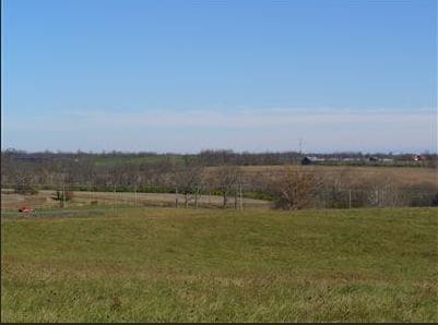
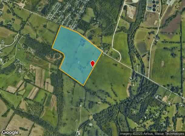
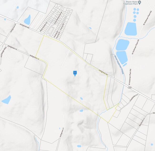
3093 Ashgrove Rd, Nicholasville, KY 40356
NEARBY LISTINGS FOR SALE OR LEASE
Property Detail
3093 Ashgrove Rd
078-00-00-013.00
LOT 2
Taxexempt
Jessamine
AE
Kentucky
21113C0070D
2
0
127.80 AC
2025
Jessamine County
060200
Lexington/Fayette
1,134 SF
Lexington-Fayette, KY
DEMOGRAPHICS near 3093 Ashgrove Rd
1 Mile
3 Mile
5 Mile
2024 Total Population
738
35,658
111,410
2029 Population
796
35,699
111,763
Pop Growth 2024-2029
+ 7.86%
+ 0.11%
+ 0.32%
Average Age
44
40
39
2024 Total Households
327
15,032
47,188
HH Growth 2024-2029
+ 7.95%
+ 0.06%
+ 0.18%
Median Household Inc
$72,722
$73,844
$64,516
Avg Household Size
2.30
2.30
2.30
2024 Avg HH Vehicles
2.00
2.00
2.00
Median Home Value
$388,635
$270,993
$240,680
Median Year Built
2010
1991
1984
Nearby Places
Map Layers
Map Styles
 Street
 Aerial
- Restaurants
- Banks
- Shops
- Fitness
- Groceries
PUBLIC TRANSPORTATION
AIRPORT
Blue Grass
DRIVE
WALK
Distance
Blue Grass
24 min
13.5 mi
Freight Ports
Port of Toledo
DRIVE
WALK
Distance
Port of Toledo
351 min
296.6 mi
SALE & LEASE HISTORY
LISTING DATE
SALE/LEASE

Sep 24, 2016
For Sale
Sep 24, 2016
For Sale
Nearby Properties
Address
Land Use
TOTAL SIZE
Lot Size
Zoning
Address
Land Use
TOTAL SIZE
Lot Size
Zoning
5,650 SF
22.46 AC
R-3
Address
Land Use
TOTAL SIZE
Lot Size
Zoning
22.10 AC
R-3
Address
Land Use
TOTAL SIZE
Lot Size
Zoning
12,767 SF
14.39 AC
R-3
Address
Land Use
TOTAL SIZE
Lot Size
Zoning
91,484 SF
14.72 AC
B-6P
Address
Land Use
TOTAL SIZE
Lot Size
Zoning
7,402 SF
18.83 AC
R-4
Address
Land Use
TOTAL SIZE
Lot Size
Zoning
41,132 SF
19 AC
Address
Land Use
TOTAL SIZE
Lot Size
Zoning
59,586 SF
5.37 AC
R-4
Address
Land Use
TOTAL SIZE
Lot Size
Zoning
6.25 AC
A-U
Address
Land Use
TOTAL SIZE
Lot Size
Zoning
14,928 SF
8.75 AC
R-3
Address
Land Use
TOTAL SIZE
Lot Size
Zoning
2,770 SF
15.20 AC
R-4
Address
Land Use
TOTAL SIZE
Lot Size
Zoning
4,992 SF
32.12 AC
Address
Land Use
TOTAL SIZE
Lot Size
Zoning
2,316 SF
15.05 AC
R-4
Address
Land Use
TOTAL SIZE
Lot Size
Zoning
12,484 SF
18.34 AC
R-4
Address
Land Use
TOTAL SIZE
Lot Size
Zoning
21,552 SF
15.73 AC
R-3
Address
Land Use
TOTAL SIZE
Lot Size
Zoning
74,908 SF
15.06 AC
A-U
Address
Land Use
TOTAL SIZE
Lot Size
Zoning
19,536 SF
19.48 AC
R-4
Address
Land Use
TOTAL SIZE
Lot Size
Zoning
Address
Land Use
TOTAL SIZE
Lot Size
Zoning
97,653 SF
6.73 AC
A-U
Address
Land Use
TOTAL SIZE
Lot Size
Zoning
4,142 SF
19.94 AC
Address
Land Use
TOTAL SIZE
Lot Size
Zoning
44,298 SF
11 AC
Address
Land Use
TOTAL SIZE
Lot Size
Zoning
39,277 SF
15 AC
Address
Land Use
TOTAL SIZE
Lot Size
Zoning
13,686 SF
2 AC
Address
Land Use
TOTAL SIZE
Lot Size
Zoning
60,990 SF
4.29 AC
Address
Land Use
TOTAL SIZE
Lot Size
Zoning
82,436 SF
4.24 AC
R-4
Address
Land Use
TOTAL SIZE
Lot Size
Zoning
Address
Land Use
TOTAL SIZE
Lot Size
Zoning
52,283 SF
4.89 AC
A-U
Address
Land Use
TOTAL SIZE
Lot Size
Zoning
1,920 SF
99.41 AC
A-U
Address
Land Use
TOTAL SIZE
Lot Size
Zoning
29,690 SF
255 AC
Address
Land Use
TOTAL SIZE
Lot Size
Zoning
2,772 SF
415.08 AC
A-R
Address
Land Use
TOTAL SIZE
Lot Size
Zoning
52,480 SF
9 AC
The World's #1 Commercial Real Estate Marketplace
Connect with us
© 2026 CoStar Group
The information above has been obtained from sources believed reliable. While we do not doubt its accuracy we have not verified it and make no guarantee, warranty or representation about it. It is your responsibility to independently confirm its accuracy and completeness. Any projections, opinions, assumptions, or estimates used are for example only and do not represent the current or future performance of the property. The value of this transaction to you depends on tax and other factors which should be evaluated by your tax, financial, and legal advisors. You and your advisors should conduct a careful, independent investigation of the property to determine to your satisfaction the suitability of the property for your needs.