Property Record
30955 Woodward Ave, Royal Oak, MI 48073


NEARBY LISTINGS FOR SALE OR LEASE
-
-
View all Royal Oak listings for sale on LoopNet.com
Property Detail
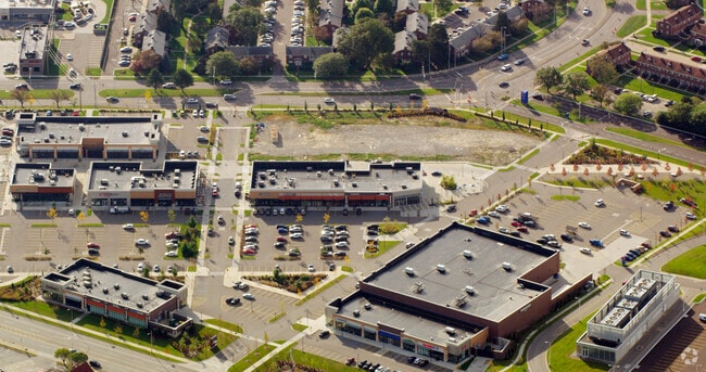
30955 Woodward Ave
Detroit
Woodward Monnier Sub
Detroit-Warren-Dearborn, MI
T1N, R11E, SEC 7 PART OF NE 1/4, ALSO OF 'JUDSON BROADWAY'S WOODWARD MONNIER SUB' LOTS 1 TO 5 INCL, ALSO LOTS 75 TO 109 INCL,
25-07-226-008
Oakland
Commercialnec
Michigan
2024
15.32 AC
2025
Auburn Hills/Madison Heights
183500
DEMOGRAPHICS near 30955 Woodward Ave
1 Mile
3 Mile
5 Mile
2024 Total Population
14,340
128,084
286,549
2029 Population
14,252
126,836
283,867
Pop Growth 2024-2029
(0.61%)
(0.97%)
(0.94%)
Average Age
41
41
41
2024 Total Households
7,088
59,066
127,725
HH Growth 2024-2029
(0.62%)
(0.95%)
(0.91%)
Median Household Inc
$81,802
$92,773
$88,513
Avg Household Size
2.00
2.10
2.20
2024 Avg HH Vehicles
2.00
2.00
2.00
Median Home Value
$277,045
$287,744
$274,870
Median Year Built
1956
1958
1959
Nearby Places
Map Layers
Map Styles
 Street
 Aerial
- Restaurants
- Banks
- Shops
- Fitness
- Groceries
PUBLIC TRANSPORTATION
COMMUTER RAIL
Troy Amtrak Station (Wolverine - Amtrak)
DRIVE
WALK
Distance
Troy Amtrak Station (Wolverine - Amtrak)
7 min
2.6 mi
Royal Oak Amtrak (Wolverine - Amtrak)
DRIVE
WALK
Distance
Royal Oak Amtrak (Wolverine - Amtrak)
7 min
3.3 mi
AIRPORT
Windsor International
DRIVE
WALK
Distance
Windsor International
46 min
26.0 mi
Detroit Metro Wayne County
DRIVE
WALK
Distance
Detroit Metro Wayne County
48 min
30.0 mi
Freight Ports
Port of Toledo
DRIVE
WALK
Distance
Port of Toledo
97 min
72.0 mi
Nearby Properties
Address
Land Use
TOTAL SIZE
Lot Size
Zoning
Address
Land Use
TOTAL SIZE
Lot Size
Zoning
350,140 SF
37.78 AC
RC
Address
Land Use
TOTAL SIZE
Lot Size
Zoning
224,766 SF
19.92 AC
B2
Address
Land Use
TOTAL SIZE
Lot Size
Zoning
0.81 AC
CBD
Address
Land Use
TOTAL SIZE
Lot Size
Zoning
10,734 SF
3.52 AC
SPEC REDEV
Address
Land Use
TOTAL SIZE
Lot Size
Zoning
111,030 SF
0.97 AC
BI
Address
Land Use
TOTAL SIZE
Lot Size
Zoning
187,801 SF
5.49 AC
RM-2
Address
Land Use
TOTAL SIZE
Lot Size
Zoning
149,395 SF
1.02 AC
BI
Address
Land Use
TOTAL SIZE
Lot Size
Zoning
143,160 SF
0.84 AC
BI
Address
Land Use
TOTAL SIZE
Lot Size
Zoning
236,140 SF
1.67 AC
BI
Address
Land Use
TOTAL SIZE
Lot Size
Zoning
99,661 SF
0.62 AC
Address
Land Use
TOTAL SIZE
Lot Size
Zoning
160,796 SF
1.84 AC
Address
Land Use
TOTAL SIZE
Lot Size
Zoning
365,104 SF
2.03 AC
Address
Land Use
TOTAL SIZE
Lot Size
Zoning
119,732 SF
3.77 AC
Address
Land Use
TOTAL SIZE
Lot Size
Zoning
157,004 SF
1.78 AC
PUD
Address
Land Use
TOTAL SIZE
Lot Size
Zoning
83,244 SF
0.38 AC
Address
Land Use
TOTAL SIZE
Lot Size
Zoning
72,457 SF
5.60 AC
OFFICE SVC
Address
Land Use
TOTAL SIZE
Lot Size
Zoning
84,711 SF
5.05 AC
BI
Address
Land Use
TOTAL SIZE
Lot Size
Zoning
301,276 SF
13.58 AC
AI
Address
Land Use
TOTAL SIZE
Lot Size
Zoning
279,360 SF
14.34 AC
RM1
Address
Land Use
TOTAL SIZE
Lot Size
Zoning
212 SF
16.59 AC
RM
Address
Land Use
TOTAL SIZE
Lot Size
Zoning
80,334 SF
0.57 AC
BI
Address
Land Use
TOTAL SIZE
Lot Size
Zoning
1.46 AC
CBD
Address
Land Use
TOTAL SIZE
Lot Size
Zoning
79,935 SF
1.02 AC
BI
Address
Land Use
TOTAL SIZE
Lot Size
Zoning
109,570 SF
0.68 AC
BI
Address
Land Use
TOTAL SIZE
Lot Size
Zoning
804 SF
1.50 AC
CBD
Address
Land Use
TOTAL SIZE
Lot Size
Zoning
245,740 SF
1.06 AC
BI
Address
Land Use
TOTAL SIZE
Lot Size
Zoning
183,090 SF
15.25 AC
RM
Address
Land Use
TOTAL SIZE
Lot Size
Zoning
24.30 AC
GEN BUS
Address
Land Use
TOTAL SIZE
Lot Size
Zoning
72,029 SF
0.57 AC
BV
The World's #1 Commercial Real Estate Marketplace
Connect with us
© 2026 CoStar Group
The information above has been obtained from sources believed reliable. While we do not doubt its accuracy we have not verified it and make no guarantee, warranty or representation about it. It is your responsibility to independently confirm its accuracy and completeness. Any projections, opinions, assumptions, or estimates used are for example only and do not represent the current or future performance of the property. The value of this transaction to you depends on tax and other factors which should be evaluated by your tax, financial, and legal advisors. You and your advisors should conduct a careful, independent investigation of the property to determine to your satisfaction the suitability of the property for your needs.