Property Record
3096 Deans Bridge Rd, Augusta, GA 30906


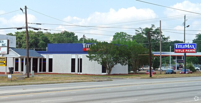

Property Detail
3096 Deans Bridge Rd
0962184000
3096 DEANS BRIDGE RD
Commercialacreage
Richmond
B-2
Georgia
B and X Area of moderate flood hazard, usually the area between the limits of the 100-year and 500-year floods.
1.10 AC
2025
South Richmond County
2025
Augusta/Richmond County
010506
Augusta-Richmond County, GA-SC
2,870 SF
NEARBY LISTINGS FOR SALE OR LEASE
DEMOGRAPHICS near 3096 Deans Bridge Rd
1 mile
3 mile
5 mile
2025 Total Population
6,969
52,943
130,120
2030 Population
6,939
52,488
130,057
Pop Growth 2025-2030
(0.43%)
(0.86%)
(0.05%)
Average Age
40
38
39
2025 Total Households
2,775
20,843
52,019
HH Growth 2025-2030
(0.36%)
(0.68%)
+ 0.08%
Median Household Inc
$52,399
$40,669
$52,217
Avg Household Size
2.50
2.50
2.40
2025 Avg HH Vehicles
2.00
2.00
2.00
Median Home Value
$154,210
$143,547
$185,690
Median Year Built
1964
1970
1976
Nearby Places
Map Layers
Map Styles
 Street
 Aerial
Layers
 Traffic
 Biking
Places
Listings with unknown addresses are not visible on the map
- Restaurants
- Banks
- Shops
- Fitness
- Groceries
PUBLIC TRANSPORTATION
AIRPORT
Augusta Regional at Bush Field
Drive
Walk
Distance
Augusta Regional at Bush Field
17 min
7.0 mi
SALE & LEASE HISTORY
LISTING DATE
SALE/LEASE

Jan 02, 2018
For Sale
Nearby Properties
Address
Land Use
TOTAL SIZE
Lot Size
Zoning
Address
Land Use
TOTAL SIZE
Lot Size
Zoning
1,428 SF
75.91 AC
R-1A
Address
Land Use
TOTAL SIZE
Lot Size
Zoning
1,620 SF
21.51 AC
R-3B
Address
Land Use
TOTAL SIZE
Lot Size
Zoning
99,046 SF
29.96 AC
R-1A
Address
Land Use
TOTAL SIZE
Lot Size
Zoning
38,080 SF
19.19 AC
R-3B
Address
Land Use
TOTAL SIZE
Lot Size
Zoning
1,782 SF
26.27 AC
R-3A
Address
Land Use
TOTAL SIZE
Lot Size
Zoning
6,323 SF
25.49 AC
R-3C
Address
Land Use
TOTAL SIZE
Lot Size
Zoning
241,284 SF
20.61 AC
R-1A
Address
Land Use
TOTAL SIZE
Lot Size
Zoning
56,631 SF
11.62 AC
R-1A, B-2
Address
Land Use
TOTAL SIZE
Lot Size
Zoning
4,947 SF
71.24 AC
R-3B
Address
Land Use
TOTAL SIZE
Lot Size
Zoning
16,120 SF
21.38 AC
R-3A
Address
Land Use
TOTAL SIZE
Lot Size
Zoning
158,192 SF
48.91 AC
R-1A
Address
Land Use
TOTAL SIZE
Lot Size
Zoning
44,160 SF
12.46 AC
R-3B
Address
Land Use
TOTAL SIZE
Lot Size
Zoning
38,412 SF
22.51 AC
R-1A
Address
Land Use
TOTAL SIZE
Lot Size
Zoning
193,478 SF
24.91 AC
B-2
Address
Land Use
TOTAL SIZE
Lot Size
Zoning
24,304 SF
11 AC
R-1A
Address
Land Use
TOTAL SIZE
Lot Size
Zoning
40,824 SF
9.49 AC
R-3B
Address
Land Use
TOTAL SIZE
Lot Size
Zoning
67,713 SF
5.24 AC
LI
Address
Land Use
TOTAL SIZE
Lot Size
Zoning
86,184 SF
9.51 AC
R-3B
Address
Land Use
TOTAL SIZE
Lot Size
Zoning
16,790 SF
22.07 AC
B-2
Address
Land Use
TOTAL SIZE
Lot Size
Zoning
154,981 SF
20.02 AC
B-2
Address
Land Use
TOTAL SIZE
Lot Size
Zoning
66,528 SF
8.99 AC
R-3C
Address
Land Use
TOTAL SIZE
Lot Size
Zoning
70,251 SF
9.17 AC
R-1B
Address
Land Use
TOTAL SIZE
Lot Size
Zoning
700 SF
7.12 AC
R-3C
Address
Land Use
TOTAL SIZE
Lot Size
Zoning
29,952 SF
13.76 AC
R-3B_B-2
Address
Land Use
TOTAL SIZE
Lot Size
Zoning
136,260 SF
14.42 AC
LI_R-1
Address
Land Use
TOTAL SIZE
Lot Size
Zoning
22,080 SF
19.49 AC
R-3B
Address
Land Use
TOTAL SIZE
Lot Size
Zoning
68,707 SF
8.26 AC
B-1
Address
Land Use
TOTAL SIZE
Lot Size
Zoning
57,408 SF
7.20 AC
R-3B
Address
Land Use
TOTAL SIZE
Lot Size
Zoning
432 SF
134.82 AC
B-2
Address
Land Use
TOTAL SIZE
Lot Size
Zoning
2,040 SF
18.66 AC
R-1C SPEX
The World's #1 Commercial Real Estate Marketplace
Connect with us
© 2026 CoStar Group
The information above has been obtained from sources believed reliable. While we do not doubt its accuracy we have not verified it and make no guarantee, warranty or representation about it. It is your responsibility to independently confirm its accuracy and completeness. Any projections, opinions, assumptions, or estimates used are for example only and do not represent the current or future performance of the property. The value of this transaction to you depends on tax and other factors which should be evaluated by your tax, financial, and legal advisors. You and your advisors should conduct a careful, independent investigation of the property to determine to your satisfaction the suitability of the property for your needs.