Property Record
3097 Brinlee Rd, Nash, TX 75569
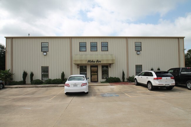

Property Detail
3097 Brinlee Rd
04920010606
WM CRUTCHER A-107 2018-1683 02/21/18 BLK/TRACT 54D 1.488 ACRES
Commercialnec
BOWIE
B and X Area of moderate flood hazard, usually the area between the limits of the 100-year and 500-year floods.
Texas
2025
1.44 AC
2025
Other Market Areas
010905
Texarkana, TX-AR
7,772 SF
NEARBY LISTINGS FOR SALE OR LEASE
-
-
View all Nash listings for sale on LoopNet.com
DEMOGRAPHICS near 3097 Brinlee Rd
1 mile
3 mile
5 mile
2025 Total Population
971
17,994
44,307
2030 Population
974
17,855
44,075
Pop Growth 2025-2030
+ 0.31%
(0.77%)
(0.52%)
Average Age
34
39
39
2025 Total Households
368
7,303
17,825
HH Growth 2025-2030
+ 0.27%
(0.81%)
(0.53%)
Median Household Inc
$57,222
$63,688
$55,859
Avg Household Size
2.70
2.40
2.40
2025 Avg HH Vehicles
2.00
2.00
2.00
Median Home Value
$123,611
$197,435
$185,648
Median Year Built
1999
1991
1986
Nearby Places
Map Layers
Map Styles
 Street
 Aerial
Layers
 Traffic
 Biking
Places
Listings with unknown addresses are not visible on the map
- Restaurants
- Banks
- Shops
- Fitness
- Groceries
PUBLIC TRANSPORTATION
COMMUTER RAIL
Drive
Walk
Distance
14 min
7.4 mi
AIRPORT
Texarkana Regional-Webb Field
Drive
Walk
Distance
Texarkana Regional-Webb Field
23 min
12.6 mi
SALE & LEASE HISTORY
LISTING DATE
SALE/LEASE

Aug 24, 2017
For Sale
Nearby Properties
Address
Land Use
TOTAL SIZE
Lot Size
Zoning
Address
Land Use
TOTAL SIZE
Lot Size
Zoning
415,000 SF
56.08 AC
Address
Land Use
TOTAL SIZE
Lot Size
Zoning
Address
Land Use
TOTAL SIZE
Lot Size
Zoning
246,136 SF
15.50 AC
Address
Land Use
TOTAL SIZE
Lot Size
Zoning
155,401 SF
15.01 AC
Address
Land Use
TOTAL SIZE
Lot Size
Zoning
130,000 SF
10.18 AC
Address
Land Use
TOTAL SIZE
Lot Size
Zoning
67,800 SF
14.99 AC
Address
Land Use
TOTAL SIZE
Lot Size
Zoning
107,400 SF
5.83 AC
Address
Land Use
TOTAL SIZE
Lot Size
Zoning
166,777 SF
9 AC
Address
Land Use
TOTAL SIZE
Lot Size
Zoning
190,026 SF
30.86 AC
Address
Land Use
TOTAL SIZE
Lot Size
Zoning
62,256 SF
9.67 AC
Address
Land Use
TOTAL SIZE
Lot Size
Zoning
101,980 SF
5 AC
Address
Land Use
TOTAL SIZE
Lot Size
Zoning
12,449 SF
9.50 AC
Address
Land Use
TOTAL SIZE
Lot Size
Zoning
165,001 SF
26.11 AC
Address
Land Use
TOTAL SIZE
Lot Size
Zoning
89,848 SF
7.15 AC
Address
Land Use
TOTAL SIZE
Lot Size
Zoning
68,816 SF
3.50 AC
Address
Land Use
TOTAL SIZE
Lot Size
Zoning
96,827 SF
11.16 AC
Address
Land Use
TOTAL SIZE
Lot Size
Zoning
70,448 SF
7.61 AC
Address
Land Use
TOTAL SIZE
Lot Size
Zoning
152,914 SF
7.69 AC
Address
Land Use
TOTAL SIZE
Lot Size
Zoning
126,542 SF
14.59 AC
Address
Land Use
TOTAL SIZE
Lot Size
Zoning
65,246 SF
9.36 AC
Address
Land Use
TOTAL SIZE
Lot Size
Zoning
122,640 SF
18.68 AC
Address
Land Use
TOTAL SIZE
Lot Size
Zoning
46,316 SF
2.01 AC
Address
Land Use
TOTAL SIZE
Lot Size
Zoning
69,869 SF
10.18 AC
Address
Land Use
TOTAL SIZE
Lot Size
Zoning
19,284 SF
5 AC
Address
Land Use
TOTAL SIZE
Lot Size
Zoning
59,330 SF
2.44 AC
Address
Land Use
TOTAL SIZE
Lot Size
Zoning
37,796 SF
27.41 AC
Address
Land Use
TOTAL SIZE
Lot Size
Zoning
47,812 SF
1.63 AC
Address
Land Use
TOTAL SIZE
Lot Size
Zoning
35,978 SF
6.96 AC
Address
Land Use
TOTAL SIZE
Lot Size
Zoning
42,336 SF
2.67 AC
Address
Land Use
TOTAL SIZE
Lot Size
Zoning
73,862 SF
9.30 AC
The World's #1 Commercial Real Estate Marketplace
Connect with us
© 2026 CoStar Group
The information above has been obtained from sources believed reliable. While we do not doubt its accuracy we have not verified it and make no guarantee, warranty or representation about it. It is your responsibility to independently confirm its accuracy and completeness. Any projections, opinions, assumptions, or estimates used are for example only and do not represent the current or future performance of the property. The value of this transaction to you depends on tax and other factors which should be evaluated by your tax, financial, and legal advisors. You and your advisors should conduct a careful, independent investigation of the property to determine to your satisfaction the suitability of the property for your needs.