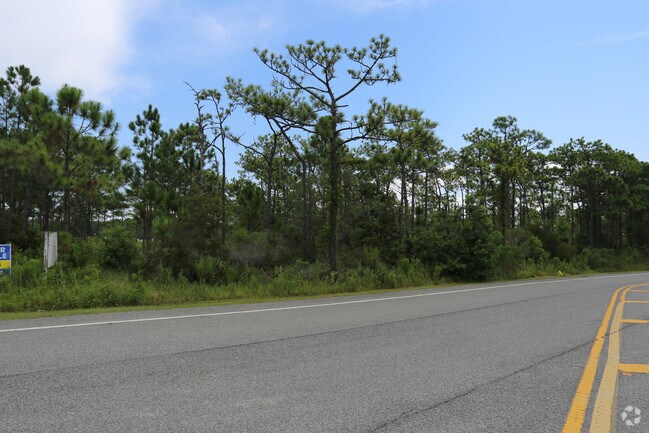
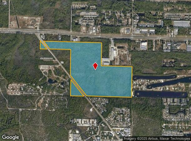
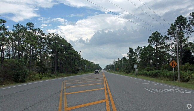
Property Record
30A Co Highway 30A Way, Santa Rosa Beach, FL 32459
NEARBY LISTINGS FOR SALE OR LEASE
Property Detail
30A Co Highway 30A Way
Crestview-Fort Walton Beach-Destin, FL
S/D Of Sec 32-2S-20
32-2S-20-33250-000-0050
LOTS 5-6-7-8-25 TO 31 INCL; 34
Miscellaneous
Walton
A
Florida
12131C0657H
5-6
0
90 AC
2025
Other Market Areas
950606
DEMOGRAPHICS near 30A Co Highway 30A Way
1 Mile
3 Mile
5 Mile
2024 Total Population
1,304
8,382
19,460
2029 Population
1,517
9,815
23,140
Pop Growth 2024-2029
+ 16.33%
+ 17.10%
+ 18.91%
Average Age
41
41
44
2024 Total Households
526
3,426
8,381
HH Growth 2024-2029
+ 16.16%
+ 16.96%
+ 19.02%
Median Household Inc
$58,142
$63,113
$58,813
Avg Household Size
2.40
2.30
2.20
2024 Avg HH Vehicles
2.00
2.00
2.00
Median Home Value
$236,170
$256,620
$274,410
Median Year Built
2000
2002
2000
Nearby Places
Map Layers
Map Styles
 Street
 Aerial
- Restaurants
- Banks
- Shops
- Fitness
- Groceries
PUBLIC TRANSPORTATION
AIRPORT
Eglin AFB/Destin-Ft Walton Beach
DRIVE
WALK
Distance
Eglin AFB/Destin-Ft Walton Beach
63 min
28.2 mi
Northwest Florida Beaches International
DRIVE
WALK
Distance
Northwest Florida Beaches International
56 min
38.3 mi
Freight Ports
Port of Panama City
DRIVE
WALK
Distance
Port of Panama City
56 min
36.6 mi
Nearby Properties
Address
Land Use
TOTAL SIZE
Lot Size
Zoning
Address
Land Use
TOTAL SIZE
Lot Size
Zoning
399,449 SF
32.23 AC
SMNBHD
Address
Land Use
TOTAL SIZE
Lot Size
Zoning
164,747 SF
18.79 AC
Address
Land Use
TOTAL SIZE
Lot Size
Zoning
269,585 SF
14.50 AC
SMNBHD
Address
Land Use
TOTAL SIZE
Lot Size
Zoning
218,504 SF
11.87 AC
HWY 98
Address
Land Use
TOTAL SIZE
Lot Size
Zoning
195,860 SF
14.03 AC
HWY 98
Address
Land Use
TOTAL SIZE
Lot Size
Zoning
200,408 SF
10.73 AC
VMU
Address
Land Use
TOTAL SIZE
Lot Size
Zoning
140,273 SF
30 AC
Address
Land Use
TOTAL SIZE
Lot Size
Zoning
205,627 SF
34.20 AC
HWY 98
Address
Land Use
TOTAL SIZE
Lot Size
Zoning
97,373 SF
12.83 AC
HWY 98
Address
Land Use
TOTAL SIZE
Lot Size
Zoning
17,317 SF
65.65 AC
GULFFR
Address
Land Use
TOTAL SIZE
Lot Size
Zoning
2.27 AC
GULFFR
Address
Land Use
TOTAL SIZE
Lot Size
Zoning
0.87 AC
GULFFR
Address
Land Use
TOTAL SIZE
Lot Size
Zoning
Address
Land Use
TOTAL SIZE
Lot Size
Zoning
83,492 SF
7.25 AC
HWY 98
Address
Land Use
TOTAL SIZE
Lot Size
Zoning
126,494 SF
7.99 AC
VMU
Address
Land Use
TOTAL SIZE
Lot Size
Zoning
70,631 SF
75.50 AC
Address
Land Use
TOTAL SIZE
Lot Size
Zoning
63,106 SF
7.73 AC
HWY 98
Address
Land Use
TOTAL SIZE
Lot Size
Zoning
114,921 SF
3.43 AC
HWY 98
Address
Land Use
TOTAL SIZE
Lot Size
Zoning
67,482 SF
5.77 AC
Address
Land Use
TOTAL SIZE
Lot Size
Zoning
71,106 SF
1 AC
Address
Land Use
TOTAL SIZE
Lot Size
Zoning
112,780 SF
5.73 AC
VMU
Address
Land Use
TOTAL SIZE
Lot Size
Zoning
78,285 SF
10.07 AC
HWY 98
Address
Land Use
TOTAL SIZE
Lot Size
Zoning
28,703 SF
0.78 AC
VMU
Address
Land Use
TOTAL SIZE
Lot Size
Zoning
14,291 SF
59.59 AC
Address
Land Use
TOTAL SIZE
Lot Size
Zoning
0.78 AC
GULFFR
Address
Land Use
TOTAL SIZE
Lot Size
Zoning
2.30 AC
VMU
Address
Land Use
TOTAL SIZE
Lot Size
Zoning
1,924 SF
2.26 AC
GULFFR
Address
Land Use
TOTAL SIZE
Lot Size
Zoning
54,208 SF
9.75 AC
NBHDIN
Address
Land Use
TOTAL SIZE
Lot Size
Zoning
118,336 SF
9.23 AC
SD
The World's #1 Commercial Real Estate Marketplace
Connect with us
© 2026 CoStar Group
The information above has been obtained from sources believed reliable. While we do not doubt its accuracy we have not verified it and make no guarantee, warranty or representation about it. It is your responsibility to independently confirm its accuracy and completeness. Any projections, opinions, assumptions, or estimates used are for example only and do not represent the current or future performance of the property. The value of this transaction to you depends on tax and other factors which should be evaluated by your tax, financial, and legal advisors. You and your advisors should conduct a careful, independent investigation of the property to determine to your satisfaction the suitability of the property for your needs.