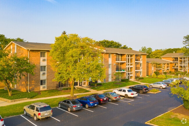
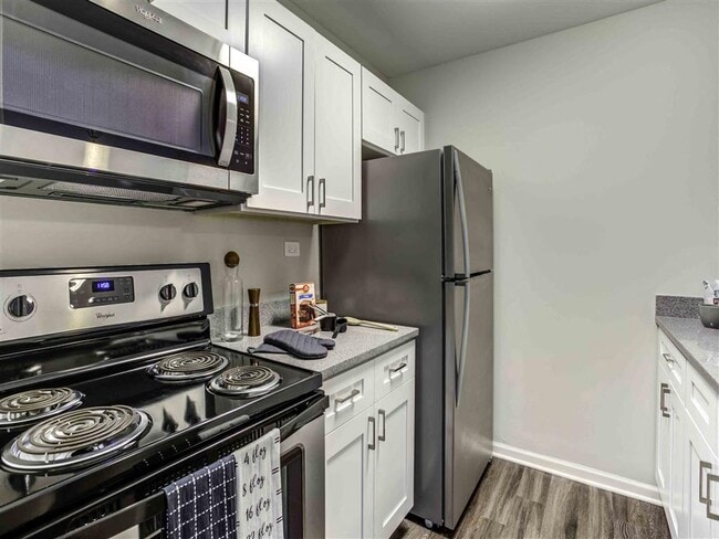
Property Record
30W041 Flamenco Ct, Naperville, IL 60563

NEARBY LISTINGS FOR SALE OR LEASE
-
-
View all Naperville listings for sale on LoopNet.com
Property Detail
30W041 Flamenco Ct
Chicago-Naperville-Elgin, IL-IN-WI
Courtyards Village East Assmt Plat
07-09-408-053
COURTYARDS VILLAGE EAST ASSMT PLAT /NO LOT NO/ /EX HWY DESC 11ED28/
Commercialnec
DuPage
X
Illinois
17043C0137J
12.70 AC
2024
Country Lakes
2024
Chicago
846410
DEMOGRAPHICS near 30W041 Flamenco Ct
1 Mile
3 Mile
5 Mile
2024 Total Population
14,796
78,911
196,583
2029 Population
14,466
78,020
193,980
Pop Growth 2024-2029
(2.23%)
(1.13%)
(1.32%)
Average Age
37
38
39
2024 Total Households
6,024
31,076
71,377
HH Growth 2024-2029
(2.41%)
(1.12%)
(1.35%)
Median Household Inc
$99,389
$108,115
$107,484
Avg Household Size
2.40
2.50
2.70
2024 Avg HH Vehicles
1.00
2.00
2.00
Median Home Value
$300,540
$359,959
$354,548
Median Year Built
1990
1991
1988
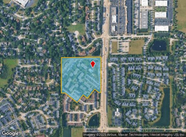
Nearby Places
Map Layers
Map Styles
 Street
 Aerial
- Restaurants
- Banks
- Shops
- Fitness
- Groceries
PUBLIC TRANSPORTATION
COMMUTER RAIL
Route 59 Station (Burlington Northern-Santa Fe Railway Line - Northeast Illinois Regional Commuter Railroad (Metra))
DRIVE
WALK
Distance
Route 59 Station (Burlington Northern-Santa Fe Railway Line - Northeast Illinois Regional Commuter Railroad (Metra))
2 min
17 min
0.9 mi
Naperville Station (Burlington Northern-Santa Fe Railway Line - Northeast Illinois Regional Commuter Railroad (Metra))
DRIVE
WALK
Distance
Naperville Station (Burlington Northern-Santa Fe Railway Line - Northeast Illinois Regional Commuter Railroad (Metra))
8 min
4.0 mi
AIRPORT
Chicago Midway International
DRIVE
WALK
Distance
Chicago Midway International
45 min
29.8 mi
Chicago O'Hare International
DRIVE
WALK
Distance
Chicago O'Hare International
44 min
30.7 mi
Freight Ports
Port Milwaukee
DRIVE
WALK
Distance
Port Milwaukee
125 min
102.4 mi
Nearby Properties
Address
Land Use
TOTAL SIZE
Lot Size
Zoning
Address
Land Use
TOTAL SIZE
Lot Size
Zoning
916,143 SF
32.66 AC
Address
Land Use
TOTAL SIZE
Lot Size
Zoning
28.52 AC
R
Address
Land Use
TOTAL SIZE
Lot Size
Zoning
29.20 AC
C
Address
Land Use
TOTAL SIZE
Lot Size
Zoning
20.60 AC
Address
Land Use
TOTAL SIZE
Lot Size
Zoning
47.26 AC
Address
Land Use
TOTAL SIZE
Lot Size
Zoning
17.59 AC
Address
Land Use
TOTAL SIZE
Lot Size
Zoning
41.42 AC
Address
Land Use
TOTAL SIZE
Lot Size
Zoning
31.66 AC
C
Address
Land Use
TOTAL SIZE
Lot Size
Zoning
19.92 AC
C
Address
Land Use
TOTAL SIZE
Lot Size
Zoning
17.70 AC
Address
Land Use
TOTAL SIZE
Lot Size
Zoning
Address
Land Use
TOTAL SIZE
Lot Size
Zoning
Address
Land Use
TOTAL SIZE
Lot Size
Zoning
797,399 SF
52.38 AC
C
Address
Land Use
TOTAL SIZE
Lot Size
Zoning
829,087 SF
35.83 AC
C
Address
Land Use
TOTAL SIZE
Lot Size
Zoning
684,925 SF
25.63 AC
Address
Land Use
TOTAL SIZE
Lot Size
Zoning
272,400 SF
20.94 AC
C
Address
Land Use
TOTAL SIZE
Lot Size
Zoning
315,328 SF
5.06 AC
Address
Land Use
TOTAL SIZE
Lot Size
Zoning
25 AC
M
Address
Land Use
TOTAL SIZE
Lot Size
Zoning
283,844 SF
16.06 AC
M
Address
Land Use
TOTAL SIZE
Lot Size
Zoning
20.97 AC
R
Address
Land Use
TOTAL SIZE
Lot Size
Zoning
5.43 AC
Address
Land Use
TOTAL SIZE
Lot Size
Zoning
266,118 SF
21.65 AC
C
Address
Land Use
TOTAL SIZE
Lot Size
Zoning
96.92 AC
I
Address
Land Use
TOTAL SIZE
Lot Size
Zoning
17.84 AC
M
Address
Land Use
TOTAL SIZE
Lot Size
Zoning
721,600 SF
34.74 AC
I
Address
Land Use
TOTAL SIZE
Lot Size
Zoning
16.15 AC
M
Address
Land Use
TOTAL SIZE
Lot Size
Zoning
15.61 AC
M
Address
Land Use
TOTAL SIZE
Lot Size
Zoning
650,361 SF
27.79 AC
I
Address
Land Use
TOTAL SIZE
Lot Size
Zoning
31.08 AC
Address
Land Use
TOTAL SIZE
Lot Size
Zoning
The World's #1 Commercial Real Estate Marketplace
Connect with us
© 2026 CoStar Group
The information above has been obtained from sources believed reliable. While we do not doubt its accuracy we have not verified it and make no guarantee, warranty or representation about it. It is your responsibility to independently confirm its accuracy and completeness. Any projections, opinions, assumptions, or estimates used are for example only and do not represent the current or future performance of the property. The value of this transaction to you depends on tax and other factors which should be evaluated by your tax, financial, and legal advisors. You and your advisors should conduct a careful, independent investigation of the property to determine to your satisfaction the suitability of the property for your needs.