Property Record
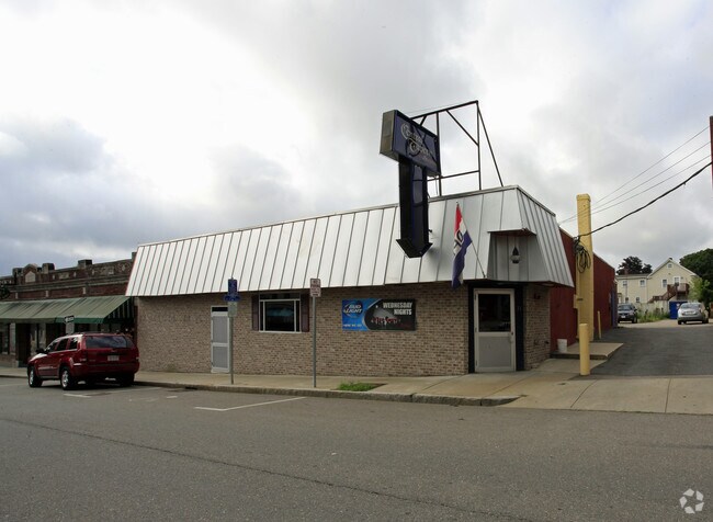
31 Central St, Milford, MA 01757


NEARBY LISTINGS FOR SALE OR LEASE
Property Detail
31 Central St
MILF-000048-000000-000394
Worcester
Restaurantbuilding
Massachusetts
X
394
25027C0869F
0.14 AC
2025
Outlying Worcester
2025
Boston
744300
Worcester, MA
3,578 SF
DEMOGRAPHICS near 31 Central St
1 mile
3 mile
5 mile
2024 Total Population
13,915
39,464
68,423
2029 Population
13,680
39,201
68,024
Pop Growth 2024-2029
(1.69%)
(0.67%)
(0.58%)
Average Age
39
41
41
2024 Total Households
5,342
14,900
25,409
HH Growth 2024-2029
(1.76%)
(0.72%)
(0.64%)
Median Household Inc
$78,548
$99,322
$113,480
Avg Household Size
2.50
2.60
2.60
2024 Avg HH Vehicles
2.00
2.00
2.00
Median Home Value
$366,137
$409,558
$456,141
Median Year Built
1952
1970
1975
Nearby Places
Map Layers
Map Styles
 Street
 Aerial
Transit
 Traffic
 Biking
Places
Listings with unknown addresses are not visible on the map
- Restaurants
- Banks
- Shops
- Fitness
- Groceries
PUBLIC TRANSPORTATION
COMMUTER RAIL
Forge Park/Route 495 (Franklin Line - Massachusetts Bay Transportation Authority Commuter Rail (Purple Line))
Drive
Walk
Distance
Forge Park/Route 495 (Franklin Line - Massachusetts Bay Transportation Authority Commuter Rail (Purple Line))
14 min
7.5 mi
Franklin (Franklin Line - Massachusetts Bay Transportation Authority Commuter Rail (Purple Line))
Drive
Walk
Distance
Franklin (Franklin Line - Massachusetts Bay Transportation Authority Commuter Rail (Purple Line))
16 min
9.3 mi
SALE & LEASE HISTORY
LISTING DATE
SALE/LEASE

Mar 18, 2019
For Sale
Mar 14, 2023
For Sale
Nearby Properties
Address
Land Use
TOTAL SIZE
Lot Size
Zoning
Address
Land Use
TOTAL SIZE
Lot Size
Zoning
16.82 AC
BP
Address
Land Use
TOTAL SIZE
Lot Size
Zoning
204,879 SF
12.44 AC
OR
Address
Land Use
TOTAL SIZE
Lot Size
Zoning
381,306 SF
20 AC
RB
Address
Land Use
TOTAL SIZE
Lot Size
Zoning
616,875 SF
141 AC
LI
Address
Land Use
TOTAL SIZE
Lot Size
Zoning
186,720 SF
13.77 AC
RB
Address
Land Use
TOTAL SIZE
Lot Size
Zoning
24.81 AC
IB
Address
Land Use
TOTAL SIZE
Lot Size
Zoning
27.32 AC
IB
Address
Land Use
TOTAL SIZE
Lot Size
Zoning
67.20 AC
RB
Address
Land Use
TOTAL SIZE
Lot Size
Zoning
347,012 SF
29.23 AC
IB
Address
Land Use
TOTAL SIZE
Lot Size
Zoning
96,433 SF
5.40 AC
RB
Address
Land Use
TOTAL SIZE
Lot Size
Zoning
139,403 SF
21.44 AC
RB
Address
Land Use
TOTAL SIZE
Lot Size
Zoning
16.50 AC
RA
Address
Land Use
TOTAL SIZE
Lot Size
Zoning
7.36 AC
RA
Address
Land Use
TOTAL SIZE
Lot Size
Zoning
19.14 AC
IB
Address
Land Use
TOTAL SIZE
Lot Size
Zoning
165,132 SF
24.49 AC
IN3
Address
Land Use
TOTAL SIZE
Lot Size
Zoning
106.49 AC
IB
Address
Land Use
TOTAL SIZE
Lot Size
Zoning
21.69 AC
IB
Address
Land Use
TOTAL SIZE
Lot Size
Zoning
14 AC
IB
Address
Land Use
TOTAL SIZE
Lot Size
Zoning
85,200 SF
35.18 AC
IB
Address
Land Use
TOTAL SIZE
Lot Size
Zoning
272,941 SF
34.05 AC
IB
Address
Land Use
TOTAL SIZE
Lot Size
Zoning
66,430 SF
10.19 AC
T
Address
Land Use
TOTAL SIZE
Lot Size
Zoning
135,579 SF
15.97 AC
IB
Address
Land Use
TOTAL SIZE
Lot Size
Zoning
11 AC
IB
Address
Land Use
TOTAL SIZE
Lot Size
Zoning
27.79 AC
IB
Address
Land Use
TOTAL SIZE
Lot Size
Zoning
4.17 AC
RB
Address
Land Use
TOTAL SIZE
Lot Size
Zoning
14.75 AC
IB
Address
Land Use
TOTAL SIZE
Lot Size
Zoning
7.80 AC
IB
Address
Land Use
TOTAL SIZE
Lot Size
Zoning
14.83 AC
CC
Address
Land Use
TOTAL SIZE
Lot Size
Zoning
142,594 SF
13.74 AC
IB
Address
Land Use
TOTAL SIZE
Lot Size
Zoning
69,139 SF
4.57 AC
CB
The World's #1 Commercial Real Estate Marketplace
Connect with us
© 2026 CoStar Group
The information above has been obtained from sources believed reliable. While we do not doubt its accuracy we have not verified it and make no guarantee, warranty or representation about it. It is your responsibility to independently confirm its accuracy and completeness. Any projections, opinions, assumptions, or estimates used are for example only and do not represent the current or future performance of the property. The value of this transaction to you depends on tax and other factors which should be evaluated by your tax, financial, and legal advisors. You and your advisors should conduct a careful, independent investigation of the property to determine to your satisfaction the suitability of the property for your needs.