Property Record
31 Cordova Ave, Buffalo, NY 14214
NEARBY LISTINGS FOR SALE OR LEASE
Property Detail
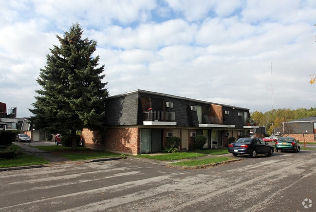
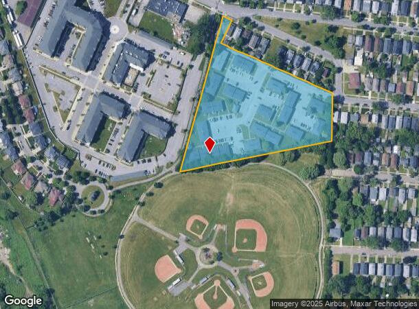
31 Cordova Ave
Buffalo-Cheektowaga-Niagara Falls, NY
Holland Land Company S Survey
140200-079-780-0002-001-000
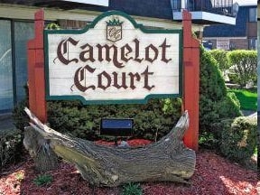
106.22 S LA SALLE WH A PC 40X105 ON LASALLE (CAMELOT COURT)
Apartment
Erie
X
New York
36029C0205H
1.000
2025
4.90 AC
2024
LaSalle
004500
Buffalo/Niagara Falls
4,940 SF
DEMOGRAPHICS near 31 Cordova Ave
1 Mile
3 Mile
5 Mile
2024 Total Population
27,160
186,804
402,211
2029 Population
26,513
183,138
395,578
Pop Growth 2024-2029
(2.38%)
(1.96%)
(1.65%)
Average Age
36
39
39
2024 Total Households
10,527
78,860
172,552
HH Growth 2024-2029
(2.54%)
(2.06%)
(1.66%)
Median Household Inc
$48,484
$55,443
$51,795
Avg Household Size
2.40
2.20
2.20
2024 Avg HH Vehicles
1.00
1.00
1.00
Median Home Value
$150,806
$172,436
$166,989
Median Year Built
1946
1948
1949
Nearby Places
- Restaurants
- Banks
- Shops
- Fitness
- Groceries
PUBLIC TRANSPORTATION
TRANSIT/SUBWAY
Lasalle (Buffalo Metro Rail - Niagara Frontier Transportation Authority Light Rail (Buffalo Metro Rail))
DRIVE
WALK
Distance
Lasalle (Buffalo Metro Rail - Niagara Frontier Transportation Authority Light Rail (Buffalo Metro Rail))
1 min
8 min
0.3 mi
University (Buffalo Metro Rail - Niagara Frontier Transportation Authority Light Rail (Buffalo Metro Rail))
DRIVE
WALK
Distance
University (Buffalo Metro Rail - Niagara Frontier Transportation Authority Light Rail (Buffalo Metro Rail))
3 min
20 min
1.0 mi
Amherst Street (Buffalo Metro Rail - Niagara Frontier Transportation Authority Light Rail (Buffalo Metro Rail))
DRIVE
WALK
Distance
Amherst Street (Buffalo Metro Rail - Niagara Frontier Transportation Authority Light Rail (Buffalo Metro Rail))
3 min
20 min
1.0 mi
COMMUTER RAIL
Buffalo (Exchange) (Empire Service - Amtrak, Maple Leaf - Amtrak, Toronto - New York - Amtrak)
DRIVE
WALK
Distance
Buffalo (Exchange) (Empire Service - Amtrak, Maple Leaf - Amtrak, Toronto - New York - Amtrak)
13 min
6.8 mi
Buffalo (Depew) (Toronto - New York - VIA Rail)
DRIVE
WALK
Distance
Buffalo (Depew) (Toronto - New York - VIA Rail)
14 min
7.1 mi
AIRPORT
Buffalo Niagara International
DRIVE
WALK
Distance
Buffalo Niagara International
14 min
5.6 mi
Niagara Falls International
DRIVE
WALK
Distance
Niagara Falls International
28 min
14.8 mi
Freight Ports
Port of Toledo
DRIVE
WALK
Distance
Port of Toledo
367 min
309.8 mi
Nearby Properties
Address
Land Use
TOTAL SIZE
Lot Size
Zoning
Address
Land Use
TOTAL SIZE
Lot Size
Zoning
135,396 SF
146.32 AC
D-E
Address
Land Use
TOTAL SIZE
Lot Size
Zoning
22,010 SF
D-M
Address
Land Use
TOTAL SIZE
Lot Size
Zoning
8,317 SF
39.03 AC
SPLIT ZONE
Address
Land Use
TOTAL SIZE
Lot Size
Zoning
646,259 SF
16.31 AC
D-M
Address
Land Use
TOTAL SIZE
Lot Size
Zoning
121,015 SF
92.60 AC
D-E
Address
Land Use
TOTAL SIZE
Lot Size
Zoning
132,940 SF
41.50 AC
CF
Address
Land Use
TOTAL SIZE
Lot Size
Zoning
561,196 SF
16 AC
D-M
Address
Land Use
TOTAL SIZE
Lot Size
Zoning
262,560 SF
26.40 AC
05C
Address
Land Use
TOTAL SIZE
Lot Size
Zoning
36,325 SF
12.50 AC
D-E
Address
Land Use
TOTAL SIZE
Lot Size
Zoning
12,641 SF
0.56 AC
N-2C
Address
Land Use
TOTAL SIZE
Lot Size
Zoning
19,608 SF
0.45 AC
N-3C
Address
Land Use
TOTAL SIZE
Lot Size
Zoning
100,737 SF
21.10 AC
CTR-5
Address
Land Use
TOTAL SIZE
Lot Size
Zoning
94,680 SF
175.90 AC
D-OG
Address
Land Use
TOTAL SIZE
Lot Size
Zoning
540,154 SF
7.06 AC
D-E
Address
Land Use
TOTAL SIZE
Lot Size
Zoning
181,897 SF
15.30 AC
CTR-2.5
Address
Land Use
TOTAL SIZE
Lot Size
Zoning
17,778 SF
14 AC
GB
Address
Land Use
TOTAL SIZE
Lot Size
Zoning
3,456 SF
6.90 AC
MFR-5
Address
Land Use
TOTAL SIZE
Lot Size
Zoning
191,420 SF
59.30 AC
Address
Land Use
TOTAL SIZE
Lot Size
Zoning
3,712 SF
36.08 AC
03RA
Address
Land Use
TOTAL SIZE
Lot Size
Zoning
7,753 SF
1 AC
N-1C
Address
Land Use
TOTAL SIZE
Lot Size
Zoning
119,851 SF
1.35 AC
N-2R
Address
Land Use
TOTAL SIZE
Lot Size
Zoning
7,408 SF
45.80 AC
D-R
Address
Land Use
TOTAL SIZE
Lot Size
Zoning
3,200 SF
4.96 AC
SC-3
Address
Land Use
TOTAL SIZE
Lot Size
Zoning
61,327 SF
175 AC
D-OG
Address
Land Use
TOTAL SIZE
Lot Size
Zoning
148,344 SF
11.14 AC
D-R
Address
Land Use
TOTAL SIZE
Lot Size
Zoning
2,112 SF
15.60 AC
Address
Land Use
TOTAL SIZE
Lot Size
Zoning
139,679 SF
7 AC
Address
Land Use
TOTAL SIZE
Lot Size
Zoning
22,000 SF
22.58 AC
05C
Address
Land Use
TOTAL SIZE
Lot Size
Zoning
171,589 SF
55.49 AC
D-OG
Address
Land Use
TOTAL SIZE
Lot Size
Zoning
3,200 SF
11.50 AC
MFR-5
The World's #1 Commercial Real Estate Marketplace
Connect with us
© 2025 CoStar Group
The information above has been obtained from sources believed reliable. While we do not doubt its accuracy we have not verified it and make no guarantee, warranty or representation about it. It is your responsibility to independently confirm its accuracy and completeness. Any projections, opinions, assumptions, or estimates used are for example only and do not represent the current or future performance of the property. The value of this transaction to you depends on tax and other factors which should be evaluated by your tax, financial, and legal advisors. You and your advisors should conduct a careful, independent investigation of the property to determine to your satisfaction the suitability of the property for your needs.