Property Record
31 Design Dr, Kansas City, MO 64116


Current Lease Availabilities
NEARBY LISTINGS FOR SALE OR LEASE
Property Detail
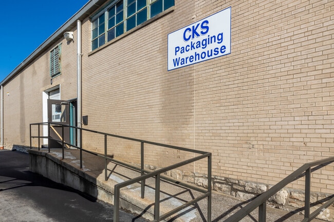
31 Design Dr
17-605-00-01-003.00
BEG NW COR E 26TH AVE & TERRY ST, N747, W717.45, S730, E76.78, S21.5, E654.94 TO POB
Commercialnec
Clay
ARE
Missouri
29095C0139G
12.17 AC
2024
City of North KC
2025
Kansas City
022100
Kansas City, MO-KS
DEMOGRAPHICS near 31 Design Dr
1 Mile
3 Mile
5 Mile
2024 Total Population
3,795
43,077
199,064
2029 Population
4,006
44,916
204,679
Pop Growth 2024-2029
+ 5.56%
+ 4.27%
+ 2.82%
Average Age
44
38
37
2024 Total Households
2,153
20,288
82,351
HH Growth 2024-2029
+ 5.39%
+ 4.43%
+ 3.11%
Median Household Inc
$42,846
$52,334
$53,263
Avg Household Size
1.70
2.00
2.30
2024 Avg HH Vehicles
1.00
2.00
2.00
Median Home Value
$233,333
$185,950
$163,496
Median Year Built
1981
1971
1963
Nearby Places
Map Layers
Map Styles
 Street
 Aerial
- Restaurants
- Banks
- Shops
- Fitness
- Groceries
PUBLIC TRANSPORTATION
COMMUTER RAIL
Kansas City (Lincoln Service Missouri River Runner - Amtrak, Missouri River Runner - Amtrak, Southwest Chief - Amtrak)
DRIVE
WALK
Distance
Kansas City (Lincoln Service Missouri River Runner - Amtrak, Missouri River Runner - Amtrak, Southwest Chief - Amtrak)
12 min
5.2 mi
AIRPORT
Kansas City International
DRIVE
WALK
Distance
Kansas City International
22 min
15.7 mi
Freight Ports
Tulsa Port Of Catoosa
DRIVE
WALK
Distance
Tulsa Port Of Catoosa
275 min
245.2 mi
Nearby Properties
Address
Land Use
TOTAL SIZE
Lot Size
Zoning
Address
Land Use
TOTAL SIZE
Lot Size
Zoning
Address
Land Use
TOTAL SIZE
Lot Size
Zoning
8.29 AC
Address
Land Use
TOTAL SIZE
Lot Size
Zoning
846,143 SF
51.25 AC
Address
Land Use
TOTAL SIZE
Lot Size
Zoning
63,748 SF
3.92 AC
Address
Land Use
TOTAL SIZE
Lot Size
Zoning
215,920 SF
38.28 AC
Address
Land Use
TOTAL SIZE
Lot Size
Zoning
Address
Land Use
TOTAL SIZE
Lot Size
Zoning
4,012,734 SF
574.30 AC
KM3
Address
Land Use
TOTAL SIZE
Lot Size
Zoning
384,543 SF
5.40 AC
Address
Land Use
TOTAL SIZE
Lot Size
Zoning
Address
Land Use
TOTAL SIZE
Lot Size
Zoning
239,083 SF
85.48 AC
KM3
Address
Land Use
TOTAL SIZE
Lot Size
Zoning
296,548 SF
5.09 AC
Address
Land Use
TOTAL SIZE
Lot Size
Zoning
276,233 SF
Address
Land Use
TOTAL SIZE
Lot Size
Zoning
10.97 AC
Address
Land Use
TOTAL SIZE
Lot Size
Zoning
5,044 SF
100.08 AC
Address
Land Use
TOTAL SIZE
Lot Size
Zoning
243,839 SF
47.82 AC
Address
Land Use
TOTAL SIZE
Lot Size
Zoning
Address
Land Use
TOTAL SIZE
Lot Size
Zoning
Address
Land Use
TOTAL SIZE
Lot Size
Zoning
295,300 SF
1.50 AC
Address
Land Use
TOTAL SIZE
Lot Size
Zoning
Address
Land Use
TOTAL SIZE
Lot Size
Zoning
46.94 AC
Address
Land Use
TOTAL SIZE
Lot Size
Zoning
491,448 SF
22.53 AC
Address
Land Use
TOTAL SIZE
Lot Size
Zoning
15.16 AC
Address
Land Use
TOTAL SIZE
Lot Size
Zoning
Address
Land Use
TOTAL SIZE
Lot Size
Zoning
31.13 AC
Address
Land Use
TOTAL SIZE
Lot Size
Zoning
Address
Land Use
TOTAL SIZE
Lot Size
Zoning
824,130 SF
20.12 AC
Address
Land Use
TOTAL SIZE
Lot Size
Zoning
128,704 SF
1.11 AC
Address
Land Use
TOTAL SIZE
Lot Size
Zoning
172,432 SF
3.34 AC
Address
Land Use
TOTAL SIZE
Lot Size
Zoning
95,436 SF
1.19 AC
Address
Land Use
TOTAL SIZE
Lot Size
Zoning
The World's #1 Commercial Real Estate Marketplace
Connect with us
© 2026 CoStar Group
The information above has been obtained from sources believed reliable. While we do not doubt its accuracy we have not verified it and make no guarantee, warranty or representation about it. It is your responsibility to independently confirm its accuracy and completeness. Any projections, opinions, assumptions, or estimates used are for example only and do not represent the current or future performance of the property. The value of this transaction to you depends on tax and other factors which should be evaluated by your tax, financial, and legal advisors. You and your advisors should conduct a careful, independent investigation of the property to determine to your satisfaction the suitability of the property for your needs.