Property Record
31 Front St, Rochester, NH 03868
NEARBY LISTINGS FOR SALE OR LEASE
-
-
View all Rochester listings for sale on LoopNet.com
Property Detail
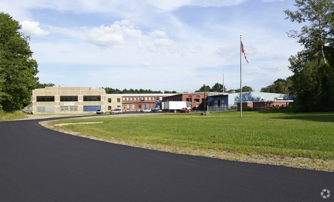
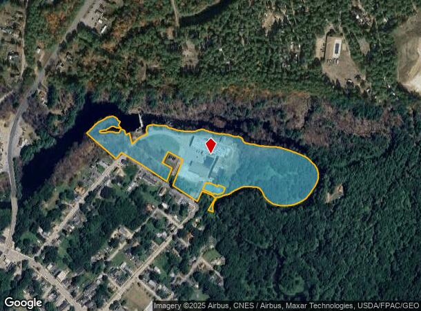
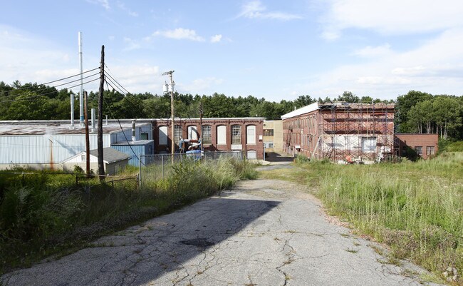
31 Front St
Industrialgeneral
Strafford
AE
New Hampshire
23031C0508G
16.33 AC
2024
Strafford County
2024
Boston
084202
Boston-Cambridge-Newton, MA-NH
112,089 SF
RCHE-000102-000020
DEMOGRAPHICS near 31 Front St
1 mile
3 mile
5 mile
2024 Total Population
2,107
14,101
34,748
2029 Population
2,184
14,713
36,309
Pop Growth 2024-2029
+ 3.65%
+ 4.34%
+ 4.49%
Average Age
40
43
43
2024 Total Households
855
5,926
14,465
HH Growth 2024-2029
+ 3.74%
+ 4.35%
+ 4.56%
Median Household Inc
$77,717
$76,369
$81,161
Avg Household Size
2.40
2.30
2.30
2024 Avg HH Vehicles
2.00
2.00
2.00
Median Home Value
$243,678
$227,936
$246,648
Median Year Built
1979
1980
1978
Nearby Places
Map Layers
Map Styles
 Street
 Aerial
Transit
 Traffic
 Biking
Places
Listings with unknown addresses are not visible on the map
- Restaurants
- Banks
- Shops
- Fitness
- Groceries
PUBLIC TRANSPORTATION
AIRPORT
Portsmouth International at Pease
Drive
Walk
Distance
Portsmouth International at Pease
38 min
22.7 mi
Freight Ports
Portland, ME
Drive
Walk
Distance
Portland, ME
65 min
47.4 mi
Nearby Properties
Address
Land Use
TOTAL SIZE
Lot Size
Zoning
Address
Land Use
TOTAL SIZE
Lot Size
Zoning
483,789 SF
37 AC
R2
Address
Land Use
TOTAL SIZE
Lot Size
Zoning
219,360 SF
6.23 AC
HSP
Address
Land Use
TOTAL SIZE
Lot Size
Zoning
11,300 SF
263 AC
A
Address
Land Use
TOTAL SIZE
Lot Size
Zoning
86,420 SF
3.30 AC
DTC
Address
Land Use
TOTAL SIZE
Lot Size
Zoning
68,535 SF
7.10 AC
R2
Address
Land Use
TOTAL SIZE
Lot Size
Zoning
236,340 SF
27.68 AC
HC
Address
Land Use
TOTAL SIZE
Lot Size
Zoning
58,500 SF
11.55 AC
R2
Address
Land Use
TOTAL SIZE
Lot Size
Zoning
111,807 SF
31.93 AC
HC
Address
Land Use
TOTAL SIZE
Lot Size
Zoning
221,995 SF
35.47 AC
IND
Address
Land Use
TOTAL SIZE
Lot Size
Zoning
53,517 SF
30 AC
A
Address
Land Use
TOTAL SIZE
Lot Size
Zoning
59,160 SF
10.44 AC
R1
Address
Land Use
TOTAL SIZE
Lot Size
Zoning
51,968 SF
5.40 AC
R2
Address
Land Use
TOTAL SIZE
Lot Size
Zoning
66,786 SF
2.41 AC
R2
Address
Land Use
TOTAL SIZE
Lot Size
Zoning
2,022 SF
5.01 AC
R2
Address
Land Use
TOTAL SIZE
Lot Size
Zoning
114,452 SF
5.81 AC
NMU
Address
Land Use
TOTAL SIZE
Lot Size
Zoning
40,577 SF
5.40 AC
R1
Address
Land Use
TOTAL SIZE
Lot Size
Zoning
12.92 AC
RA
Address
Land Use
TOTAL SIZE
Lot Size
Zoning
65,452 SF
8.87 AC
HC
Address
Land Use
TOTAL SIZE
Lot Size
Zoning
169 AC
RA
Address
Land Use
TOTAL SIZE
Lot Size
Zoning
44,272 SF
27 AC
A
Address
Land Use
TOTAL SIZE
Lot Size
Zoning
1,288 SF
72 AC
A
Address
Land Use
TOTAL SIZE
Lot Size
Zoning
36,638 SF
4.71 AC
HSP
Address
Land Use
TOTAL SIZE
Lot Size
Zoning
16,080 SF
6.41 AC
IND
Address
Land Use
TOTAL SIZE
Lot Size
Zoning
74.59 AC
A
Address
Land Use
TOTAL SIZE
Lot Size
Zoning
11,885 SF
8.83 AC
R1
Address
Land Use
TOTAL SIZE
Lot Size
Zoning
1,968 SF
239 AC
RA
Address
Land Use
TOTAL SIZE
Lot Size
Zoning
23,344 SF
5.30 AC
NMU
Address
Land Use
TOTAL SIZE
Lot Size
Zoning
10,172 SF
92.55 AC
A
Address
Land Use
TOTAL SIZE
Lot Size
Zoning
37,884 SF
3.49 AC
R2
Address
Land Use
TOTAL SIZE
Lot Size
Zoning
34 AC
A
The World's #1 Commercial Real Estate Marketplace
Connect with us
© 2026 CoStar Group
The information above has been obtained from sources believed reliable. While we do not doubt its accuracy we have not verified it and make no guarantee, warranty or representation about it. It is your responsibility to independently confirm its accuracy and completeness. Any projections, opinions, assumptions, or estimates used are for example only and do not represent the current or future performance of the property. The value of this transaction to you depends on tax and other factors which should be evaluated by your tax, financial, and legal advisors. You and your advisors should conduct a careful, independent investigation of the property to determine to your satisfaction the suitability of the property for your needs.