Property Record
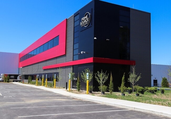
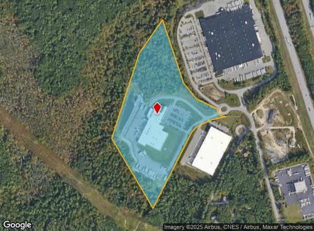
31 Jacks Bridge Rd, Londonderry, NH 03053
NEARBY LISTINGS FOR SALE OR LEASE
Property Detail
31 Jacks Bridge Rd
LOND-000017-000000-000045-000003
Rockingham
Industrialgeneral
New Hampshire
X
45-3
33011C0395D
25.87 AC
2024
Rockingham
2024
Boston
003703
Boston-Cambridge-Newton, MA-NH
119,139 SF
DEMOGRAPHICS near 31 Jacks Bridge Rd
1 Mile
3 Mile
5 Mile
2024 Total Population
1,119
17,992
82,368
2029 Population
1,180
18,834
84,629
Pop Growth 2024-2029
+ 5.45%
+ 4.68%
+ 2.74%
Average Age
40
41
41
2024 Total Households
427
6,864
32,961
HH Growth 2024-2029
+ 5.39%
+ 4.65%
+ 2.69%
Median Household Inc
$109,110
$110,263
$87,041
Avg Household Size
2.60
2.60
2.40
2024 Avg HH Vehicles
2.00
2.00
2.00
Median Home Value
$419,072
$397,049
$331,926
Median Year Built
1995
1989
1977
Nearby Places
- Restaurants
- Banks
- Shops
- Fitness
- Groceries
PUBLIC TRANSPORTATION
AIRPORT
Manchester Boston Regional
DRIVE
WALK
Distance
Manchester Boston Regional
20 min
7.3 mi
Freight Ports
Port of Boston
DRIVE
WALK
Distance
Port of Boston
78 min
49.3 mi
Nearby Properties
Address
Land Use
TOTAL SIZE
Lot Size
Zoning
Address
Land Use
TOTAL SIZE
Lot Size
Zoning
383,493 SF
34.51 AC
Address
Land Use
TOTAL SIZE
Lot Size
Zoning
603,357 SF
45.12 AC
GB
Address
Land Use
TOTAL SIZE
Lot Size
Zoning
8,064 SF
34.29 AC
Address
Land Use
TOTAL SIZE
Lot Size
Zoning
1,710 SF
65 AC
AR-I
Address
Land Use
TOTAL SIZE
Lot Size
Zoning
46,906 SF
552.35 AC
Address
Land Use
TOTAL SIZE
Lot Size
Zoning
50.47 AC
GB
Address
Land Use
TOTAL SIZE
Lot Size
Zoning
723,875 SF
38.08 AC
Address
Land Use
TOTAL SIZE
Lot Size
Zoning
49,788 SF
34.73 AC
Address
Land Use
TOTAL SIZE
Lot Size
Zoning
180,600 SF
14.19 AC
IND-I
Address
Land Use
TOTAL SIZE
Lot Size
Zoning
366,008 SF
41.69 AC
IND-I
Address
Land Use
TOTAL SIZE
Lot Size
Zoning
487,970 SF
79.74 AC
IND-I
Address
Land Use
TOTAL SIZE
Lot Size
Zoning
201,831 SF
18.46 AC
IND-II
Address
Land Use
TOTAL SIZE
Lot Size
Zoning
142,318 SF
26.13 AC
GB
Address
Land Use
TOTAL SIZE
Lot Size
Zoning
227,589 SF
GB
Address
Land Use
TOTAL SIZE
Lot Size
Zoning
244,637 SF
27.28 AC
IND-II
Address
Land Use
TOTAL SIZE
Lot Size
Zoning
304,312 SF
29.62 AC
IND-II
Address
Land Use
TOTAL SIZE
Lot Size
Zoning
116.34 AC
IND-II
Address
Land Use
TOTAL SIZE
Lot Size
Zoning
162,272 SF
9.69 AC
Address
Land Use
TOTAL SIZE
Lot Size
Zoning
24.20 AC
GB
Address
Land Use
TOTAL SIZE
Lot Size
Zoning
112,851 SF
10.93 AC
Address
Land Use
TOTAL SIZE
Lot Size
Zoning
146,997 SF
16.88 AC
Address
Land Use
TOTAL SIZE
Lot Size
Zoning
105,525 SF
11.76 AC
Address
Land Use
TOTAL SIZE
Lot Size
Zoning
94,419 SF
6 AC
Address
Land Use
TOTAL SIZE
Lot Size
Zoning
18,132 SF
11.92 AC
Address
Land Use
TOTAL SIZE
Lot Size
Zoning
125,060 SF
8.76 AC
IND-I
Address
Land Use
TOTAL SIZE
Lot Size
Zoning
75,032 SF
4.54 AC
Address
Land Use
TOTAL SIZE
Lot Size
Zoning
722 SF
65 AC
Address
Land Use
TOTAL SIZE
Lot Size
Zoning
105,926 SF
5.04 AC
Address
Land Use
TOTAL SIZE
Lot Size
Zoning
62,485 SF
6 AC
The World's #1 Commercial Real Estate Marketplace
Connect with us
© 2025 CoStar Group
The information above has been obtained from sources believed reliable. While we do not doubt its accuracy we have not verified it and make no guarantee, warranty or representation about it. It is your responsibility to independently confirm its accuracy and completeness. Any projections, opinions, assumptions, or estimates used are for example only and do not represent the current or future performance of the property. The value of this transaction to you depends on tax and other factors which should be evaluated by your tax, financial, and legal advisors. You and your advisors should conduct a careful, independent investigation of the property to determine to your satisfaction the suitability of the property for your needs.