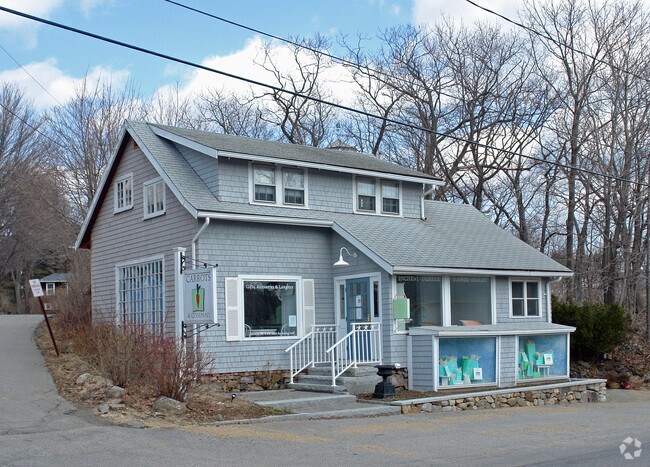
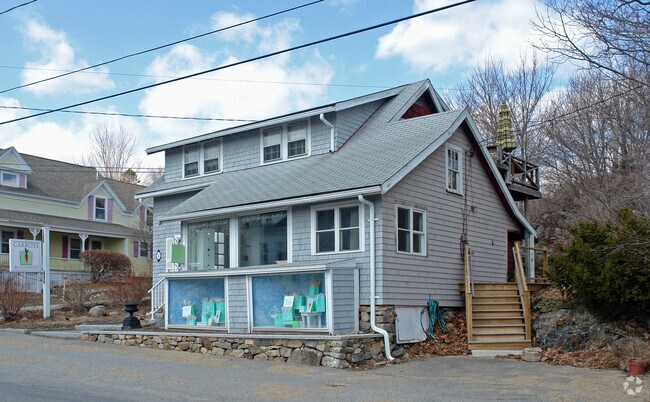
Property Record
31 Perkins Cove Rd, Ogunquit, ME 03907

Property Detail
31 Perkins Cove Rd
OGUN-000003-000000-000064
YORK
Commercialofficeresidentialmixeduse
Maine
SGD-2
64
B and X Area of moderate flood hazard, usually the area between the limits of the 100-year and 500-year floods.
0.07 AC
2024
York County
2024
Portland/South Portland
034006
Portland-South Portland, ME
1,956 SF
NEARBY LISTINGS FOR SALE OR LEASE
DEMOGRAPHICS near 31 Perkins Cove Rd
1 mile
3 mile
5 mile
2025 Total Population
557
3,945
10,641
2030 Population
550
4,035
11,113
Pop Growth 2025-2030
(1.26%)
+ 2.28%
+ 4.44%
Average Age
54
52
51
2025 Total Households
272
1,867
4,943
HH Growth 2025-2030
(1.84%)
+ 1.93%
+ 4.39%
Median Household Inc
$137,500
$119,198
$105,933
Avg Household Size
2.00
2.10
2.10
2025 Avg HH Vehicles
2.00
2.00
2.00
Median Home Value
$776,923
$705,150
$695,016
Median Year Built
1980
1983
1981
Nearby Places
Map Layers
Map Styles
 Street
 Aerial
Transit
 Traffic
 Biking
Places
Listings with unknown addresses are not visible on the map
- Restaurants
- Banks
- Shops
- Fitness
- Groceries
PUBLIC TRANSPORTATION
COMMUTER RAIL
Drive
Walk
Distance
18 min
7.3 mi
AIRPORT
Portsmouth International at Pease
Drive
Walk
Distance
Portsmouth International at Pease
31 min
17.9 mi
Portland International Jetport
Drive
Walk
Distance
Portland International Jetport
52 min
35.5 mi
Freight Ports
Portland, ME
Drive
Walk
Distance
Portland, ME
53 min
38.0 mi
SALE & LEASE HISTORY
LISTING DATE
SALE/LEASE

Jul 17, 2017
For Lease
Nearby Properties
Address
Land Use
TOTAL SIZE
Lot Size
Zoning
Address
Land Use
TOTAL SIZE
Lot Size
Zoning
64.25 AC
R2
Address
Land Use
TOTAL SIZE
Lot Size
Zoning
4.10 AC
LB/SLC
Address
Land Use
TOTAL SIZE
Lot Size
Zoning
4.64 AC
SLC/LB
Address
Land Use
TOTAL SIZE
Lot Size
Zoning
3.68 AC
SLC/GB
Address
Land Use
TOTAL SIZE
Lot Size
Zoning
2.63 AC
LBD/SL
Address
Land Use
TOTAL SIZE
Lot Size
Zoning
1.49 AC
SGD-1
Address
Land Use
TOTAL SIZE
Lot Size
Zoning
1.29 AC
SLR
Address
Land Use
TOTAL SIZE
Lot Size
Zoning
13.33 AC
R1-6
Address
Land Use
TOTAL SIZE
Lot Size
Zoning
4.65 AC
GBD2
Address
Land Use
TOTAL SIZE
Lot Size
Zoning
3.97 AC
GBD2
Address
Land Use
TOTAL SIZE
Lot Size
Zoning
3.78 AC
GBD2/R
Address
Land Use
TOTAL SIZE
Lot Size
Zoning
1.11 AC
LBD
Address
Land Use
TOTAL SIZE
Lot Size
Zoning
5.65 AC
GBD2
Address
Land Use
TOTAL SIZE
Lot Size
Zoning
4.67 AC
GBD2/R
Address
Land Use
TOTAL SIZE
Lot Size
Zoning
2.38 AC
SGD-2
Address
Land Use
TOTAL SIZE
Lot Size
Zoning
400 SF
0.36 AC
GB02
Address
Land Use
TOTAL SIZE
Lot Size
Zoning
2.07 AC
SLC
Address
Land Use
TOTAL SIZE
Lot Size
Zoning
4,718 SF
2.38 AC
SLR
Address
Land Use
TOTAL SIZE
Lot Size
Zoning
142 AC
RP
Address
Land Use
TOTAL SIZE
Lot Size
Zoning
3.53 AC
SLC/GB
Address
Land Use
TOTAL SIZE
Lot Size
Zoning
1.43 AC
SLC
Address
Land Use
TOTAL SIZE
Lot Size
Zoning
5.43 AC
GBD2/R
Address
Land Use
TOTAL SIZE
Lot Size
Zoning
1.79 AC
SLC
Address
Land Use
TOTAL SIZE
Lot Size
Zoning
24,555 SF
3.50 AC
GB
Address
Land Use
TOTAL SIZE
Lot Size
Zoning
2,264 SF
48.65 AC
GB
Address
Land Use
TOTAL SIZE
Lot Size
Zoning
12.85 AC
SLR/R
Address
Land Use
TOTAL SIZE
Lot Size
Zoning
1.30 AC
R2
Address
Land Use
TOTAL SIZE
Lot Size
Zoning
0.89 AC
SLR/OF
Address
Land Use
TOTAL SIZE
Lot Size
Zoning
1,763 SF
28 AC
R
Address
Land Use
TOTAL SIZE
Lot Size
Zoning
7,728 SF
3 AC
SLC
The World's #1 Commercial Real Estate Marketplace
Connect with us
© 2026 CoStar Group
The information above has been obtained from sources believed reliable. While we do not doubt its accuracy we have not verified it and make no guarantee, warranty or representation about it. It is your responsibility to independently confirm its accuracy and completeness. Any projections, opinions, assumptions, or estimates used are for example only and do not represent the current or future performance of the property. The value of this transaction to you depends on tax and other factors which should be evaluated by your tax, financial, and legal advisors. You and your advisors should conduct a careful, independent investigation of the property to determine to your satisfaction the suitability of the property for your needs.