Property Record
31 Pine Hill Rd, Thomaston, CT 06787


Property Detail
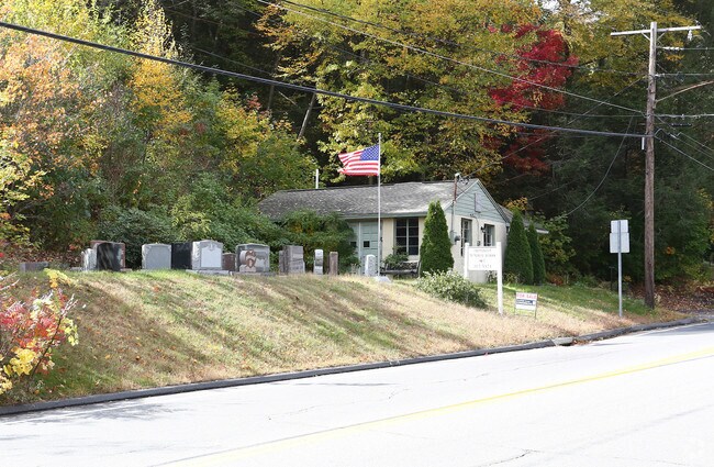
31 Pine Hill Rd
THOM-000060-000003-000007
Naugatuck Vly
Storebuilding
Connecticut
RA15
7
2025
0.34 AC
2025
SE Litchfield County
349100
Hartford
598 SF
Torrington, CT
NEARBY LISTINGS FOR SALE OR LEASE
-
-
View all Thomaston listings for sale on LoopNet.com
DEMOGRAPHICS near 31 Pine Hill Rd
1 mile
3 mile
5 mile
2025 Total Population
2,242
11,945
45,659
2030 Population
2,301
12,296
46,802
Pop Growth 2025-2030
+ 2.63%
+ 2.94%
+ 2.50%
Average Age
44
44
43
2025 Total Households
1,043
4,927
18,306
HH Growth 2025-2030
+ 2.49%
+ 2.88%
+ 2.46%
Median Household Inc
$99,133
$97,559
$91,493
Avg Household Size
2.10
2.30
2.40
2025 Avg HH Vehicles
2.00
2.00
2.00
Median Home Value
$279,597
$327,658
$300,459
Median Year Built
1972
1971
1969
Nearby Places
Map Layers
Map Styles
 Street
 Aerial
Transit
 Traffic
 Biking
Places
Listings with unknown addresses are not visible on the map
- Restaurants
- Banks
- Shops
- Fitness
- Groceries
PUBLIC TRANSPORTATION
COMMUTER RAIL
Waterbury Station (New Haven Line - Metro-North Commuter Railroad Company (Metro-North))
Drive
Walk
Distance
Waterbury Station (New Haven Line - Metro-North Commuter Railroad Company (Metro-North))
13 min
8.8 mi
AIRPORT
Tweed/New Haven
Drive
Walk
Distance
Tweed/New Haven
54 min
35.9 mi
Bradley International
Drive
Walk
Distance
Bradley International
66 min
38.8 mi
Freight Ports
Port of New Haven
Drive
Walk
Distance
Port of New Haven
49 min
33.0 mi
Nearby Properties
Address
Land Use
TOTAL SIZE
Lot Size
Zoning
Address
Land Use
TOTAL SIZE
Lot Size
Zoning
276,286 SF
19.50 AC
IG80
Address
Land Use
TOTAL SIZE
Lot Size
Zoning
65,974 SF
20.70 AC
RA15
Address
Land Use
TOTAL SIZE
Lot Size
Zoning
326,357 SF
53.34 AC
IR200
Address
Land Use
TOTAL SIZE
Lot Size
Zoning
15 AC
M1
Address
Land Use
TOTAL SIZE
Lot Size
Zoning
178,860 SF
52.98 AC
IR200
Address
Land Use
TOTAL SIZE
Lot Size
Zoning
1,154 SF
435 AC
R90
Address
Land Use
TOTAL SIZE
Lot Size
Zoning
128,480 SF
19.91 AC
IR200
Address
Land Use
TOTAL SIZE
Lot Size
Zoning
125,770 SF
19 AC
IR200
Address
Land Use
TOTAL SIZE
Lot Size
Zoning
10 AC
RA1
Address
Land Use
TOTAL SIZE
Lot Size
Zoning
18,252 SF
1.56 AC
GC
Address
Land Use
TOTAL SIZE
Lot Size
Zoning
3.99 AC
RA1
Address
Land Use
TOTAL SIZE
Lot Size
Zoning
81,029 SF
20 AC
IR200
Address
Land Use
TOTAL SIZE
Lot Size
Zoning
5.13 AC
IR200
Address
Land Use
TOTAL SIZE
Lot Size
Zoning
157.47 AC
R90
Address
Land Use
TOTAL SIZE
Lot Size
Zoning
12.44 AC
M2
Address
Land Use
TOTAL SIZE
Lot Size
Zoning
508.90 AC
RA1
Address
Land Use
TOTAL SIZE
Lot Size
Zoning
49,954 SF
3.90 AC
M1
Address
Land Use
TOTAL SIZE
Lot Size
Zoning
4.08 AC
RA15
Address
Land Use
TOTAL SIZE
Lot Size
Zoning
16,867 SF
7.94 AC
RA15GC
Address
Land Use
TOTAL SIZE
Lot Size
Zoning
46,470 SF
9.77 AC
M1
Address
Land Use
TOTAL SIZE
Lot Size
Zoning
11,920 SF
4.20 AC
RA15
Address
Land Use
TOTAL SIZE
Lot Size
Zoning
37.72 AC
RA80A
Address
Land Use
TOTAL SIZE
Lot Size
Zoning
48.04 AC
R90
Address
Land Use
TOTAL SIZE
Lot Size
Zoning
48,000 SF
17.93 AC
IR80
Address
Land Use
TOTAL SIZE
Lot Size
Zoning
129,174 SF
11.92 AC
GC
Address
Land Use
TOTAL SIZE
Lot Size
Zoning
9,594 SF
1.87 AC
GC
Address
Land Use
TOTAL SIZE
Lot Size
Zoning
2.30 AC
GC
Address
Land Use
TOTAL SIZE
Lot Size
Zoning
34,945 SF
8.41 AC
IR200
Address
Land Use
TOTAL SIZE
Lot Size
Zoning
130,374 SF
10.50 AC
M2
Address
Land Use
TOTAL SIZE
Lot Size
Zoning
6.55 AC
M1
The World's #1 Commercial Real Estate Marketplace
Connect with us
© 2026 CoStar Group
The information above has been obtained from sources believed reliable. While we do not doubt its accuracy we have not verified it and make no guarantee, warranty or representation about it. It is your responsibility to independently confirm its accuracy and completeness. Any projections, opinions, assumptions, or estimates used are for example only and do not represent the current or future performance of the property. The value of this transaction to you depends on tax and other factors which should be evaluated by your tax, financial, and legal advisors. You and your advisors should conduct a careful, independent investigation of the property to determine to your satisfaction the suitability of the property for your needs.