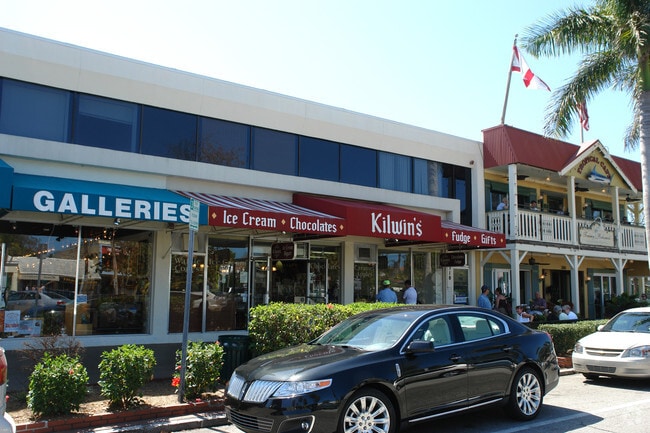
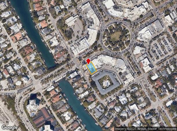
Property Record
312 John Ringling Blvd, Sarasota, FL 34236
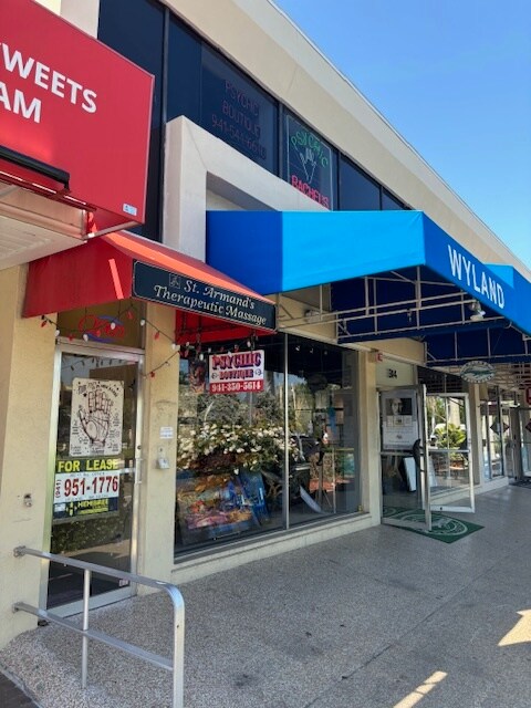

Current Lease Availabilities
General Retail LEASE
$36.00 - $50.00 SF/YR
120 - 300 SF
NEARBY LISTINGS FOR SALE OR LEASE
Property Detail
312 John Ringling Blvd
North Port-Sarasota-Bradenton, FL
Saint Armands Division John Ringling Est
2014-05-0127
LOTS 21 22 & 23 BLK 11 ST ARMANDS DIVISION
Communitycenter
Sarasota
AE
Florida
12115C0129G
21
2024
0.22 AC
2025
Sarasota
000700
Tampa/St Petersburg
5,249 SF
DEMOGRAPHICS near 312 John Ringling Blvd
1 Mile
3 Mile
5 Mile
2024 Total Population
3,195
26,814
97,186
2029 Population
3,853
31,763
113,198
Pop Growth 2024-2029
+ 20.59%
+ 18.46%
+ 16.48%
Average Age
69
59
50
2024 Total Households
1,671
14,494
45,677
HH Growth 2024-2029
+ 21.30%
+ 18.66%
+ 16.85%
Median Household Inc
$116,430
$105,458
$72,513
Avg Household Size
1.70
1.80
2.00
2024 Avg HH Vehicles
2.00
1.00
2.00
Median Home Value
$899,273
$859,537
$508,384
Median Year Built
1971
1984
1975
Nearby Places
Map Layers
Map Styles
 Street
 Aerial
- Restaurants
- Banks
- Shops
- Fitness
- Groceries
PUBLIC TRANSPORTATION
AIRPORT
Sarasota/Bradenton International
DRIVE
WALK
Distance
Sarasota/Bradenton International
16 min
7.0 mi
Freight Ports
Port Manatee
DRIVE
WALK
Distance
Port Manatee
46 min
26.9 mi
Nearby Properties
Address
Land Use
TOTAL SIZE
Lot Size
Zoning
Address
Land Use
TOTAL SIZE
Lot Size
Zoning
2,010,667 SF
14.38 AC
SMH
Address
Land Use
TOTAL SIZE
Lot Size
Zoning
124,840 SF
29.18 AC
G
Address
Land Use
TOTAL SIZE
Lot Size
Zoning
516,332 SF
7.62 AC
DTB
Address
Land Use
TOTAL SIZE
Lot Size
Zoning
595,734 SF
1.63 AC
DTB
Address
Land Use
TOTAL SIZE
Lot Size
Zoning
595,368 SF
13.76 AC
MCI
Address
Land Use
TOTAL SIZE
Lot Size
Zoning
458,955 SF
3.99 AC
DTE
Address
Land Use
TOTAL SIZE
Lot Size
Zoning
409,998 SF
1.09 AC
DTC
Address
Land Use
TOTAL SIZE
Lot Size
Zoning
950 SF
26.80 AC
G
Address
Land Use
TOTAL SIZE
Lot Size
Zoning
394,304 SF
2.85 AC
DTE
Address
Land Use
TOTAL SIZE
Lot Size
Zoning
425,532 SF
3.05 AC
DTE
Address
Land Use
TOTAL SIZE
Lot Size
Zoning
253,844 SF
4.09 AC
WFR
Address
Land Use
TOTAL SIZE
Lot Size
Zoning
60.62 AC
G
Address
Land Use
TOTAL SIZE
Lot Size
Zoning
1.70 AC
DTB
Address
Land Use
TOTAL SIZE
Lot Size
Zoning
321,015 SF
1.11 AC
DTB
Address
Land Use
TOTAL SIZE
Lot Size
Zoning
91,324 SF
2.18 AC
SMH
Address
Land Use
TOTAL SIZE
Lot Size
Zoning
146,948 SF
1.08 AC
SMH
Address
Land Use
TOTAL SIZE
Lot Size
Zoning
199,653 SF
0.38 AC
DTC
Address
Land Use
TOTAL SIZE
Lot Size
Zoning
2,900 SF
152 AC
G
Address
Land Use
TOTAL SIZE
Lot Size
Zoning
133,389 SF
6.14 AC
WFR
Address
Land Use
TOTAL SIZE
Lot Size
Zoning
252,254 SF
0.98 AC
DTB
Address
Land Use
TOTAL SIZE
Lot Size
Zoning
196,633 SF
14.73 AC
BG
Address
Land Use
TOTAL SIZE
Lot Size
Zoning
26,202 SF
1.21 AC
G
Address
Land Use
TOTAL SIZE
Lot Size
Zoning
17,718 SF
3.91 AC
WFR
Address
Land Use
TOTAL SIZE
Lot Size
Zoning
257,614 SF
0.36 AC
DTB
Address
Land Use
TOTAL SIZE
Lot Size
Zoning
71,744 SF
2.30 AC
DTC
Address
Land Use
TOTAL SIZE
Lot Size
Zoning
262,739 SF
3.56 AC
DTB
Address
Land Use
TOTAL SIZE
Lot Size
Zoning
66,008 SF
3.98 AC
G
Address
Land Use
TOTAL SIZE
Lot Size
Zoning
300,601 SF
1.93 AC
SMH
Address
Land Use
TOTAL SIZE
Lot Size
Zoning
169,017 SF
1.86 AC
G
Address
Land Use
TOTAL SIZE
Lot Size
Zoning
200,598 SF
1.49 AC
DTC
The World's #1 Commercial Real Estate Marketplace
Connect with us
© 2025 CoStar Group
The information above has been obtained from sources believed reliable. While we do not doubt its accuracy we have not verified it and make no guarantee, warranty or representation about it. It is your responsibility to independently confirm its accuracy and completeness. Any projections, opinions, assumptions, or estimates used are for example only and do not represent the current or future performance of the property. The value of this transaction to you depends on tax and other factors which should be evaluated by your tax, financial, and legal advisors. You and your advisors should conduct a careful, independent investigation of the property to determine to your satisfaction the suitability of the property for your needs.