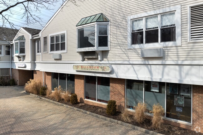
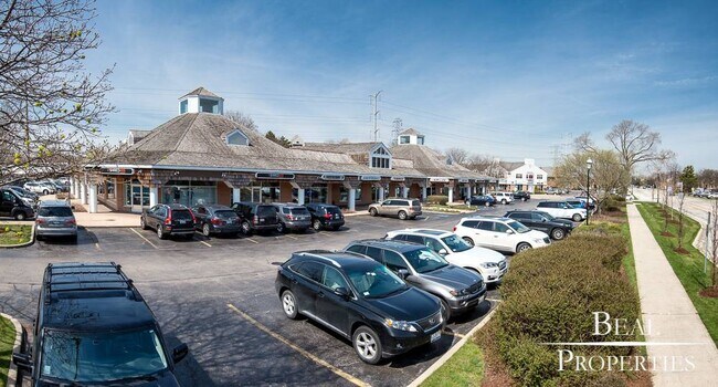
Property Record
310 Happ Rd, Northfield, IL 60093

Property Detail
310 Happ Rd
Chicago-Naperville-Elgin, IL-IN
(PLAT) OF SUB (NORTHFIELD) VILLAGE (CENTER) BNG A SUB OF PT OF THE SW SEC 19-42-13
05-19-327-005-0000
Cook
Storebuilding
Illinois
B and X Area of moderate flood hazard, usually the area between the limits of the 100-year and 500-year floods.
1
2023
1.54 AC
2025
Central North
800800
Chicago
35,579 SF
NEARBY LISTINGS FOR SALE OR LEASE
DEMOGRAPHICS near 310 Happ Rd
1 mile
3 mile
5 mile
2025 Total Population
5,131
77,493
253,606
2030 Population
5,217
78,429
256,111
Pop Growth 2025-2030
+ 1.68%
+ 1.21%
+ 0.99%
Average Age
44
43
44
2025 Total Households
1,889
27,796
91,332
HH Growth 2025-2030
+ 1.54%
+ 1.14%
+ 0.84%
Median Household Inc
$162,027
$167,088
$129,328
Avg Household Size
2.70
2.70
2.70
2025 Avg HH Vehicles
2.00
2.00
2.00
Median Home Value
$760,883
$795,656
$574,005
Median Year Built
1968
1964
1962
Nearby Places
Map Layers
Map Styles
 Street
 Aerial
Layers
 Traffic
 Biking
Places
Listings with unknown addresses are not visible on the map
- Restaurants
- Banks
- Shops
- Fitness
- Groceries
PUBLIC TRANSPORTATION
COMMUTER RAIL
Winnetka Station (Union Pacific North Line - Northeast Illinois Regional Commuter Railroad (Metra))
Drive
Walk
Distance
Winnetka Station (Union Pacific North Line - Northeast Illinois Regional Commuter Railroad (Metra))
5 min
2.4 mi
Hubbard Woods Station (Union Pacific North Line - Northeast Illinois Regional Commuter Railroad (Metra))
Drive
Walk
Distance
Hubbard Woods Station (Union Pacific North Line - Northeast Illinois Regional Commuter Railroad (Metra))
7 min
2.6 mi
AIRPORT
Chicago O'Hare International
Drive
Walk
Distance
Chicago O'Hare International
26 min
16.1 mi
Chicago Midway International
Drive
Walk
Distance
Chicago Midway International
39 min
24.5 mi
Freight Ports
Port Milwaukee
Drive
Walk
Distance
Port Milwaukee
81 min
67.2 mi
SALE & LEASE HISTORY
LISTING DATE
SALE/LEASE

Sep 21, 2023
For Lease
Oct 15, 2018
For Lease
Nov 12, 2025
For Lease
May 21, 2024
For Lease
Mar 07, 2025
For Lease
Jun 22, 2023
For Lease
Jul 02, 2024
For Lease
Feb 21, 2018
For Lease
Feb 01, 2018
For Lease
Dec 18, 2017
For Lease
Nearby Properties
Address
Land Use
TOTAL SIZE
Lot Size
Zoning
Address
Land Use
TOTAL SIZE
Lot Size
Zoning
8.04 AC
Address
Land Use
TOTAL SIZE
Lot Size
Zoning
579,162 SF
6.41 AC
Address
Land Use
TOTAL SIZE
Lot Size
Zoning
415,554 SF
7.51 AC
Address
Land Use
TOTAL SIZE
Lot Size
Zoning
14.11 AC
Address
Land Use
TOTAL SIZE
Lot Size
Zoning
172,538 SF
5.60 AC
Address
Land Use
TOTAL SIZE
Lot Size
Zoning
495,857 SF
19.55 AC
Address
Land Use
TOTAL SIZE
Lot Size
Zoning
10.58 AC
Address
Land Use
TOTAL SIZE
Lot Size
Zoning
230,886 SF
9.30 AC
Address
Land Use
TOTAL SIZE
Lot Size
Zoning
679,109 SF
24.46 AC
Address
Land Use
TOTAL SIZE
Lot Size
Zoning
6.90 AC
Address
Land Use
TOTAL SIZE
Lot Size
Zoning
27.59 AC
Address
Land Use
TOTAL SIZE
Lot Size
Zoning
58,280 SF
3.46 AC
Address
Land Use
TOTAL SIZE
Lot Size
Zoning
169,657 SF
7.25 AC
Address
Land Use
TOTAL SIZE
Lot Size
Zoning
18.69 AC
Address
Land Use
TOTAL SIZE
Lot Size
Zoning
172,544 SF
7.22 AC
Address
Land Use
TOTAL SIZE
Lot Size
Zoning
206,139 SF
2.19 AC
Address
Land Use
TOTAL SIZE
Lot Size
Zoning
78,819 SF
5.86 AC
Address
Land Use
TOTAL SIZE
Lot Size
Zoning
189,892 SF
Address
Land Use
TOTAL SIZE
Lot Size
Zoning
17.91 AC
Address
Land Use
TOTAL SIZE
Lot Size
Zoning
114,174 SF
16.77 AC
Address
Land Use
TOTAL SIZE
Lot Size
Zoning
97.02 AC
Address
Land Use
TOTAL SIZE
Lot Size
Zoning
126.61 AC
Address
Land Use
TOTAL SIZE
Lot Size
Zoning
182,945 SF
2.51 AC
Address
Land Use
TOTAL SIZE
Lot Size
Zoning
94,063 SF
1.61 AC
Address
Land Use
TOTAL SIZE
Lot Size
Zoning
108,890 SF
8.87 AC
Address
Land Use
TOTAL SIZE
Lot Size
Zoning
267,170 SF
7.11 AC
Address
Land Use
TOTAL SIZE
Lot Size
Zoning
60,301 SF
3.35 AC
Address
Land Use
TOTAL SIZE
Lot Size
Zoning
62,616 SF
5.65 AC
Address
Land Use
TOTAL SIZE
Lot Size
Zoning
219,116 SF
4.97 AC
Address
Land Use
TOTAL SIZE
Lot Size
Zoning
126,621 SF
3.03 AC
The World's #1 Commercial Real Estate Marketplace
Connect with us
© 2026 CoStar Group
The information above has been obtained from sources believed reliable. While we do not doubt its accuracy we have not verified it and make no guarantee, warranty or representation about it. It is your responsibility to independently confirm its accuracy and completeness. Any projections, opinions, assumptions, or estimates used are for example only and do not represent the current or future performance of the property. The value of this transaction to you depends on tax and other factors which should be evaluated by your tax, financial, and legal advisors. You and your advisors should conduct a careful, independent investigation of the property to determine to your satisfaction the suitability of the property for your needs.