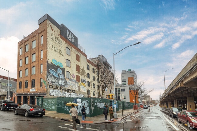
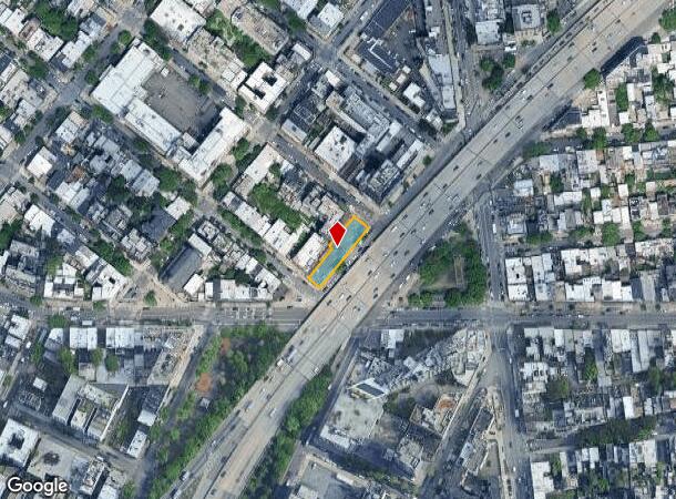
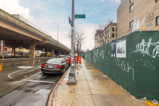
Property Record
304 N 7Th St, Brooklyn, NY 11211
NEARBY LISTINGS FOR SALE OR LEASE
Property Detail
304 N 7Th St
02331-0020
Kings
Apartment
New York
X
20
3604970204F
0.20 AC
2024
North Brooklyn
2025
Long Island (New York)
051900
New York-Jersey City-White Plains, NY-NJ
27,418 SF
DEMOGRAPHICS near 304 N 7Th St
1 Mile
3 Mile
5 Mile
2024 Total Population
178,349
1,336,830
3,145,091
2029 Population
171,603
1,262,335
2,957,816
Pop Growth 2024-2029
(3.78%)
(5.57%)
(5.95%)
Average Age
35
38
39
2024 Total Households
72,707
591,161
1,362,484
HH Growth 2024-2029
(4.30%)
(5.96%)
(6.26%)
Median Household Inc
$88,408
$92,493
$90,380
Avg Household Size
2.40
2.10
2.20
2024 Avg HH Vehicles
.00
.00
.00
Median Home Value
$1,026,522
$962,110
$895,975
Median Year Built
1963
1950
1951
Nearby Places
Map Layers
Map Styles
 Street
 Aerial
- Restaurants
- Banks
- Shops
- Fitness
- Groceries
PUBLIC TRANSPORTATION
TRANSIT/SUBWAY
Metropolitan Avenue (G - New York MTA Subway (The Subway))
DRIVE
WALK
Distance
Metropolitan Avenue (G - New York MTA Subway (The Subway))
2 min
4 min
0.2 mi
Lorimer Street (L Line) (L - New York MTA Subway (The Subway))
DRIVE
WALK
Distance
Lorimer Street (L Line) (L - New York MTA Subway (The Subway))
2 min
5 min
0.2 mi
Bedford Avenue (L - New York MTA Subway (The Subway))
DRIVE
WALK
Distance
Bedford Avenue (L - New York MTA Subway (The Subway))
2 min
6 min
0.3 mi
Graham Avenue (L - New York MTA Subway (The Subway))
DRIVE
WALK
Distance
Graham Avenue (L - New York MTA Subway (The Subway))
3 min
10 min
0.5 mi
Marcy Avenue (J - New York MTA Subway (The Subway), M - New York MTA Subway (The Subway), Z - New York MTA Subway (The Subway))
DRIVE
WALK
Distance
Marcy Avenue (J - New York MTA Subway (The Subway), M - New York MTA Subway (The Subway), Z - New York MTA Subway (The Subway))
1 min
10 min
0.5 mi
COMMUTER RAIL
Hunterspoint Avenue Station (Hempstead Branch - Long Island Rail Road, Oyster Bay Branch - Long Island Rail Road)
DRIVE
WALK
Distance
Hunterspoint Avenue Station (Hempstead Branch - Long Island Rail Road, Oyster Bay Branch - Long Island Rail Road)
9 min
3.1 mi
DRIVE
WALK
Distance
8 min
3.2 mi
AIRPORT
LaGuardia
DRIVE
WALK
Distance
LaGuardia
16 min
7.2 mi
John F Kennedy International
DRIVE
WALK
Distance
John F Kennedy International
26 min
13.5 mi
Newark Liberty International
DRIVE
WALK
Distance
Newark Liberty International
26 min
14.9 mi
Freight Ports
NY - Red Hook Container Terminal
DRIVE
WALK
Distance
NY - Red Hook Container Terminal
9 min
4.6 mi
Nearby Properties
Address
Land Use
TOTAL SIZE
Lot Size
Zoning
Address
Land Use
TOTAL SIZE
Lot Size
Zoning
8,462,176 SF
61.41 AC
R7-2
Address
Land Use
TOTAL SIZE
Lot Size
Zoning
1,678,135 SF
1.01 AC
C5-3
Address
Land Use
TOTAL SIZE
Lot Size
Zoning
2,812,739 SF
2.10 AC
C5-3
Address
Land Use
TOTAL SIZE
Lot Size
Zoning
2,400,000 SF
15.14 AC
C5-2
Address
Land Use
TOTAL SIZE
Lot Size
Zoning
2,124,441 SF
17.29 AC
R8
Address
Land Use
TOTAL SIZE
Lot Size
Zoning
1,233,394 SF
1.78 AC
C5-3
Address
Land Use
TOTAL SIZE
Lot Size
Zoning
1,134,017 SF
1.05 AC
C5-3
Address
Land Use
TOTAL SIZE
Lot Size
Zoning
1,104,505 SF
2.32 AC
C4-7
Address
Land Use
TOTAL SIZE
Lot Size
Zoning
1,560,607 SF
2.69 AC
C6-6
Address
Land Use
TOTAL SIZE
Lot Size
Zoning
916,553 SF
1.39 AC
C5-3
Address
Land Use
TOTAL SIZE
Lot Size
Zoning
940,000 SF
1.44 AC
C6-2
Address
Land Use
TOTAL SIZE
Lot Size
Zoning
1,050,990 SF
1.21 AC
C52.5
Address
Land Use
TOTAL SIZE
Lot Size
Zoning
693,256 SF
1.18 AC
C5-3
Address
Land Use
TOTAL SIZE
Lot Size
Zoning
7,058,736 SF
147.61 AC
M3-1
Address
Land Use
TOTAL SIZE
Lot Size
Zoning
869,038 SF
1.53 AC
M1-1
Address
Land Use
TOTAL SIZE
Lot Size
Zoning
1,260,362 SF
4.32 AC
C1-7
Address
Land Use
TOTAL SIZE
Lot Size
Zoning
802,000 SF
1.20 AC
C62A
Address
Land Use
TOTAL SIZE
Lot Size
Zoning
3,122,165 SF
19.02 AC
R7-2
Address
Land Use
TOTAL SIZE
Lot Size
Zoning
412,612 SF
0.69 AC
M1-6
Address
Land Use
TOTAL SIZE
Lot Size
Zoning
2,210,200 SF
2.58 AC
C5-5
Address
Land Use
TOTAL SIZE
Lot Size
Zoning
1,653,794 SF
3.15 AC
C6-4
Address
Land Use
TOTAL SIZE
Lot Size
Zoning
704,950 SF
1.19 AC
C5-2
Address
Land Use
TOTAL SIZE
Lot Size
Zoning
932,587 SF
1.23 AC
C5-3
Address
Land Use
TOTAL SIZE
Lot Size
Zoning
972,820 SF
1.98 AC
M1-6
Address
Land Use
TOTAL SIZE
Lot Size
Zoning
1,043,803 SF
1.59 AC
M1-6
Address
Land Use
TOTAL SIZE
Lot Size
Zoning
1,065,915 SF
2.13 AC
M16R10
Address
Land Use
TOTAL SIZE
Lot Size
Zoning
1,385,425 SF
6.43 AC
R8
Address
Land Use
TOTAL SIZE
Lot Size
Zoning
1,035,307 SF
0.86 AC
C5-3
Address
Land Use
TOTAL SIZE
Lot Size
Zoning
1,617,206 SF
1.23 AC
C5-5
Address
Land Use
TOTAL SIZE
Lot Size
Zoning
733,001 SF
0.76 AC
C5-3
The World's #1 Commercial Real Estate Marketplace
Connect with us
© 2026 CoStar Group
The information above has been obtained from sources believed reliable. While we do not doubt its accuracy we have not verified it and make no guarantee, warranty or representation about it. It is your responsibility to independently confirm its accuracy and completeness. Any projections, opinions, assumptions, or estimates used are for example only and do not represent the current or future performance of the property. The value of this transaction to you depends on tax and other factors which should be evaluated by your tax, financial, and legal advisors. You and your advisors should conduct a careful, independent investigation of the property to determine to your satisfaction the suitability of the property for your needs.