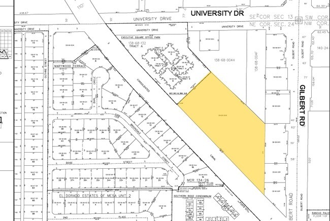
Property Record
310 N Gilbert Rd, Mesa, AZ 85203


Property Detail
310 N Gilbert Rd
138-68-004D
COM NE COR NE4 SEC S 88D 23M W 580.765F S 130.36F S 43D 44M E 175.106F TPOB S 47D 01M E 390.099F TO WLY LN E 169.70F NE4 S 374F N 44D 35M W 645.344F N 43D 44M W 14.638F N 46D 15M E 246F TPOB
Publicstorage
Maricopa
C-G
Arizona
AH Areas with a 1% annual chance of shallow flooding, usually in the form of a pond, withan average depth ranging from 1 to 3 feet. These areas have a 26% chance of flooding over the life of a 30-year mortgage.
2.97 AC
2025
Mesa East
2025
Phoenix
421601
Phoenix-Mesa-Chandler, AZ
54,608 SF
NEARBY LISTINGS FOR SALE OR LEASE
DEMOGRAPHICS near 310 N Gilbert Rd
1 mile
3 mile
5 mile
2025 Total Population
22,999
168,485
343,353
2030 Population
23,790
174,614
356,310
Pop Growth 2025-2030
+ 3.44%
+ 3.64%
+ 3.77%
Average Age
36
38
39
2025 Total Households
8,116
60,682
129,007
HH Growth 2025-2030
+ 3.66%
+ 4.04%
+ 4.09%
Median Household Inc
$70,788
$71,036
$73,767
Avg Household Size
2.70
2.70
2.60
2025 Avg HH Vehicles
2.00
2.00
2.00
Median Home Value
$351,924
$387,335
$408,189
Median Year Built
1976
1982
1984
Nearby Places
Map Layers
Map Styles
 Street
 Aerial
Transit
 Traffic
 Biking
Places
Listings with unknown addresses are not visible on the map
- Restaurants
- Banks
- Shops
- Fitness
- Groceries
PUBLIC TRANSPORTATION
TRANSIT/SUBWAY
Gilbert Rd/Main St (Valley Metro Rail - Valley Metro (Phoenix Light Rail))
Drive
Walk
Distance
Gilbert Rd/Main St (Valley Metro Rail - Valley Metro (Phoenix Light Rail))
2 min
12 min
0.6 mi
AIRPORT
Phoenix-Mesa Gateway
Drive
Walk
Distance
Phoenix-Mesa Gateway
24 min
14.9 mi
Phoenix Sky Harbor International
Drive
Walk
Distance
Phoenix Sky Harbor International
25 min
15.6 mi
Freight Ports
Port of San Diego
Drive
Walk
Distance
Port of San Diego
415 min
377.0 mi
Nearby Properties
Address
Land Use
TOTAL SIZE
Lot Size
Zoning
Address
Land Use
TOTAL SIZE
Lot Size
Zoning
125,356 SF
21.63 AC
R-9
Address
Land Use
TOTAL SIZE
Lot Size
Zoning
7.90 AC
Address
Land Use
TOTAL SIZE
Lot Size
Zoning
377,442 SF
0.21 AC
C-DT
Address
Land Use
TOTAL SIZE
Lot Size
Zoning
400,798 SF
55.94 AC
PF
Address
Land Use
TOTAL SIZE
Lot Size
Zoning
281,301 SF
19.13 AC
I-1
Address
Land Use
TOTAL SIZE
Lot Size
Zoning
579,506 SF
17.78 AC
PF
Address
Land Use
TOTAL SIZE
Lot Size
Zoning
20.08 AC
Address
Land Use
TOTAL SIZE
Lot Size
Zoning
454,015 SF
10.03 AC
DB1
Address
Land Use
TOTAL SIZE
Lot Size
Zoning
427,210 SF
38.33 AC
PF
Address
Land Use
TOTAL SIZE
Lot Size
Zoning
344,641 SF
21.43 AC
I-1
Address
Land Use
TOTAL SIZE
Lot Size
Zoning
1.46 AC
C-G
Address
Land Use
TOTAL SIZE
Lot Size
Zoning
478,411 SF
4.07 AC
CDT
Address
Land Use
TOTAL SIZE
Lot Size
Zoning
1.17 AC
Address
Land Use
TOTAL SIZE
Lot Size
Zoning
199,472 SF
4.79 AC
C-DT
Address
Land Use
TOTAL SIZE
Lot Size
Zoning
367,012 SF
19.91 AC
M-H
Address
Land Use
TOTAL SIZE
Lot Size
Zoning
26,951 SF
1.08 AC
I-1
Address
Land Use
TOTAL SIZE
Lot Size
Zoning
92,285 SF
7.90 AC
PEP
Address
Land Use
TOTAL SIZE
Lot Size
Zoning
79,452 SF
37.59 AC
PF
Address
Land Use
TOTAL SIZE
Lot Size
Zoning
169,128 SF
27.30 AC
R-9
Address
Land Use
TOTAL SIZE
Lot Size
Zoning
147,408 SF
34.58 AC
PF
Address
Land Use
TOTAL SIZE
Lot Size
Zoning
536,470 SF
28.81 AC
M-H
Address
Land Use
TOTAL SIZE
Lot Size
Zoning
349,318 SF
18.47 AC
M-H
Address
Land Use
TOTAL SIZE
Lot Size
Zoning
160,843 SF
22.07 AC
PF
Address
Land Use
TOTAL SIZE
Lot Size
Zoning
266,240 SF
9.75 AC
M-H
Address
Land Use
TOTAL SIZE
Lot Size
Zoning
291,925 SF
17.70 AC
M-H
Address
Land Use
TOTAL SIZE
Lot Size
Zoning
219,685 SF
20.13 AC
I-1
Address
Land Use
TOTAL SIZE
Lot Size
Zoning
321,591 SF
15.68 AC
M-H
Address
Land Use
TOTAL SIZE
Lot Size
Zoning
11,460 SF
1.06 AC
C-G
Address
Land Use
TOTAL SIZE
Lot Size
Zoning
108,672 SF
1.59 AC
CDT
Address
Land Use
TOTAL SIZE
Lot Size
Zoning
81,000 SF
15.70 AC
AG
The World's #1 Commercial Real Estate Marketplace
Connect with us
© 2026 CoStar Group
The information above has been obtained from sources believed reliable. While we do not doubt its accuracy we have not verified it and make no guarantee, warranty or representation about it. It is your responsibility to independently confirm its accuracy and completeness. Any projections, opinions, assumptions, or estimates used are for example only and do not represent the current or future performance of the property. The value of this transaction to you depends on tax and other factors which should be evaluated by your tax, financial, and legal advisors. You and your advisors should conduct a careful, independent investigation of the property to determine to your satisfaction the suitability of the property for your needs.