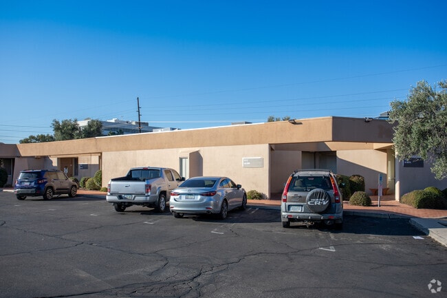
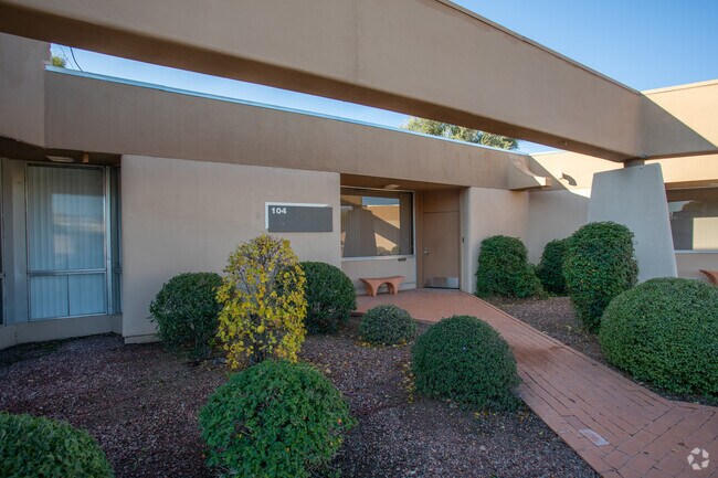
Property Record
310 N Wilmot Rd, Tucson, AZ 85711

Current Lease Availabilities
NEARBY LISTINGS FOR SALE OR LEASE
Property Detail
310 N Wilmot Rd
Tucson, AZ
Null
133-17-062H
PCL IN NWLY PTN E330 W1000 M/L S2 S2 LOT 3 LYG S OF CARONDELET DR .17 AC SEC 7-14-15
Medicalbuilding
Pima
X
Arizona
04019C2301L
3
2025
1.53 AC
2025
Central Tucson
004068
Tucson
12,146 SF
DEMOGRAPHICS near 310 N Wilmot Rd
1 Mile
3 Mile
5 Mile
2024 Total Population
12,229
128,351
256,410
2029 Population
12,648
132,928
265,143
Pop Growth 2024-2029
+ 3.43%
+ 3.57%
+ 3.41%
Average Age
45
41
41
2024 Total Households
5,922
59,343
116,800
HH Growth 2024-2029
+ 3.41%
+ 3.64%
+ 3.47%
Median Household Inc
$44,988
$46,718
$52,175
Avg Household Size
1.90
2.10
2.10
2024 Avg HH Vehicles
1.00
1.00
2.00
Median Home Value
$255,976
$224,968
$243,756
Median Year Built
1970
1973
1975
Nearby Places
Map Layers
Map Styles
 Street
 Aerial
- Restaurants
- Banks
- Shops
- Fitness
- Groceries
PUBLIC TRANSPORTATION
COMMUTER RAIL
DRIVE
WALK
Distance
16 min
6.9 mi
AIRPORT
Tucson International
DRIVE
WALK
Distance
Tucson International
22 min
12.2 mi
Nearby Properties
Address
Land Use
TOTAL SIZE
Lot Size
Zoning
Address
Land Use
TOTAL SIZE
Lot Size
Zoning
2,323,062 SF
628.02 AC
I1
Address
Land Use
TOTAL SIZE
Lot Size
Zoning
1,089,840 SF
45.56 AC
Address
Land Use
TOTAL SIZE
Lot Size
Zoning
2,041,946 SF
640 AC
I1
Address
Land Use
TOTAL SIZE
Lot Size
Zoning
53,431 SF
9.98 AC
Address
Land Use
TOTAL SIZE
Lot Size
Zoning
88,741 SF
8.02 AC
Address
Land Use
TOTAL SIZE
Lot Size
Zoning
684,356 SF
19.65 AC
PAD13
Address
Land Use
TOTAL SIZE
Lot Size
Zoning
66,438 SF
8.53 AC
C2
Address
Land Use
TOTAL SIZE
Lot Size
Zoning
473,573 SF
22.65 AC
C3
Address
Land Use
TOTAL SIZE
Lot Size
Zoning
261,002 SF
37.28 AC
R1
Address
Land Use
TOTAL SIZE
Lot Size
Zoning
137,890 SF
8.28 AC
PAD1
Address
Land Use
TOTAL SIZE
Lot Size
Zoning
41,486 SF
0.93 AC
C2
Address
Land Use
TOTAL SIZE
Lot Size
Zoning
413,801 SF
8.10 AC
OCR2
Address
Land Use
TOTAL SIZE
Lot Size
Zoning
318,290 SF
32 AC
R1
Address
Land Use
TOTAL SIZE
Lot Size
Zoning
168,286 SF
7.36 AC
Address
Land Use
TOTAL SIZE
Lot Size
Zoning
504,584 SF
18.17 AC
O3
Address
Land Use
TOTAL SIZE
Lot Size
Zoning
278,632 SF
37.62 AC
RX1
Address
Land Use
TOTAL SIZE
Lot Size
Zoning
430,180 SF
19.78 AC
R3
Address
Land Use
TOTAL SIZE
Lot Size
Zoning
406,400 SF
4.29 AC
PAD1
Address
Land Use
TOTAL SIZE
Lot Size
Zoning
11,074 SF
0.94 AC
C1
Address
Land Use
TOTAL SIZE
Lot Size
Zoning
209,980 SF
6.16 AC
C2
Address
Land Use
TOTAL SIZE
Lot Size
Zoning
26,554 SF
5.08 AC
I1
Address
Land Use
TOTAL SIZE
Lot Size
Zoning
364,128 SF
11.55 AC
O3
Address
Land Use
TOTAL SIZE
Lot Size
Zoning
109,335 SF
7.83 AC
PAD13
Address
Land Use
TOTAL SIZE
Lot Size
Zoning
256,775 SF
6.69 AC
C1
Address
Land Use
TOTAL SIZE
Lot Size
Zoning
180,149 SF
17.48 AC
PAD3
Address
Land Use
TOTAL SIZE
Lot Size
Zoning
1,804 SF
8.29 AC
R3
Address
Land Use
TOTAL SIZE
Lot Size
Zoning
326,189 SF
4.31 AC
O3
Address
Land Use
TOTAL SIZE
Lot Size
Zoning
162,473 SF
6.08 AC
C3
Address
Land Use
TOTAL SIZE
Lot Size
Zoning
240,585 SF
18.16 AC
R2
Address
Land Use
TOTAL SIZE
Lot Size
Zoning
74,815 SF
5.05 AC
The World's #1 Commercial Real Estate Marketplace
Connect with us
© 2025 CoStar Group
The information above has been obtained from sources believed reliable. While we do not doubt its accuracy we have not verified it and make no guarantee, warranty or representation about it. It is your responsibility to independently confirm its accuracy and completeness. Any projections, opinions, assumptions, or estimates used are for example only and do not represent the current or future performance of the property. The value of this transaction to you depends on tax and other factors which should be evaluated by your tax, financial, and legal advisors. You and your advisors should conduct a careful, independent investigation of the property to determine to your satisfaction the suitability of the property for your needs.