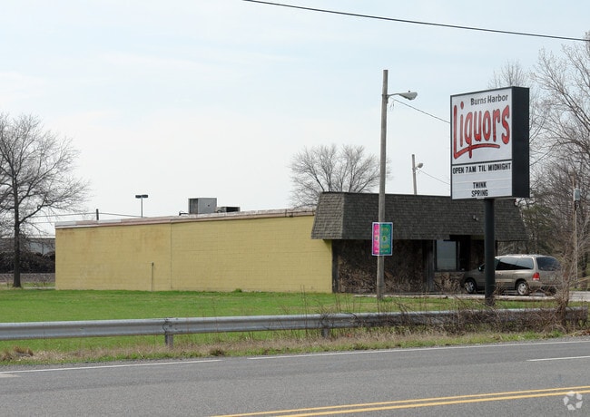
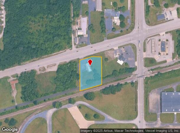
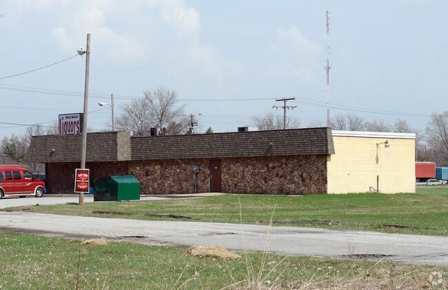
Property Record
310 Us Highway 20 Rd, Burns Harbor, IN 46304
NEARBY LISTINGS FOR SALE OR LEASE
Property Detail
310 Us Highway 20 Rd
64-06-05-427-006.000-024
W216.5 E610 N1/2 SE N RR & S HWY 20 5-36-6 1.50AC DR478 P514 TIF
Storebuilding
Porter
X
Indiana
18127C0107D
1.50 AC
2023
Porter County
2024
Chicago
050202
Chicago-Naperville-Elgin, IL-IN-WI
2,460 SF
DEMOGRAPHICS near 310 Us Highway 20 Rd
1 Mile
3 Mile
5 Mile
2024 Total Population
2,644
24,223
67,081
2029 Population
2,759
24,941
68,771
Pop Growth 2024-2029
+ 4.35%
+ 2.96%
+ 2.52%
Average Age
39
40
40
2024 Total Households
1,087
9,173
26,111
HH Growth 2024-2029
+ 4.51%
+ 3.05%
+ 2.57%
Median Household Inc
$89,148
$76,937
$76,698
Avg Household Size
2.40
2.60
2.50
2024 Avg HH Vehicles
2.00
2.00
2.00
Median Home Value
$223,796
$231,711
$223,560
Median Year Built
2005
1990
1979
Nearby Places
Map Layers
Map Styles
 Street
 Aerial
- Restaurants
- Banks
- Shops
- Fitness
- Groceries
PUBLIC TRANSPORTATION
COMMUTER RAIL
Ogden Dunes (Portage) Station (South Shore Line - Northern Indiana Commuter Transportation District (South Shore Line))
DRIVE
WALK
Distance
Ogden Dunes (Portage) Station (South Shore Line - Northern Indiana Commuter Transportation District (South Shore Line))
8 min
4.8 mi
Dune Park (Chesterton) Station (South Shore Line - Northern Indiana Commuter Transportation District (South Shore Line))
DRIVE
WALK
Distance
Dune Park (Chesterton) Station (South Shore Line - Northern Indiana Commuter Transportation District (South Shore Line))
9 min
5.3 mi
AIRPORT
Chicago Midway International
DRIVE
WALK
Distance
Chicago Midway International
62 min
42.6 mi
Nearby Properties
Address
Land Use
TOTAL SIZE
Lot Size
Zoning
Address
Land Use
TOTAL SIZE
Lot Size
Zoning
5,092,064 SF
0.06 AC
Address
Land Use
TOTAL SIZE
Lot Size
Zoning
511,056 SF
131 SF
Address
Land Use
TOTAL SIZE
Lot Size
Zoning
3,430,063 SF
0.04 AC
Address
Land Use
TOTAL SIZE
Lot Size
Zoning
2,305,884 SF
0.03 AC
Address
Land Use
TOTAL SIZE
Lot Size
Zoning
567,109 SF
131 SF
Address
Land Use
TOTAL SIZE
Lot Size
Zoning
400,440 SF
87 SF
Address
Land Use
TOTAL SIZE
Lot Size
Zoning
533,172 SF
Address
Land Use
TOTAL SIZE
Lot Size
Zoning
789,622 SF
0.02 AC
Address
Land Use
TOTAL SIZE
Lot Size
Zoning
199,296 SF
87 SF
Address
Land Use
TOTAL SIZE
Lot Size
Zoning
204,400 SF
Address
Land Use
TOTAL SIZE
Lot Size
Zoning
243,963 SF
Address
Land Use
TOTAL SIZE
Lot Size
Zoning
78,620 SF
87 SF
Address
Land Use
TOTAL SIZE
Lot Size
Zoning
233,491 SF
174 SF
Address
Land Use
TOTAL SIZE
Lot Size
Zoning
73,376 SF
44 SF
Address
Land Use
TOTAL SIZE
Lot Size
Zoning
116,310 SF
131 SF
Address
Land Use
TOTAL SIZE
Lot Size
Zoning
67,925 SF
2.97 AC
Address
Land Use
TOTAL SIZE
Lot Size
Zoning
478,084 SF
0.01 AC
Address
Land Use
TOTAL SIZE
Lot Size
Zoning
70,454 SF
1.14 AC
Address
Land Use
TOTAL SIZE
Lot Size
Zoning
70,454 SF
1.20 AC
Address
Land Use
TOTAL SIZE
Lot Size
Zoning
147,024 SF
44 SF
Address
Land Use
TOTAL SIZE
Lot Size
Zoning
61,561 SF
3.71 AC
Address
Land Use
TOTAL SIZE
Lot Size
Zoning
216,590 SF
Address
Land Use
TOTAL SIZE
Lot Size
Zoning
159,933 SF
0.01 AC
Address
Land Use
TOTAL SIZE
Lot Size
Zoning
34,360 SF
131 SF
Address
Land Use
TOTAL SIZE
Lot Size
Zoning
164,640 SF
44 SF
Address
Land Use
TOTAL SIZE
Lot Size
Zoning
174,960 SF
Address
Land Use
TOTAL SIZE
Lot Size
Zoning
73,528 SF
44 SF
Address
Land Use
TOTAL SIZE
Lot Size
Zoning
122,175 SF
44 SF
Address
Land Use
TOTAL SIZE
Lot Size
Zoning
35,750 SF
44 SF
Address
Land Use
TOTAL SIZE
Lot Size
Zoning
53,164 SF
44 SF
The World's #1 Commercial Real Estate Marketplace
Connect with us
© 2025 CoStar Group
The information above has been obtained from sources believed reliable. While we do not doubt its accuracy we have not verified it and make no guarantee, warranty or representation about it. It is your responsibility to independently confirm its accuracy and completeness. Any projections, opinions, assumptions, or estimates used are for example only and do not represent the current or future performance of the property. The value of this transaction to you depends on tax and other factors which should be evaluated by your tax, financial, and legal advisors. You and your advisors should conduct a careful, independent investigation of the property to determine to your satisfaction the suitability of the property for your needs.