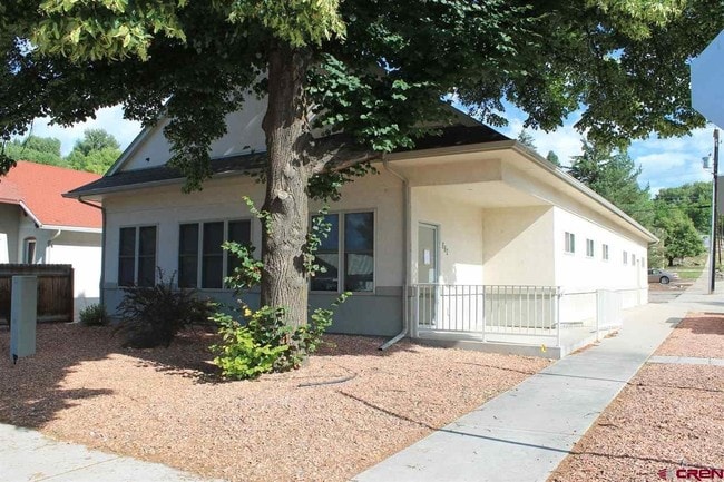
Property Record
310 W Bridge St, Hotchkiss, CO 81419

Property Detail
310 W Bridge St
R007857
310 W BRIDGE ST HOTCHKISS 81419 S: 30 T: 14S R: 92W SUBDIVISION: REICHS SUBDIVISION BLOCK: 3 LOT: 2 TOTAL 0.15 AC+- LOT: 2 BLOCK: 3 REICHS SUBDIVISION SEC 30 T14S R92W 6PM BK 443 PG 854 BK 484 PG 213 BK 484 PG 216 BK 522 PG 764 BK 522 PG 764 THRU 769
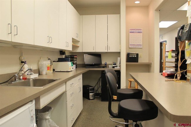
Officebuilding
Delta
B and X Area of moderate flood hazard, usually the area between the limits of the 100-year and 500-year floods.
Colorado
2024
2
2024
0.15 AC
965001
Colorado Southwest Area
2,652 SF
Other Market Areas
NEARBY LISTINGS FOR SALE OR LEASE
DEMOGRAPHICS near 310 W Bridge St
1 mile
3 mile
5 mile
2024 Total Population
1,041
1,978
2,953
2029 Population
1,038
1,985
2,976
Pop Growth 2024-2029
(0.29%)
+ 0.35%
+ 0.78%
Average Age
45
46
46
2024 Total Households
449
850
1,277
HH Growth 2024-2029
(0.45%)
+ 0.24%
+ 0.78%
Median Household Inc
$74,021
$76,934
$77,223
Avg Household Size
2.30
2.30
2.30
2024 Avg HH Vehicles
2.00
2.00
2.00
Median Home Value
$386,666
$399,999
$407,252
Median Year Built
1955
1969
1972
Nearby Places
Map Layers
Map Styles
 Street
 Aerial
Transit
 Traffic
 Biking
Places
Listings with unknown addresses are not visible on the map
- Restaurants
- Banks
- Shops
- Fitness
- Groceries
PUBLIC TRANSPORTATION
AIRPORT
Montrose Regional
Drive
Walk
Distance
Montrose Regional
55 min
38.8 mi
SALE & LEASE HISTORY
LISTING DATE
SALE/LEASE

Jun 02, 2017
For Sale
Nearby Properties
Address
Land Use
TOTAL SIZE
Lot Size
Zoning
Address
Land Use
TOTAL SIZE
Lot Size
Zoning
65,744 SF
15.33 AC
Address
Land Use
TOTAL SIZE
Lot Size
Zoning
54,920 SF
34.90 AC
Address
Land Use
TOTAL SIZE
Lot Size
Zoning
9,120 SF
25.76 AC
Address
Land Use
TOTAL SIZE
Lot Size
Zoning
25,348 SF
1.65 AC
Address
Land Use
TOTAL SIZE
Lot Size
Zoning
10,561 SF
0.28 AC
Address
Land Use
TOTAL SIZE
Lot Size
Zoning
3,386 SF
40.64 AC
Address
Land Use
TOTAL SIZE
Lot Size
Zoning
6,273 SF
0.28 AC
Address
Land Use
TOTAL SIZE
Lot Size
Zoning
8,949 SF
0.67 AC
Address
Land Use
TOTAL SIZE
Lot Size
Zoning
8,476 SF
0.47 AC
Address
Land Use
TOTAL SIZE
Lot Size
Zoning
8,160 SF
12.40 AC
Address
Land Use
TOTAL SIZE
Lot Size
Zoning
5,457 SF
106.54 AC
Address
Land Use
TOTAL SIZE
Lot Size
Zoning
6,098 SF
0.52 AC
Address
Land Use
TOTAL SIZE
Lot Size
Zoning
5,009 SF
0.28 AC
Address
Land Use
TOTAL SIZE
Lot Size
Zoning
3,321 SF
0.56 AC
Address
Land Use
TOTAL SIZE
Lot Size
Zoning
9,000 SF
14.83 AC
Address
Land Use
TOTAL SIZE
Lot Size
Zoning
8,330 SF
0.50 AC
Address
Land Use
TOTAL SIZE
Lot Size
Zoning
5,544 SF
10 AC
Address
Land Use
TOTAL SIZE
Lot Size
Zoning
3,691 SF
1.56 AC
Address
Land Use
TOTAL SIZE
Lot Size
Zoning
1,073 SF
22.92 AC
Address
Land Use
TOTAL SIZE
Lot Size
Zoning
5,440 SF
11.22 AC
Address
Land Use
TOTAL SIZE
Lot Size
Zoning
2,873 SF
0.36 AC
Address
Land Use
TOTAL SIZE
Lot Size
Zoning
2,831 SF
0.36 AC
Address
Land Use
TOTAL SIZE
Lot Size
Zoning
5,322 SF
0.21 AC
Address
Land Use
TOTAL SIZE
Lot Size
Zoning
7,320 SF
0.19 AC
Address
Land Use
TOTAL SIZE
Lot Size
Zoning
6,608 SF
0.68 AC
Address
Land Use
TOTAL SIZE
Lot Size
Zoning
6,552 SF
52.90 AC
Address
Land Use
TOTAL SIZE
Lot Size
Zoning
3,528 SF
105.96 AC
Address
Land Use
TOTAL SIZE
Lot Size
Zoning
3,360 SF
12.41 AC
Address
Land Use
TOTAL SIZE
Lot Size
Zoning
7,449 SF
0.21 AC
Address
Land Use
TOTAL SIZE
Lot Size
Zoning
3,553 SF
1.28 AC
The World's #1 Commercial Real Estate Marketplace
Connect with us
© 2026 CoStar Group
The information above has been obtained from sources believed reliable. While we do not doubt its accuracy we have not verified it and make no guarantee, warranty or representation about it. It is your responsibility to independently confirm its accuracy and completeness. Any projections, opinions, assumptions, or estimates used are for example only and do not represent the current or future performance of the property. The value of this transaction to you depends on tax and other factors which should be evaluated by your tax, financial, and legal advisors. You and your advisors should conduct a careful, independent investigation of the property to determine to your satisfaction the suitability of the property for your needs.