Property Record
310 Weathers Dr, Laredo, TX 78045
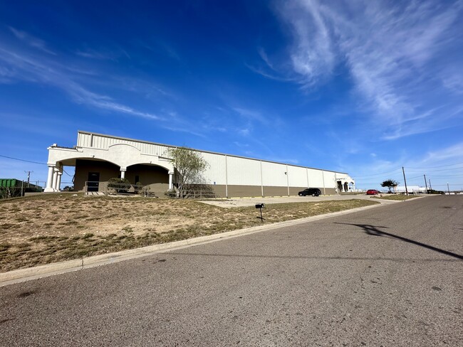

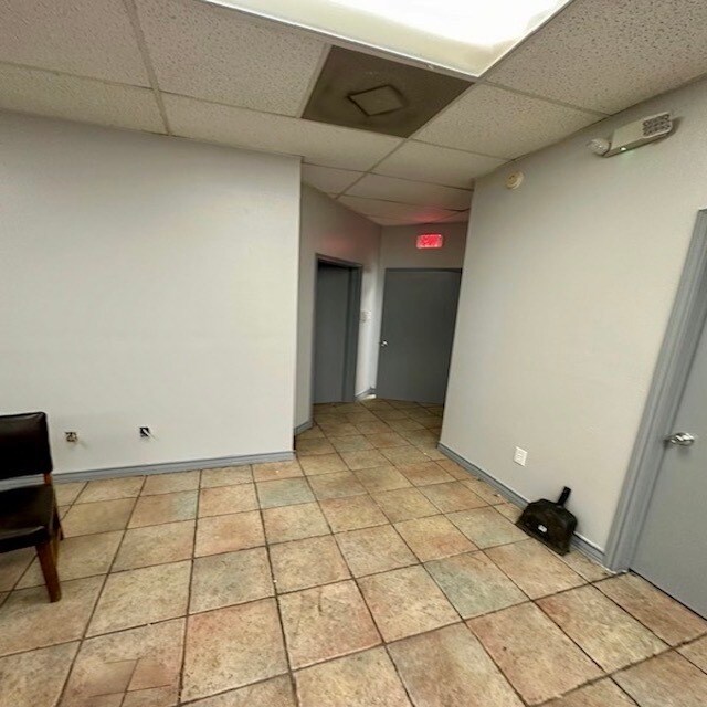
Property Detail
310 Weathers Dr
237240
LOT 6-A BLK 4 PAN AMERICAN BUSINESS PARK III
Commercialnec
Webb
M1
Texas
B and X Area of moderate flood hazard, usually the area between the limits of the 100-year and 500-year floods.
6-a
2024
2.15 AC
2025
Texas South Area
001711
Other Market Areas
27,178 SF
Laredo, TX
NEARBY LISTINGS FOR SALE OR LEASE
DEMOGRAPHICS near 310 Weathers Dr
1 mile
3 mile
5 mile
2025 Total Population
1,952
13,758
38,312
2030 Population
2,016
14,136
39,370
Pop Growth 2025-2030
+ 3.28%
+ 2.75%
+ 2.76%
Average Age
30
31
34
2025 Total Households
528
3,718
11,470
HH Growth 2025-2030
+ 3.60%
+ 2.96%
+ 3.05%
Median Household Inc
$85,652
$80,394
$78,579
Avg Household Size
3.60
3.60
3.30
2025 Avg HH Vehicles
2.00
2.00
2.00
Median Home Value
$240,400
$229,619
$221,658
Median Year Built
2009
2007
2003
Nearby Places
Map Layers
Map Styles
 Street
 Aerial
Transit
 Traffic
 Biking
Places
Listings with unknown addresses are not visible on the map
- Restaurants
- Banks
- Shops
- Fitness
- Groceries
PUBLIC TRANSPORTATION
AIRPORT
Laredo International
Drive
Walk
Distance
Laredo International
21 min
12.8 mi
Freight Ports
Port of Corpus Christi
Drive
Walk
Distance
Port of Corpus Christi
177 min
151.7 mi
SALE & LEASE HISTORY
LISTING DATE
SALE/LEASE

Jan 25, 2024
For Lease
Nearby Properties
Address
Land Use
TOTAL SIZE
Lot Size
Zoning
Address
Land Use
TOTAL SIZE
Lot Size
Zoning
292,914 SF
32.60 AC
Address
Land Use
TOTAL SIZE
Lot Size
Zoning
420,000 SF
25.82 AC
Address
Land Use
TOTAL SIZE
Lot Size
Zoning
410,108 SF
33.18 AC
Address
Land Use
TOTAL SIZE
Lot Size
Zoning
240,880 SF
30 AC
Address
Land Use
TOTAL SIZE
Lot Size
Zoning
48,288 SF
100.18 AC
Address
Land Use
TOTAL SIZE
Lot Size
Zoning
562,944 SF
30 AC
M1
Address
Land Use
TOTAL SIZE
Lot Size
Zoning
521,026 SF
30 AC
M1
Address
Land Use
TOTAL SIZE
Lot Size
Zoning
286,008 SF
37.30 AC
Address
Land Use
TOTAL SIZE
Lot Size
Zoning
342,583 SF
24.65 AC
Address
Land Use
TOTAL SIZE
Lot Size
Zoning
396,990 SF
24.18 AC
Address
Land Use
TOTAL SIZE
Lot Size
Zoning
309,902 SF
25.69 AC
Address
Land Use
TOTAL SIZE
Lot Size
Zoning
398,259 SF
28.88 AC
Address
Land Use
TOTAL SIZE
Lot Size
Zoning
115,076 SF
32.87 AC
Address
Land Use
TOTAL SIZE
Lot Size
Zoning
379,125 SF
23.83 AC
Address
Land Use
TOTAL SIZE
Lot Size
Zoning
257,516 SF
21.94 AC
Address
Land Use
TOTAL SIZE
Lot Size
Zoning
263,842 SF
22.20 AC
Address
Land Use
TOTAL SIZE
Lot Size
Zoning
243,399 SF
15.50 AC
Address
Land Use
TOTAL SIZE
Lot Size
Zoning
66,232 SF
47.65 AC
Address
Land Use
TOTAL SIZE
Lot Size
Zoning
162,013 SF
9.16 AC
B1
Address
Land Use
TOTAL SIZE
Lot Size
Zoning
44,474 SF
50 AC
Address
Land Use
TOTAL SIZE
Lot Size
Zoning
96,665 SF
11.12 AC
R1A
Address
Land Use
TOTAL SIZE
Lot Size
Zoning
253,180 SF
16.56 AC
M1
Address
Land Use
TOTAL SIZE
Lot Size
Zoning
98,998 SF
10.31 AC
B3
Address
Land Use
TOTAL SIZE
Lot Size
Zoning
200,446 SF
25.68 AC
M1
Address
Land Use
TOTAL SIZE
Lot Size
Zoning
204,070 SF
23.63 AC
Address
Land Use
TOTAL SIZE
Lot Size
Zoning
174,928 SF
10 AC
R2
Address
Land Use
TOTAL SIZE
Lot Size
Zoning
253,870 SF
16.05 AC
M1
Address
Land Use
TOTAL SIZE
Lot Size
Zoning
214,698 SF
14.88 AC
M1
Address
Land Use
TOTAL SIZE
Lot Size
Zoning
247,168 SF
15.45 AC
Address
Land Use
TOTAL SIZE
Lot Size
Zoning
148,788 SF
11.59 AC
The World's #1 Commercial Real Estate Marketplace
Connect with us
© 2026 CoStar Group
The information above has been obtained from sources believed reliable. While we do not doubt its accuracy we have not verified it and make no guarantee, warranty or representation about it. It is your responsibility to independently confirm its accuracy and completeness. Any projections, opinions, assumptions, or estimates used are for example only and do not represent the current or future performance of the property. The value of this transaction to you depends on tax and other factors which should be evaluated by your tax, financial, and legal advisors. You and your advisors should conduct a careful, independent investigation of the property to determine to your satisfaction the suitability of the property for your needs.