Property Record
3100 10Th St N, Arlington, VA 22201
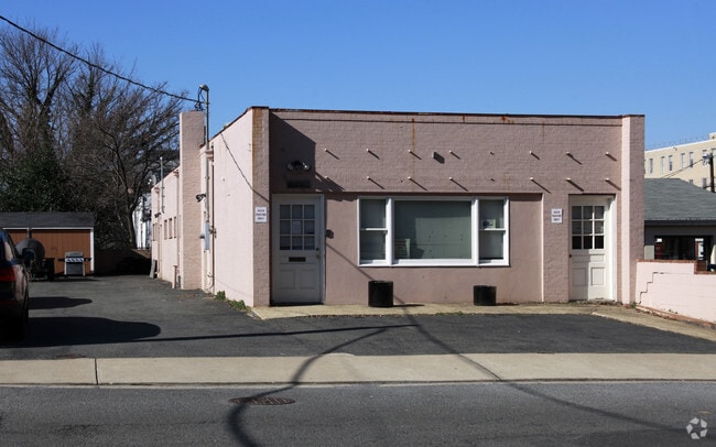


Property Detail
3100 10Th St N
19-007-040
PARCEL A BLK 1 LATTNERS ADD TO CLARENDON 45462 SQ FT
Apartment
ARLINGTON
C-3
Virginia
B and X Area of moderate flood hazard, usually the area between the limits of the 100-year and 500-year floods.
1.04 AC
2025
Virginia Square
2025
Washington, DC
101900
Washington-Arlington-Alexandria, DC-VA-MD-WV
8,354 SF
NEARBY LISTINGS FOR SALE OR LEASE
DEMOGRAPHICS near 3100 10Th St N
1 mile
3 mile
5 mile
2025 Total Population
55,462
272,591
726,782
2030 Population
57,574
282,972
758,567
Pop Growth 2025-2030
+ 3.81%
+ 3.81%
+ 4.37%
Average Age
36
38
38
2025 Total Households
28,592
125,432
345,109
HH Growth 2025-2030
+ 3.97%
+ 4.13%
+ 5.02%
Median Household Inc
$145,863
$133,984
$132,577
Avg Household Size
1.90
2.00
2.00
2025 Avg HH Vehicles
1.00
1.00
1.00
Median Home Value
$833,773
$770,044
$659,239
Median Year Built
1992
1976
1969
Nearby Places
Map Layers
Map Styles
 Street
 Aerial
Layers
 Traffic
 Biking
Places
Listings with unknown addresses are not visible on the map
- Restaurants
- Banks
- Shops
- Fitness
- Groceries
PUBLIC TRANSPORTATION
TRANSIT/SUBWAY
Clarendon (Orange Line - Washington Metropolitan Area Transit Authority Metrorail (Metrorail), Silver Line - Washington Metropolitan Area Transit Authority Metrorail (Metrorail))
Drive
Walk
Distance
Clarendon (Orange Line - Washington Metropolitan Area Transit Authority Metrorail (Metrorail), Silver Line - Washington Metropolitan Area Transit Authority Metrorail (Metrorail))
1 min
4 min
0.2 mi
Virginia Square-GMU (Orange Line - Washington Metropolitan Area Transit Authority Metrorail (Metrorail), Silver Line - Washington Metropolitan Area Transit Authority Metrorail (Metrorail))
Drive
Walk
Distance
Virginia Square-GMU (Orange Line - Washington Metropolitan Area Transit Authority Metrorail (Metrorail), Silver Line - Washington Metropolitan Area Transit Authority Metrorail (Metrorail))
3 min
9 min
0.5 mi
Ballston-MU (Orange Line - Washington Metropolitan Area Transit Authority Metrorail (Metrorail), Silver Line - Washington Metropolitan Area Transit Authority Metrorail (Metrorail))
Drive
Walk
Distance
Ballston-MU (Orange Line - Washington Metropolitan Area Transit Authority Metrorail (Metrorail), Silver Line - Washington Metropolitan Area Transit Authority Metrorail (Metrorail))
4 min
18 min
0.9 mi
COMMUTER RAIL
Drive
Walk
Distance
10 min
4.7 mi
Union Station (Red Line - Washington Metropolitan Area Transit Authority Metrorail (Metrorail))
Drive
Walk
Distance
Union Station (Red Line - Washington Metropolitan Area Transit Authority Metrorail (Metrorail))
13 min
6.0 mi
AIRPORT
Ronald Reagan Washington Ntl
Drive
Walk
Distance
Ronald Reagan Washington Ntl
12 min
5.0 mi
Washington Dulles International
Drive
Walk
Distance
Washington Dulles International
39 min
24.1 mi
Baltimore/Washington International Thurgood Marshall
Drive
Walk
Distance
Baltimore/Washington International Thurgood Marshall
57 min
36.1 mi
Freight Ports
Port of Baltimore
Drive
Walk
Distance
Port of Baltimore
63 min
43.4 mi
Nearby Properties
Address
Land Use
TOTAL SIZE
Lot Size
Zoning
Address
Land Use
TOTAL SIZE
Lot Size
Zoning
6,500,000 SF
92.03 AC
S-3A
Address
Land Use
TOTAL SIZE
Lot Size
Zoning
2,455,000 SF
11.08 AC
MU-2
Address
Land Use
TOTAL SIZE
Lot Size
Zoning
1.57 AC
D-5
Address
Land Use
TOTAL SIZE
Lot Size
Zoning
469,183 SF
1.20 AC
D-5
Address
Land Use
TOTAL SIZE
Lot Size
Zoning
900,000 SF
260 AC
S-3A
Address
Land Use
TOTAL SIZE
Lot Size
Zoning
900,000 SF
12.60 AC
RA-4
Address
Land Use
TOTAL SIZE
Lot Size
Zoning
77.26 AC
R-3/GT
Address
Land Use
TOTAL SIZE
Lot Size
Zoning
636,768 SF
1.91 AC
C-O-ROSSLY
Address
Land Use
TOTAL SIZE
Lot Size
Zoning
508,547 SF
4.58 AC
C-O-2.5
Address
Land Use
TOTAL SIZE
Lot Size
Zoning
293,674 SF
13.45 AC
C-O-2.5
Address
Land Use
TOTAL SIZE
Lot Size
Zoning
40,891 SF
2.39 AC
C-O-2.5/C-
Address
Land Use
TOTAL SIZE
Lot Size
Zoning
776,520 SF
1.49 AC
MU-9B
Address
Land Use
TOTAL SIZE
Lot Size
Zoning
1,365,427 SF
2.62 AC
MU-9B;RA-4
Address
Land Use
TOTAL SIZE
Lot Size
Zoning
499,000 SF
1.49 AC
RA-4
Address
Land Use
TOTAL SIZE
Lot Size
Zoning
400,000 SF
1.30 AC
RA-4
Address
Land Use
TOTAL SIZE
Lot Size
Zoning
20.19 AC
S-3A/S-D
Address
Land Use
TOTAL SIZE
Lot Size
Zoning
482,000 SF
1.17 AC
MU-9B;RA-4
Address
Land Use
TOTAL SIZE
Lot Size
Zoning
45,523 SF
0.24 AC
C-O-ROSSLY
Address
Land Use
TOTAL SIZE
Lot Size
Zoning
62,298 SF
2.58 AC
R-5
Address
Land Use
TOTAL SIZE
Lot Size
Zoning
1,882 SF
0.97 AC
C-O-A
Address
Land Use
TOTAL SIZE
Lot Size
Zoning
4.67 AC
MU-13;MU-1
Address
Land Use
TOTAL SIZE
Lot Size
Zoning
20,513 SF
0.82 AC
C-O
Address
Land Use
TOTAL SIZE
Lot Size
Zoning
580,759 SF
0.69 AC
C-O/C-O-RO
Address
Land Use
TOTAL SIZE
Lot Size
Zoning
633,810 SF
3.45 AC
RA-H-3.2
Address
Land Use
TOTAL SIZE
Lot Size
Zoning
591,243 SF
1.90 AC
RA-H-3.2
Address
Land Use
TOTAL SIZE
Lot Size
Zoning
986,000 SF
2.30 AC
C-O-A
Address
Land Use
TOTAL SIZE
Lot Size
Zoning
977,839 SF
1.25 AC
D-6
The World's #1 Commercial Real Estate Marketplace
Connect with us
© 2026 CoStar Group
The information above has been obtained from sources believed reliable. While we do not doubt its accuracy we have not verified it and make no guarantee, warranty or representation about it. It is your responsibility to independently confirm its accuracy and completeness. Any projections, opinions, assumptions, or estimates used are for example only and do not represent the current or future performance of the property. The value of this transaction to you depends on tax and other factors which should be evaluated by your tax, financial, and legal advisors. You and your advisors should conduct a careful, independent investigation of the property to determine to your satisfaction the suitability of the property for your needs.