Property Record
3100 86Th St, Sturtevant, WI 53177


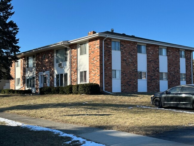
Property Detail
3100 86Th St
Racine-Mount Pleasant, WI
WIESE'S WESTMINSTER HEIGHTS NO 2 LOT 1 BLK 12
181-032227221000
Racine
Commercialnec
Wisconsin
005
1
B and X Area of moderate flood hazard, usually the area between the limits of the 100-year and 500-year floods.
0.50 AC
2025
Sturtevant Village
2025
Milwaukee/Madison
001702
NEARBY LISTINGS FOR SALE OR LEASE
-
-
View all Sturtevant listings for sale on LoopNet.com
DEMOGRAPHICS near 3100 86Th St
1 mile
3 mile
5 mile
2025 Total Population
5,779
26,327
87,264
2030 Population
5,833
26,688
87,827
Pop Growth 2025-2030
+ 0.93%
+ 1.37%
+ 0.65%
Average Age
40
43
41
2025 Total Households
1,924
10,577
35,204
HH Growth 2025-2030
+ 1.04%
+ 1.38%
+ 0.61%
Median Household Inc
$91,425
$74,860
$73,443
Avg Household Size
2.50
2.20
2.30
2025 Avg HH Vehicles
2.00
2.00
2.00
Median Home Value
$254,799
$246,492
$227,335
Median Year Built
1975
1978
1970
Nearby Places
Map Layers
Map Styles
 Street
 Aerial
Layers
 Traffic
 Biking
Places
Listings with unknown addresses are not visible on the map
- Restaurants
- Banks
- Shops
- Fitness
- Groceries
PUBLIC TRANSPORTATION
COMMUTER RAIL
Drive
Walk
Distance
8 min
3.1 mi
AIRPORT
General Mitchell International
Drive
Walk
Distance
General Mitchell International
31 min
22.8 mi
Freight Ports
Port Milwaukee
Drive
Walk
Distance
Port Milwaukee
36 min
26.7 mi
SALE & LEASE HISTORY
LISTING DATE
SALE/LEASE

Sep 09, 2025
For Sale
Nearby Properties
Address
Land Use
TOTAL SIZE
Lot Size
Zoning
Address
Land Use
TOTAL SIZE
Lot Size
Zoning
318.64 AC
Address
Land Use
TOTAL SIZE
Lot Size
Zoning
241.29 AC
Address
Land Use
TOTAL SIZE
Lot Size
Zoning
22.34 AC
Address
Land Use
TOTAL SIZE
Lot Size
Zoning
9.31 AC
Address
Land Use
TOTAL SIZE
Lot Size
Zoning
Address
Land Use
TOTAL SIZE
Lot Size
Zoning
32.55 AC
Address
Land Use
TOTAL SIZE
Lot Size
Zoning
23.10 AC
Address
Land Use
TOTAL SIZE
Lot Size
Zoning
47.01 AC
M-1
Address
Land Use
TOTAL SIZE
Lot Size
Zoning
9.40 AC
B-3
Address
Land Use
TOTAL SIZE
Lot Size
Zoning
37.55 AC
Address
Land Use
TOTAL SIZE
Lot Size
Zoning
26.79 AC
Address
Land Use
TOTAL SIZE
Lot Size
Zoning
23.21 AC
Address
Land Use
TOTAL SIZE
Lot Size
Zoning
57.80 AC
M1
Address
Land Use
TOTAL SIZE
Lot Size
Zoning
20.61 AC
Address
Land Use
TOTAL SIZE
Lot Size
Zoning
30.45 AC
002
Address
Land Use
TOTAL SIZE
Lot Size
Zoning
Address
Land Use
TOTAL SIZE
Lot Size
Zoning
Address
Land Use
TOTAL SIZE
Lot Size
Zoning
Address
Land Use
TOTAL SIZE
Lot Size
Zoning
19.33 AC
002
Address
Land Use
TOTAL SIZE
Lot Size
Zoning
18.33 AC
Address
Land Use
TOTAL SIZE
Lot Size
Zoning
32.99 AC
002
Address
Land Use
TOTAL SIZE
Lot Size
Zoning
Address
Land Use
TOTAL SIZE
Lot Size
Zoning
Address
Land Use
TOTAL SIZE
Lot Size
Zoning
Address
Land Use
TOTAL SIZE
Lot Size
Zoning
5.74 AC
Address
Land Use
TOTAL SIZE
Lot Size
Zoning
16.91 AC
Address
Land Use
TOTAL SIZE
Lot Size
Zoning
22.98 AC
M-1
Address
Land Use
TOTAL SIZE
Lot Size
Zoning
16.97 AC
Address
Land Use
TOTAL SIZE
Lot Size
Zoning
19.77 AC
B-3
Address
Land Use
TOTAL SIZE
Lot Size
Zoning
71.23 AC
The World's #1 Commercial Real Estate Marketplace
Connect with us
© 2026 CoStar Group
The information above has been obtained from sources believed reliable. While we do not doubt its accuracy we have not verified it and make no guarantee, warranty or representation about it. It is your responsibility to independently confirm its accuracy and completeness. Any projections, opinions, assumptions, or estimates used are for example only and do not represent the current or future performance of the property. The value of this transaction to you depends on tax and other factors which should be evaluated by your tax, financial, and legal advisors. You and your advisors should conduct a careful, independent investigation of the property to determine to your satisfaction the suitability of the property for your needs.