Property Record
3100 Bell Oaks Cir, Montgomery, AL 36116
NEARBY LISTINGS FOR SALE OR LEASE
-
-
View all Montgomery listings for sale on LoopNet.com
Property Detail
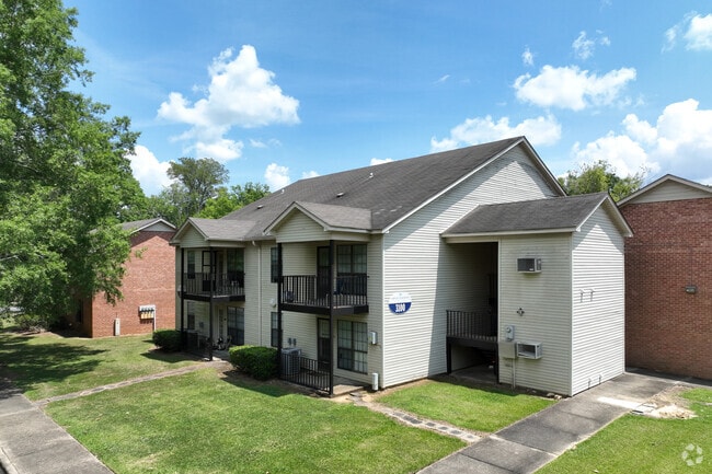
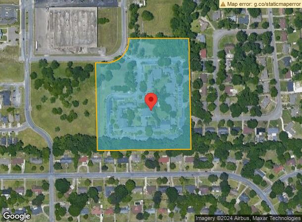
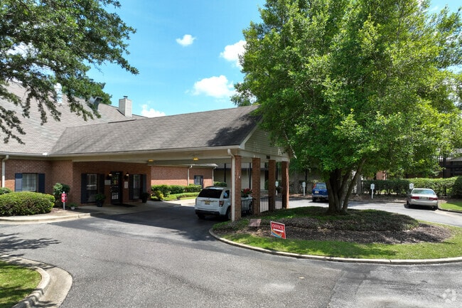
3100 Bell Oaks Cir
Montgomery, AL
Bell Oaks Plat 1
10-08-33-1-005-010.000
1008331005010000
Realpropertynec
Montgomery
X
Alabama
01101C0209H
1
2025
10 AC
2025
Outer South/Airport
002902
Montgomery
14,765 SF
DEMOGRAPHICS near 3100 Bell Oaks Cir
1 Mile
3 Mile
5 Mile
2024 Total Population
9,679
61,985
124,536
2029 Population
9,447
60,198
122,009
Pop Growth 2024-2029
(2.40%)
(2.88%)
(2.03%)
Average Age
38
37
38
2024 Total Households
4,071
25,680
52,483
HH Growth 2024-2029
(2.38%)
(2.98%)
(2.04%)
Median Household Inc
$35,032
$43,654
$43,034
Avg Household Size
2.30
2.30
2.20
2024 Avg HH Vehicles
2.00
2.00
2.00
Median Home Value
$117,200
$139,668
$136,364
Median Year Built
1974
1976
1974
Nearby Places
Map Layers
Map Styles
 Street
 Aerial
- Restaurants
- Banks
- Shops
- Fitness
- Groceries
PUBLIC TRANSPORTATION
AIRPORT
Montgomery Regional (Dannelly Field)
DRIVE
WALK
Distance
Montgomery Regional (Dannelly Field)
13 min
9.7 mi
Freight Ports
Port of Panama City
DRIVE
WALK
Distance
Port of Panama City
230 min
183.2 mi
SALE & LEASE HISTORY
LISTING DATE
SALE/LEASE

Oct 07, 2021
For Sale
Nearby Properties
Address
Land Use
TOTAL SIZE
Lot Size
Zoning
Address
Land Use
TOTAL SIZE
Lot Size
Zoning
260,402 SF
17 AC
O-2
Address
Land Use
TOTAL SIZE
Lot Size
Zoning
1,343 SF
31.75 AC
R-65-M
Address
Land Use
TOTAL SIZE
Lot Size
Zoning
4,836 SF
16.25 AC
R-75-M
Address
Land Use
TOTAL SIZE
Lot Size
Zoning
40,829 SF
50.49 AC
SD
Address
Land Use
TOTAL SIZE
Lot Size
Zoning
15,932 SF
25.50 AC
R-60-M
Address
Land Use
TOTAL SIZE
Lot Size
Zoning
1,554 SF
18.26 AC
R-75-M
Address
Land Use
TOTAL SIZE
Lot Size
Zoning
10,317 SF
16.70 AC
AGR-1
Address
Land Use
TOTAL SIZE
Lot Size
Zoning
164,528 SF
5.28 AC
B-3
Address
Land Use
TOTAL SIZE
Lot Size
Zoning
32,902 SF
14 AC
R-75-M
Address
Land Use
TOTAL SIZE
Lot Size
Zoning
8,519 SF
15.60 AC
B-2
Address
Land Use
TOTAL SIZE
Lot Size
Zoning
341,170 SF
O-2
Address
Land Use
TOTAL SIZE
Lot Size
Zoning
208,584 SF
21.10 AC
B-3
Address
Land Use
TOTAL SIZE
Lot Size
Zoning
84,764 SF
5.20 AC
B-2
Address
Land Use
TOTAL SIZE
Lot Size
Zoning
21,634 SF
6.64 AC
Address
Land Use
TOTAL SIZE
Lot Size
Zoning
105,816 SF
4.34 AC
B-2
Address
Land Use
TOTAL SIZE
Lot Size
Zoning
154,711 SF
31 AC
Address
Land Use
TOTAL SIZE
Lot Size
Zoning
14,733 SF
19 AC
O-2
Address
Land Use
TOTAL SIZE
Lot Size
Zoning
3,312 SF
15.73 AC
R-65-M
Address
Land Use
TOTAL SIZE
Lot Size
Zoning
249,231 SF
20 AC
INST
Address
Land Use
TOTAL SIZE
Lot Size
Zoning
135,573 SF
35 AC
O-2
Address
Land Use
TOTAL SIZE
Lot Size
Zoning
1,721 SF
12.02 AC
R-60-M
Address
Land Use
TOTAL SIZE
Lot Size
Zoning
14,409 SF
16.01 AC
B-3
Address
Land Use
TOTAL SIZE
Lot Size
Zoning
8,697 SF
21.84 AC
R-20-T
Address
Land Use
TOTAL SIZE
Lot Size
Zoning
94,781 SF
4.43 AC
B-2
Address
Land Use
TOTAL SIZE
Lot Size
Zoning
2,164 SF
7.50 AC
R-60-A
Address
Land Use
TOTAL SIZE
Lot Size
Zoning
38,718 SF
13.72 AC
B-3
Address
Land Use
TOTAL SIZE
Lot Size
Zoning
1,904 SF
13 AC
R-75-S
Address
Land Use
TOTAL SIZE
Lot Size
Zoning
2,397 SF
4.35 AC
R-75-M
Address
Land Use
TOTAL SIZE
Lot Size
Zoning
113,108 SF
3.70 AC
B-3
Address
Land Use
TOTAL SIZE
Lot Size
Zoning
3,458 SF
15.34 AC
R-65-M
The World's #1 Commercial Real Estate Marketplace
Connect with us
© 2026 CoStar Group
The information above has been obtained from sources believed reliable. While we do not doubt its accuracy we have not verified it and make no guarantee, warranty or representation about it. It is your responsibility to independently confirm its accuracy and completeness. Any projections, opinions, assumptions, or estimates used are for example only and do not represent the current or future performance of the property. The value of this transaction to you depends on tax and other factors which should be evaluated by your tax, financial, and legal advisors. You and your advisors should conduct a careful, independent investigation of the property to determine to your satisfaction the suitability of the property for your needs.