Property Record
3100 Cooper Rd, Westerville, OH 43081
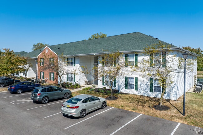


Property Detail
3100 Cooper Rd
Columbus, OH
COOPER RD R17 T2 1-4T 2 21.177 ACRES 2-3
010-213829
FRANKLIN
Apartment
Ohio
AE The base floodplain where base flood elevations are provided. AE Zones are now used on new format FIRMs instead of A1-A30 Zones.
2
2024
20.72 AC
2025
Northern Woods
007101
Columbus
30,383 SF
NEARBY LISTINGS FOR SALE OR LEASE
-
-
View all Westerville listings for sale on LoopNet.com
DEMOGRAPHICS near 3100 Cooper Rd
1 mile
3 mile
5 mile
2025 Total Population
14,563
123,483
293,854
2030 Population
14,891
126,137
303,018
Pop Growth 2025-2030
+ 2.25%
+ 2.15%
+ 3.12%
Average Age
37
37
38
2025 Total Households
5,921
47,564
120,174
HH Growth 2025-2030
+ 2.58%
+ 2.32%
+ 3.29%
Median Household Inc
$67,095
$66,768
$75,079
Avg Household Size
2.40
2.50
2.40
2025 Avg HH Vehicles
2.00
2.00
2.00
Median Home Value
$259,845
$270,656
$299,126
Median Year Built
1976
1975
1980
Nearby Places
Map Layers
Map Styles
 Street
 Aerial
Layers
 Traffic
 Biking
Places
Listings with unknown addresses are not visible on the map
- Restaurants
- Banks
- Shops
- Fitness
- Groceries
PUBLIC TRANSPORTATION
AIRPORT
John Glenn Columbus International
Drive
Walk
Distance
John Glenn Columbus International
17 min
10.0 mi
Rickenbacker International
Drive
Walk
Distance
Rickenbacker International
35 min
25.9 mi
Freight Ports
Port of Toledo
Drive
Walk
Distance
Port of Toledo
176 min
138.9 mi
Nearby Properties
Address
Land Use
TOTAL SIZE
Lot Size
Zoning
Address
Land Use
TOTAL SIZE
Lot Size
Zoning
2,299,970 SF
60.76 AC
Address
Land Use
TOTAL SIZE
Lot Size
Zoning
440,828 SF
13.72 AC
Address
Land Use
TOTAL SIZE
Lot Size
Zoning
529,035 SF
37.56 AC
Address
Land Use
TOTAL SIZE
Lot Size
Zoning
426,490 SF
19.43 AC
Address
Land Use
TOTAL SIZE
Lot Size
Zoning
516,485 SF
50.03 AC
Address
Land Use
TOTAL SIZE
Lot Size
Zoning
697,077 SF
40.91 AC
Address
Land Use
TOTAL SIZE
Lot Size
Zoning
159,315 SF
13.25 AC
Address
Land Use
TOTAL SIZE
Lot Size
Zoning
165,944 SF
14.21 AC
Address
Land Use
TOTAL SIZE
Lot Size
Zoning
3,263 SF
989.66 AC
Address
Land Use
TOTAL SIZE
Lot Size
Zoning
152,684 SF
20.94 AC
Address
Land Use
TOTAL SIZE
Lot Size
Zoning
201,072 SF
22.28 AC
Address
Land Use
TOTAL SIZE
Lot Size
Zoning
292,377 SF
36.29 AC
Address
Land Use
TOTAL SIZE
Lot Size
Zoning
500,376 SF
3 AC
Address
Land Use
TOTAL SIZE
Lot Size
Zoning
170,259 SF
16.30 AC
Address
Land Use
TOTAL SIZE
Lot Size
Zoning
194,750 SF
13.53 AC
Address
Land Use
TOTAL SIZE
Lot Size
Zoning
150,718 SF
4.35 AC
Address
Land Use
TOTAL SIZE
Lot Size
Zoning
236,681 SF
7.83 AC
Address
Land Use
TOTAL SIZE
Lot Size
Zoning
135,898 SF
0.78 AC
Address
Land Use
TOTAL SIZE
Lot Size
Zoning
112,288 SF
1.12 AC
Address
Land Use
TOTAL SIZE
Lot Size
Zoning
142,998 SF
30.25 AC
Address
Land Use
TOTAL SIZE
Lot Size
Zoning
184,756 SF
23.53 AC
Address
Land Use
TOTAL SIZE
Lot Size
Zoning
358,807 SF
1.77 AC
Address
Land Use
TOTAL SIZE
Lot Size
Zoning
85,854 SF
1.13 AC
Address
Land Use
TOTAL SIZE
Lot Size
Zoning
353,528 SF
1.28 AC
Address
Land Use
TOTAL SIZE
Lot Size
Zoning
172,848 SF
5.34 AC
Address
Land Use
TOTAL SIZE
Lot Size
Zoning
122,920 SF
20.30 AC
Address
Land Use
TOTAL SIZE
Lot Size
Zoning
362,014 SF
37.08 AC
Address
Land Use
TOTAL SIZE
Lot Size
Zoning
85,228 SF
45.03 AC
Address
Land Use
TOTAL SIZE
Lot Size
Zoning
42,108 SF
27.10 AC
The World's #1 Commercial Real Estate Marketplace
Connect with us
© 2026 CoStar Group
The information above has been obtained from sources believed reliable. While we do not doubt its accuracy we have not verified it and make no guarantee, warranty or representation about it. It is your responsibility to independently confirm its accuracy and completeness. Any projections, opinions, assumptions, or estimates used are for example only and do not represent the current or future performance of the property. The value of this transaction to you depends on tax and other factors which should be evaluated by your tax, financial, and legal advisors. You and your advisors should conduct a careful, independent investigation of the property to determine to your satisfaction the suitability of the property for your needs.