Property Record
3100 Macon Dr, Sacramento, CA 95835


NEARBY LISTINGS FOR SALE OR LEASE
Property Detail
3100 Macon Dr
Sacramento
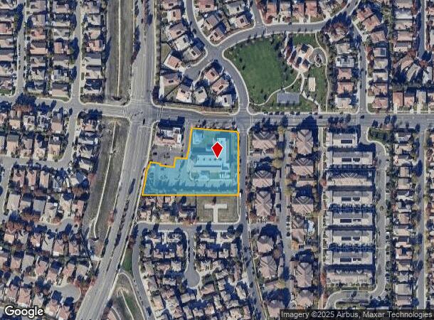
Parcel Map Of Macon Centre
Sacramento--Roseville--Arden-Arcade, CA
PARCEL MAP OF MACON CENTRE, LOT 2
201-1280-002
Sacramento
Daycare
California
2024
2
2025
1.97 AC
007111
Natomas
15,413 SF
DEMOGRAPHICS near 3100 Macon Dr
1 Mile
3 Mile
5 Mile
2024 Total Population
15,408
64,253
138,089
2029 Population
15,715
65,186
139,538
Pop Growth 2024-2029
+ 1.99%
+ 1.45%
+ 1.05%
Average Age
39
37
37
2024 Total Households
5,118
22,933
47,701
HH Growth 2024-2029
+ 1.84%
+ 1.46%
+ 1.04%
Median Household Inc
$125,543
$108,551
$94,117
Avg Household Size
3.00
2.80
2.80
2024 Avg HH Vehicles
2.00
2.00
2.00
Median Home Value
$564,543
$493,321
$465,899
Median Year Built
2005
2005
2000
Nearby Places
Map Layers
Map Styles
 Street
 Aerial
- Restaurants
- Banks
- Shops
- Fitness
- Groceries
PUBLIC TRANSPORTATION
COMMUTER RAIL
Sacramento (Capitol Corridor - Capitol Corridor Joint Powers Authority)
DRIVE
WALK
Distance
Sacramento (Capitol Corridor - Capitol Corridor Joint Powers Authority)
12 min
9.0 mi
AIRPORT
Sacramento International
DRIVE
WALK
Distance
Sacramento International
11 min
6.5 mi
Freight Ports
Port of Stockton
DRIVE
WALK
Distance
Port of Stockton
63 min
54.9 mi
Nearby Properties
Address
Land Use
TOTAL SIZE
Lot Size
Zoning
Address
Land Use
TOTAL SIZE
Lot Size
Zoning
805,506 SF
68.27 AC
SPA
Address
Land Use
TOTAL SIZE
Lot Size
Zoning
1,134,362 SF
132.79 AC
SPA
Address
Land Use
TOTAL SIZE
Lot Size
Zoning
363,761 SF
10.34 AC
SC-PUD
Address
Land Use
TOTAL SIZE
Lot Size
Zoning
522,025 SF
65.80 AC
SC-PUD EC-
Address
Land Use
TOTAL SIZE
Lot Size
Zoning
Address
Land Use
TOTAL SIZE
Lot Size
Zoning
153,090 SF
7.77 AC
MP
Address
Land Use
TOTAL SIZE
Lot Size
Zoning
343,500 SF
12.68 AC
R-2B-R-PUD
Address
Land Use
TOTAL SIZE
Lot Size
Zoning
100.41 AC
C-2-PUD
Address
Land Use
TOTAL SIZE
Lot Size
Zoning
31.76 AC
SPA
Address
Land Use
TOTAL SIZE
Lot Size
Zoning
30.44 AC
SPA
Address
Land Use
TOTAL SIZE
Lot Size
Zoning
241,321 SF
14.43 AC
R-3-PUD
Address
Land Use
TOTAL SIZE
Lot Size
Zoning
30.39 AC
SPA
Address
Land Use
TOTAL SIZE
Lot Size
Zoning
388,609 SF
14.67 AC
R-3-PUD
Address
Land Use
TOTAL SIZE
Lot Size
Zoning
17.55 AC
SPA
Address
Land Use
TOTAL SIZE
Lot Size
Zoning
429,346 SF
18.88 AC
R-2B-PUD E
Address
Land Use
TOTAL SIZE
Lot Size
Zoning
131.26 AC
SPA
Address
Land Use
TOTAL SIZE
Lot Size
Zoning
298,493 SF
18.56 AC
EC-40-PUD
Address
Land Use
TOTAL SIZE
Lot Size
Zoning
195,928 SF
8.62 AC
EC-40-PUD
Address
Land Use
TOTAL SIZE
Lot Size
Zoning
19.68 AC
SPA
Address
Land Use
TOTAL SIZE
Lot Size
Zoning
164,061 SF
8.15 AC
R-3-PUD
Address
Land Use
TOTAL SIZE
Lot Size
Zoning
282,292 SF
14.42 AC
R-3-PUD
Address
Land Use
TOTAL SIZE
Lot Size
Zoning
Address
Land Use
TOTAL SIZE
Lot Size
Zoning
6.23 AC
EC-50-PUD
Address
Land Use
TOTAL SIZE
Lot Size
Zoning
9.01 AC
EC-80-PUD
Address
Land Use
TOTAL SIZE
Lot Size
Zoning
4.29 AC
EC-50-PUD
Address
Land Use
TOTAL SIZE
Lot Size
Zoning
217,682 SF
9.57 AC
R-3-PUD
Address
Land Use
TOTAL SIZE
Lot Size
Zoning
209,376 SF
9.14 AC
MP M-1
Address
Land Use
TOTAL SIZE
Lot Size
Zoning
13.90 AC
SC-PUD
Address
Land Use
TOTAL SIZE
Lot Size
Zoning
1,784 SF
15.07 AC
M-1
Address
Land Use
TOTAL SIZE
Lot Size
Zoning
222,792 SF
12.50 AC
MP
The World's #1 Commercial Real Estate Marketplace
Connect with us
© 2025 CoStar Group
The information above has been obtained from sources believed reliable. While we do not doubt its accuracy we have not verified it and make no guarantee, warranty or representation about it. It is your responsibility to independently confirm its accuracy and completeness. Any projections, opinions, assumptions, or estimates used are for example only and do not represent the current or future performance of the property. The value of this transaction to you depends on tax and other factors which should be evaluated by your tax, financial, and legal advisors. You and your advisors should conduct a careful, independent investigation of the property to determine to your satisfaction the suitability of the property for your needs.