Property Record
3100 N Elm St, Greensboro, NC 27408
NEARBY LISTINGS FOR SALE OR LEASE
Property Detail
3100 N Elm St
Greensboro-High Point, NC
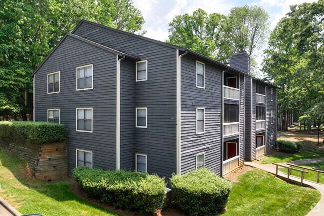
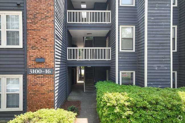
Paces Village Apts
0067370
PACES VILLAGE APTS/N. ELM ST LO:2 PL:86-1
Apartment
Guilford
X
North Carolina
3710786600J
2
2024
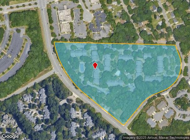
15.45 AC
2025
New Irving Park
012703
Greensboro/Winston-Salem
168,798 SF
DEMOGRAPHICS near 3100 N Elm St
1 Mile
3 Mile
5 Mile
2024 Total Population
8,619
72,829
175,931
2029 Population
8,547
72,597
175,977
Pop Growth 2024-2029
(0.84%)
(0.32%)
+ 0.03%
Average Age
41
40
38
2024 Total Households
3,761
31,529
69,279
HH Growth 2024-2029
(0.88%)
(0.35%)
+ 0.06%
Median Household Inc
$57,834
$58,668
$55,660
Avg Household Size
2.20
2.20
2.20
2024 Avg HH Vehicles
2.00
2.00
2.00
Median Home Value
$373,255
$200,196
$218,944
Median Year Built
1986
1978
1979
Nearby Places
Map Layers
Map Styles
 Street
 Aerial
- Restaurants
- Banks
- Shops
- Fitness
- Groceries
PUBLIC TRANSPORTATION
COMMUTER RAIL
Greensboro Station (Piedmont - North Carolina by Train (NC Train))
DRIVE
WALK
Distance
Greensboro Station (Piedmont - North Carolina by Train (NC Train))
7 min
3.7 mi
AIRPORT
Piedmont Triad International
DRIVE
WALK
Distance
Piedmont Triad International
21 min
12.1 mi
Freight Ports
Virginia Port Authority - Richmond
DRIVE
WALK
Distance
Virginia Port Authority - Richmond
233 min
202.7 mi
Nearby Properties
Address
Land Use
TOTAL SIZE
Lot Size
Zoning
Address
Land Use
TOTAL SIZE
Lot Size
Zoning
908,421 SF
62.30 AC
PI
Address
Land Use
TOTAL SIZE
Lot Size
Zoning
646,229 SF
25.47 AC
LI
Address
Land Use
TOTAL SIZE
Lot Size
Zoning
413,840 SF
3.68 AC
PI
Address
Land Use
TOTAL SIZE
Lot Size
Zoning
106,706 SF
343.57 AC
PI
Address
Land Use
TOTAL SIZE
Lot Size
Zoning
227,063 SF
6.65 AC
C-H
Address
Land Use
TOTAL SIZE
Lot Size
Zoning
223,891 SF
10.53 AC
PUD
Address
Land Use
TOTAL SIZE
Lot Size
Zoning
281,337 SF
20.64 AC
PUD
Address
Land Use
TOTAL SIZE
Lot Size
Zoning
222,661 SF
51.39 AC
R-3
Address
Land Use
TOTAL SIZE
Lot Size
Zoning
347,338 SF
130.48 AC
PI
Address
Land Use
TOTAL SIZE
Lot Size
Zoning
252,109 SF
8.83 AC
PUD
Address
Land Use
TOTAL SIZE
Lot Size
Zoning
336,133 SF
23.93 AC
CU-RM-12
Address
Land Use
TOTAL SIZE
Lot Size
Zoning
176,355 SF
4.25 AC
CB
Address
Land Use
TOTAL SIZE
Lot Size
Zoning
171,358 SF
11.91 AC
PUD
Address
Land Use
TOTAL SIZE
Lot Size
Zoning
223,272 SF
9.91 AC
RM-26
Address
Land Use
TOTAL SIZE
Lot Size
Zoning
302,048 SF
24.45 AC
RM-12
Address
Land Use
TOTAL SIZE
Lot Size
Zoning
61,400 SF
4.11 AC
O
Address
Land Use
TOTAL SIZE
Lot Size
Zoning
120,204 SF
9.82 AC
C-H
Address
Land Use
TOTAL SIZE
Lot Size
Zoning
112,050 SF
9.24 AC
LI
Address
Land Use
TOTAL SIZE
Lot Size
Zoning
138,773 SF
13.90 AC
C-H
Address
Land Use
TOTAL SIZE
Lot Size
Zoning
206,820 SF
14.59 AC
C-H
Address
Land Use
TOTAL SIZE
Lot Size
Zoning
133,444 SF
4.09 AC
PI
Address
Land Use
TOTAL SIZE
Lot Size
Zoning
106,176 SF
5.51 AC
C-H
Address
Land Use
TOTAL SIZE
Lot Size
Zoning
115,794 SF
5.25 AC
BP
Address
Land Use
TOTAL SIZE
Lot Size
Zoning
194,064 SF
22.83 AC
RM-12
Address
Land Use
TOTAL SIZE
Lot Size
Zoning
139,624 SF
8.92 AC
BP
Address
Land Use
TOTAL SIZE
Lot Size
Zoning
149,389 SF
7.69 AC
BP
Address
Land Use
TOTAL SIZE
Lot Size
Zoning
316,644 SF
22.31 AC
RM-12
Address
Land Use
TOTAL SIZE
Lot Size
Zoning
126,750 SF
6.62 AC
BP
Address
Land Use
TOTAL SIZE
Lot Size
Zoning
68,100 SF
97.08 AC
R-3
Address
Land Use
TOTAL SIZE
Lot Size
Zoning
270,848 SF
18.28 AC
RM-18
The World's #1 Commercial Real Estate Marketplace
Connect with us
© 2025 CoStar Group
The information above has been obtained from sources believed reliable. While we do not doubt its accuracy we have not verified it and make no guarantee, warranty or representation about it. It is your responsibility to independently confirm its accuracy and completeness. Any projections, opinions, assumptions, or estimates used are for example only and do not represent the current or future performance of the property. The value of this transaction to you depends on tax and other factors which should be evaluated by your tax, financial, and legal advisors. You and your advisors should conduct a careful, independent investigation of the property to determine to your satisfaction the suitability of the property for your needs.