Property Record
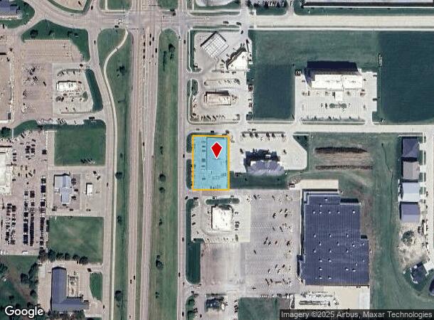
3100 Osborne Dr E, Hastings, NE 68901

NEARBY LISTINGS FOR SALE OR LEASE
Property Detail
3100 Osborne Dr E
Hastings, NE
Walmart Subdiv Pt Fr S1/2 31-8-9
284-16457.83
1635.20-LOT 3 WAL-MART SUB-DIV - - .77 AC; MAP NUMBER: 3663-31-0-1635.20-000-0003
Restaurantbuilding
Adams
X
Nebraska
31001C0157C
3
2024
0.77 AC
2025
Nebraska Area
965500
Other Market Areas
9,840 SF
DEMOGRAPHICS near 3100 Osborne Dr E
1 Mile
3 Mile
5 Mile
2024 Total Population
1,489
23,293
26,213
2029 Population
1,510
23,233
26,147
Pop Growth 2024-2029
+ 1.41%
(0.26%)
(0.25%)
Average Age
40
39
39
2024 Total Households
557
9,596
10,794
HH Growth 2024-2029
+ 1.26%
(0.29%)
(0.28%)
Median Household Inc
$122,303
$57,607
$57,849
Avg Household Size
2.60
2.30
2.30
2024 Avg HH Vehicles
3.00
2.00
2.00
Median Home Value
$255,133
$160,142
$163,353
Median Year Built
1991
1961
1964
Nearby Places
Map Layers
Map Styles
 Street
 Aerial
- Restaurants
- Banks
- Shops
- Fitness
- Groceries
PUBLIC TRANSPORTATION
COMMUTER RAIL
DRIVE
WALK
Distance
7 min
2.8 mi
AIRPORT
Central Nebraska Regional
DRIVE
WALK
Distance
Central Nebraska Regional
36 min
27.6 mi
Nearby Properties
Address
Land Use
TOTAL SIZE
Lot Size
Zoning
Address
Land Use
TOTAL SIZE
Lot Size
Zoning
960 SF
136.95 AC
INDUSTRIAL
Address
Land Use
TOTAL SIZE
Lot Size
Zoning
49,820 SF
44.48 AC
INDUSTRIAL
Address
Land Use
TOTAL SIZE
Lot Size
Zoning
35,760 SF
15.52 AC
COMMERCIAL
Address
Land Use
TOTAL SIZE
Lot Size
Zoning
214,497 SF
14.50 AC
COMMERCIAL
Address
Land Use
TOTAL SIZE
Lot Size
Zoning
32,304 SF
4.37 AC
MULTI-FAMI
Address
Land Use
TOTAL SIZE
Lot Size
Zoning
52,334 SF
1.90 AC
COMMERCIAL
Address
Land Use
TOTAL SIZE
Lot Size
Zoning
53,876 SF
9.86 AC
COMMERCIAL
Address
Land Use
TOTAL SIZE
Lot Size
Zoning
11,114 SF
11.40 AC
COMMERCIAL
Address
Land Use
TOTAL SIZE
Lot Size
Zoning
899,456 SF
1.75 AC
COMMERCIAL
Address
Land Use
TOTAL SIZE
Lot Size
Zoning
67,480 SF
20.33 AC
COMMERCIAL
Address
Land Use
TOTAL SIZE
Lot Size
Zoning
49,914 SF
2.87 AC
COMMERCIAL
Address
Land Use
TOTAL SIZE
Lot Size
Zoning
109,020 SF
8.93 AC
COMMERCIAL
Address
Land Use
TOTAL SIZE
Lot Size
Zoning
97,500 SF
6.37 AC
INDUSTRIAL
Address
Land Use
TOTAL SIZE
Lot Size
Zoning
4,960 SF
10.91 AC
COMMERCIAL
Address
Land Use
TOTAL SIZE
Lot Size
Zoning
160,604 SF
14.55 AC
COMMERCIAL
Address
Land Use
TOTAL SIZE
Lot Size
Zoning
55,200 SF
7.99 AC
INDUSTRIAL
Address
Land Use
TOTAL SIZE
Lot Size
Zoning
71,623 SF
4.41 AC
COMMERCIAL
Address
Land Use
TOTAL SIZE
Lot Size
Zoning
63,000 SF
3.68 AC
INDUSTRIAL
Address
Land Use
TOTAL SIZE
Lot Size
Zoning
20,525 SF
6.62 AC
COMMERCIAL
Address
Land Use
TOTAL SIZE
Lot Size
Zoning
824 SF
0.50 AC
COMMERCIAL
Address
Land Use
TOTAL SIZE
Lot Size
Zoning
74,262 SF
6.17 AC
COMMERCIAL
Address
Land Use
TOTAL SIZE
Lot Size
Zoning
107,223 SF
0.50 AC
COMMERCIAL
Address
Land Use
TOTAL SIZE
Lot Size
Zoning
21,600 SF
9.25 AC
COMMERCIAL
Address
Land Use
TOTAL SIZE
Lot Size
Zoning
217,808 SF
2.85 AC
COMMERCIAL
Address
Land Use
TOTAL SIZE
Lot Size
Zoning
5,324 SF
4.62 AC
INDUSTRIAL
Address
Land Use
TOTAL SIZE
Lot Size
Zoning
33,243 SF
3.29 AC
COMMERCIAL
Address
Land Use
TOTAL SIZE
Lot Size
Zoning
9,130 SF
2 AC
COMMERCIAL
Address
Land Use
TOTAL SIZE
Lot Size
Zoning
16,800 SF
15 AC
COMMERCIAL
Address
Land Use
TOTAL SIZE
Lot Size
Zoning
72,546 SF
2.44 AC
COMMERCIAL
The World's #1 Commercial Real Estate Marketplace
Connect with us
© 2026 CoStar Group
The information above has been obtained from sources believed reliable. While we do not doubt its accuracy we have not verified it and make no guarantee, warranty or representation about it. It is your responsibility to independently confirm its accuracy and completeness. Any projections, opinions, assumptions, or estimates used are for example only and do not represent the current or future performance of the property. The value of this transaction to you depends on tax and other factors which should be evaluated by your tax, financial, and legal advisors. You and your advisors should conduct a careful, independent investigation of the property to determine to your satisfaction the suitability of the property for your needs.