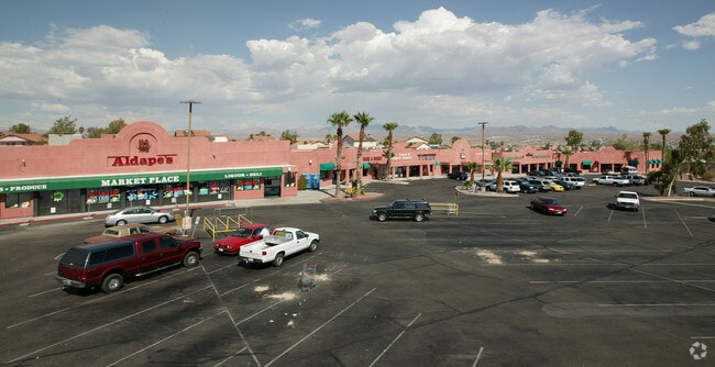
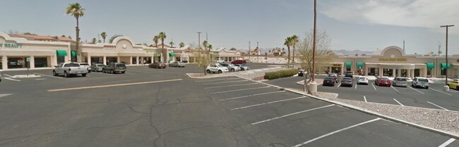
Property Record
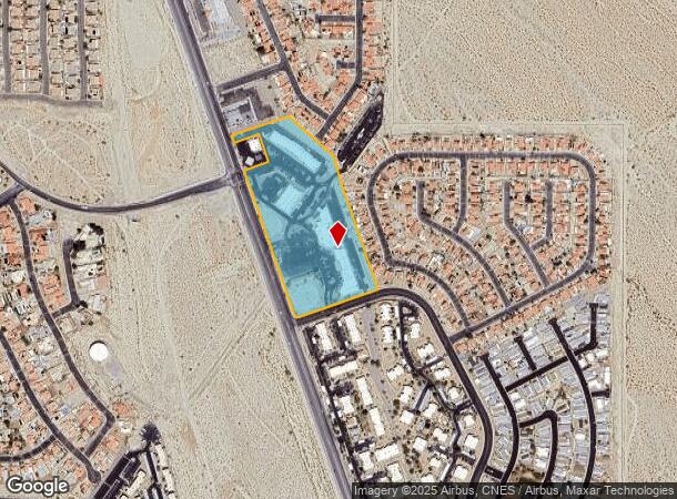
3100 S Needles Hwy, Laughlin, NV 89029
NEARBY LISTINGS FOR SALE OR LEASE
Property Detail
3100 S Needles Hwy
264-21-810-007
El Mirage Coml Center
Storebuilding
EL MIRAGE COML CENTER PLAT BOOK 34 PAGE 37 PT BLOCK 1
X
Clark
04015C4465G
Nevada
2026
11.84 AC
2026
Outlying S Clark Cnty
005702
Las Vegas
70,870 SF
Las Vegas-Henderson-North Las Vegas, NV
DEMOGRAPHICS near 3100 S Needles Hwy
1 mile
3 mile
5 mile
2024 Total Population
8,335
29,553
44,481
2029 Population
9,064
32,589
49,180
Pop Growth 2024-2029
+ 8.75%
+ 10.27%
+ 10.56%
Average Age
52
47
48
2024 Total Households
4,268
13,268
20,118
HH Growth 2024-2029
+ 8.69%
+ 10.54%
+ 10.93%
Median Household Inc
$41,554
$36,354
$37,610
Avg Household Size
2.00
2.20
2.20
2024 Avg HH Vehicles
1.00
2.00
2.00
Median Home Value
$236,995
$159,109
$173,499
Median Year Built
1990
1987
1988
Nearby Places
Map Layers
Map Styles
 Street
 Aerial
Transit
 Traffic
 Biking
Places
Listings with unknown addresses are not visible on the map
- Restaurants
- Banks
- Shops
- Fitness
- Groceries
PUBLIC TRANSPORTATION
AIRPORT
Laughlin/Bullhead International
Drive
Walk
Distance
Laughlin/Bullhead International
17 min
7.6 mi
Freight Ports
Port of San Diego
Drive
Walk
Distance
Port of San Diego
381 min
339.2 mi
SALE & LEASE HISTORY
LISTING DATE
SALE/LEASE

Dec 18, 2018
For Lease
Nearby Properties
Address
Land Use
TOTAL SIZE
Lot Size
Zoning
Address
Land Use
TOTAL SIZE
Lot Size
Zoning
235,806 SF
34.57 AC
H1
Address
Land Use
TOTAL SIZE
Lot Size
Zoning
256,872 SF
47.81 AC
Address
Land Use
TOTAL SIZE
Lot Size
Zoning
15,750 SF
27.78 AC
H1
Address
Land Use
TOTAL SIZE
Lot Size
Zoning
152,143 SF
39.95 AC
Address
Land Use
TOTAL SIZE
Lot Size
Zoning
53,240 SF
9.78 AC
Address
Land Use
TOTAL SIZE
Lot Size
Zoning
850,418 SF
20.44 AC
H1
Address
Land Use
TOTAL SIZE
Lot Size
Zoning
21,950 SF
7.57 AC
H1
Address
Land Use
TOTAL SIZE
Lot Size
Zoning
55,402 SF
3.24 AC
Address
Land Use
TOTAL SIZE
Lot Size
Zoning
32,605 SF
33.09 AC
Address
Land Use
TOTAL SIZE
Lot Size
Zoning
80 AC
RU
Address
Land Use
TOTAL SIZE
Lot Size
Zoning
109,753 SF
15.58 AC
Address
Land Use
TOTAL SIZE
Lot Size
Zoning
525,752 SF
7.87 AC
Address
Land Use
TOTAL SIZE
Lot Size
Zoning
2,906 SF
14.24 AC
RU
Address
Land Use
TOTAL SIZE
Lot Size
Zoning
1,011,986 SF
17.67 AC
H1
Address
Land Use
TOTAL SIZE
Lot Size
Zoning
8,747 SF
320 AC
PF
Address
Land Use
TOTAL SIZE
Lot Size
Zoning
89,705 SF
6.42 AC
Address
Land Use
TOTAL SIZE
Lot Size
Zoning
7,861 SF
17 AC
Address
Land Use
TOTAL SIZE
Lot Size
Zoning
52,001 SF
5.70 AC
Address
Land Use
TOTAL SIZE
Lot Size
Zoning
39,927 SF
13.41 AC
Address
Land Use
TOTAL SIZE
Lot Size
Zoning
42,243 SF
1.14 AC
Address
Land Use
TOTAL SIZE
Lot Size
Zoning
49,526 SF
3.50 AC
Address
Land Use
TOTAL SIZE
Lot Size
Zoning
2,189 SF
2.49 AC
Address
Land Use
TOTAL SIZE
Lot Size
Zoning
139,189 SF
5.29 AC
RU
Address
Land Use
TOTAL SIZE
Lot Size
Zoning
24,886 SF
0.77 AC
Address
Land Use
TOTAL SIZE
Lot Size
Zoning
27,921 SF
19.40 AC
Address
Land Use
TOTAL SIZE
Lot Size
Zoning
117,430 SF
5.53 AC
Address
Land Use
TOTAL SIZE
Lot Size
Zoning
25,934 SF
0.47 AC
Address
Land Use
TOTAL SIZE
Lot Size
Zoning
54,477 SF
3.74 AC
Address
Land Use
TOTAL SIZE
Lot Size
Zoning
25,030 SF
5.74 AC
Address
Land Use
TOTAL SIZE
Lot Size
Zoning
63,397 SF
4.93 AC
The World's #1 Commercial Real Estate Marketplace
Connect with us
© 2026 CoStar Group
The information above has been obtained from sources believed reliable. While we do not doubt its accuracy we have not verified it and make no guarantee, warranty or representation about it. It is your responsibility to independently confirm its accuracy and completeness. Any projections, opinions, assumptions, or estimates used are for example only and do not represent the current or future performance of the property. The value of this transaction to you depends on tax and other factors which should be evaluated by your tax, financial, and legal advisors. You and your advisors should conduct a careful, independent investigation of the property to determine to your satisfaction the suitability of the property for your needs.