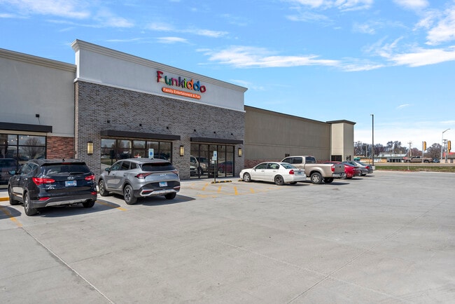
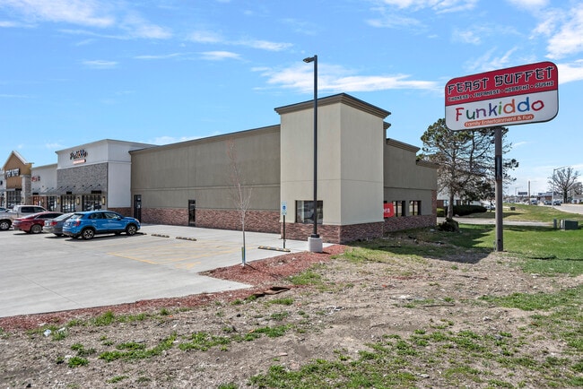
Property Record
3101 S Macarthur Blvd, Springfield, IL 62704


NEARBY LISTINGS FOR SALE OR LEASE
Property Detail
3101 S Macarthur Blvd
Springfield, IL
Pierik Place
22-08.0-281-008
E 148' LOTS 1 & 2 PIERIK PLACE EX N PT TAKEN FOR ROAD ROW (37,897 SQ FT) 8-15-5
Commercialnec
Sangamon
X
Illinois
17167C0243F
1-2
2024
0.87 AC
2024
Springfield/Decatur
002100
Other Market Areas
DEMOGRAPHICS near 3101 S Macarthur Blvd
1 mile
3 mile
5 mile
2024 Total Population
10,215
68,653
124,020
2029 Population
10,117
68,290
123,560
Pop Growth 2024-2029
(0.96%)
(0.53%)
(0.37%)
Average Age
38
41
41
2024 Total Households
4,879
31,813
55,521
HH Growth 2024-2029
(1.09%)
(0.61%)
(0.46%)
Median Household Inc
$54,361
$56,117
$60,757
Avg Household Size
2.00
2.00
2.10
2024 Avg HH Vehicles
1.00
1.00
2.00
Median Home Value
$111,931
$137,472
$146,305
Median Year Built
1961
1963
1967
Nearby Places
Map Layers
Map Styles
 Street
 Aerial
Transit
 Traffic
 Biking
Places
Listings with unknown addresses are not visible on the map
- Restaurants
- Banks
- Shops
- Fitness
- Groceries
PUBLIC TRANSPORTATION
COMMUTER RAIL
Springfield (Lincoln Service - Amtrak, Lincoln Service Missouri River Runner - Amtrak, Texas Eagle - Amtrak)
Drive
Walk
Distance
Springfield (Lincoln Service - Amtrak, Lincoln Service Missouri River Runner - Amtrak, Texas Eagle - Amtrak)
9 min
3.6 mi
AIRPORT
Abraham Lincoln Capital
Drive
Walk
Distance
Abraham Lincoln Capital
16 min
6.4 mi
Freight Ports
Port Milwaukee
Drive
Walk
Distance
Port Milwaukee
320 min
280.5 mi
Nearby Properties
Address
Land Use
TOTAL SIZE
Lot Size
Zoning
Address
Land Use
TOTAL SIZE
Lot Size
Zoning
24.91 AC
Address
Land Use
TOTAL SIZE
Lot Size
Zoning
2.36 AC
Address
Land Use
TOTAL SIZE
Lot Size
Zoning
19.94 AC
Address
Land Use
TOTAL SIZE
Lot Size
Zoning
3.17 AC
Address
Land Use
TOTAL SIZE
Lot Size
Zoning
21.61 AC
Address
Land Use
TOTAL SIZE
Lot Size
Zoning
13.91 AC
Address
Land Use
TOTAL SIZE
Lot Size
Zoning
1.16 AC
Address
Land Use
TOTAL SIZE
Lot Size
Zoning
1.05 AC
Address
Land Use
TOTAL SIZE
Lot Size
Zoning
Address
Land Use
TOTAL SIZE
Lot Size
Zoning
Address
Land Use
TOTAL SIZE
Lot Size
Zoning
21.53 AC
Address
Land Use
TOTAL SIZE
Lot Size
Zoning
Address
Land Use
TOTAL SIZE
Lot Size
Zoning
Address
Land Use
TOTAL SIZE
Lot Size
Zoning
Address
Land Use
TOTAL SIZE
Lot Size
Zoning
Address
Land Use
TOTAL SIZE
Lot Size
Zoning
30.02 AC
Address
Land Use
TOTAL SIZE
Lot Size
Zoning
Address
Land Use
TOTAL SIZE
Lot Size
Zoning
7.51 AC
Address
Land Use
TOTAL SIZE
Lot Size
Zoning
Address
Land Use
TOTAL SIZE
Lot Size
Zoning
11.02 AC
Address
Land Use
TOTAL SIZE
Lot Size
Zoning
15.99 AC
Address
Land Use
TOTAL SIZE
Lot Size
Zoning
Address
Land Use
TOTAL SIZE
Lot Size
Zoning
10.08 AC
Address
Land Use
TOTAL SIZE
Lot Size
Zoning
Address
Land Use
TOTAL SIZE
Lot Size
Zoning
0.29 AC
Address
Land Use
TOTAL SIZE
Lot Size
Zoning
0.88 AC
Address
Land Use
TOTAL SIZE
Lot Size
Zoning
10.52 AC
Address
Land Use
TOTAL SIZE
Lot Size
Zoning
12.74 AC
Address
Land Use
TOTAL SIZE
Lot Size
Zoning
13.99 AC
Address
Land Use
TOTAL SIZE
Lot Size
Zoning
10.13 AC
The World's #1 Commercial Real Estate Marketplace
Connect with us
© 2026 CoStar Group
The information above has been obtained from sources believed reliable. While we do not doubt its accuracy we have not verified it and make no guarantee, warranty or representation about it. It is your responsibility to independently confirm its accuracy and completeness. Any projections, opinions, assumptions, or estimates used are for example only and do not represent the current or future performance of the property. The value of this transaction to you depends on tax and other factors which should be evaluated by your tax, financial, and legal advisors. You and your advisors should conduct a careful, independent investigation of the property to determine to your satisfaction the suitability of the property for your needs.